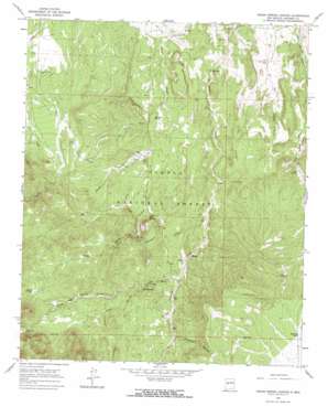
Indian Spring Canyon Topo Map New Mexico
To zoom in, hover over the map of Indian Spring Canyon
USGS Topo Quad 34107c4 - 1:24,000 scale
| Topo Map Name: | Indian Spring Canyon |
| USGS Topo Quad ID: | 34107c4 |
| Print Size: | ca. 21 1/4" wide x 27" high |
| Southeast Coordinates: | 34.25° N latitude / 107.375° W longitude |
| Map Center Coordinates: | 34.3125° N latitude / 107.4375° W longitude |
| U.S. State: | NM |
| Filename: | o34107c4.jpg |
| Download Map JPG Image: | Indian Spring Canyon topo map 1:24,000 scale |
| Map Type: | Topographic |
| Topo Series: | 7.5´ |
| Map Scale: | 1:24,000 |
| Source of Map Images: | United States Geological Survey (USGS) |
| Alternate Map Versions: |
Indian Spring Canyon NM 1964, updated 1968 Download PDF Buy paper map Indian Spring Canyon NM 1995, updated 1998 Download PDF Buy paper map Indian Spring Canyon NM 2011 Download PDF Buy paper map Indian Spring Canyon NM 2013 Download PDF Buy paper map Indian Spring Canyon NM 2017 Download PDF Buy paper map |
| FStopo: | US Forest Service topo Indian Spring Canyon is available: Download FStopo PDF Download FStopo TIF |
1:24,000 Topo Quads surrounding Indian Spring Canyon
> Back to 34107a1 at 1:100,000 scale
> Back to 34106a1 at 1:250,000 scale
> Back to U.S. Topo Maps home
Indian Spring Canyon topo map: Gazetteer
Indian Spring Canyon: Airports
Alamo Navajo Airport elevation 1961m 6433′Indian Spring Canyon: Arroyos
Cañon Cencerro elevation 2094m 6870′Indian Spring Canyon: Mines
Hook Ranch elevation 2047m 6715′Hot Spot Mines elevation 2032m 6666′
Mag 1 elevation 2022m 6633′
Indian Spring Canyon: Reservoirs
Earth Tank elevation 1981m 6499′Heifer Tank elevation 2172m 7125′
Indian Tank elevation 2239m 7345′
Mexican Tank elevation 2167m 7109′
Indian Spring Canyon: Springs
Abbe Spring elevation 2039m 6689′Burro Spring elevation 2101m 6893′
Coal Spring elevation 2020m 6627′
Dove Spring elevation 2139m 7017′
Montoya Spring elevation 1981m 6499′
Murdo Spring elevation 1913m 6276′
Reid Spring elevation 2096m 6876′
Indian Spring Canyon: Valleys
Corkscrew Canyon elevation 2133m 6998′Dove Spring Canyon elevation 2089m 6853′
Indian Spring Canyon elevation 1978m 6489′
Maverick Draw elevation 2041m 6696′
Three Log Spring Canyon elevation 2124m 6968′
Indian Spring Canyon: Wells
26-25-1 Water Well elevation 1943m 6374′26-25-2 Water Well elevation 1918m 6292′
26-26-1 Water Well elevation 1914m 6279′
A-4 Water Well elevation 2044m 6706′
Diego Monte Water Well elevation 1907m 6256′
Little Well elevation 2040m 6692′
Middle Well elevation 2116m 6942′
New Well elevation 2105m 6906′
North Well elevation 2140m 7020′
Secatero Water Well elevation 1946m 6384′
Section 31 Water Well elevation 1923m 6309′
Section Thirty Tank elevation 1920m 6299′
Three Log Well elevation 2260m 7414′
Indian Spring Canyon digital topo map on disk
Buy this Indian Spring Canyon topo map showing relief, roads, GPS coordinates and other geographical features, as a high-resolution digital map file on DVD:


