Bonine Canyon Topo Map New Mexico
To zoom in, hover over the map of Bonine Canyon
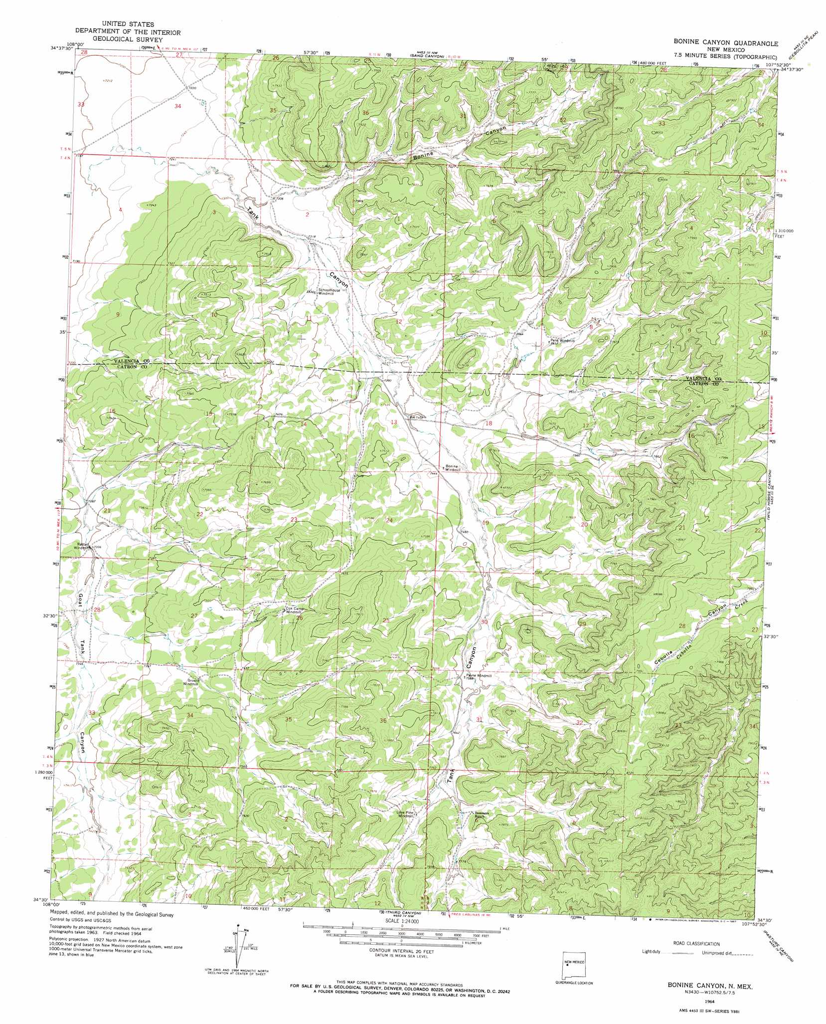
USGS Topo Quad 34107e8 - 1:24,000 scale
| Topo Map Name: | Bonine Canyon |
| USGS Topo Quad ID: | 34107e8 |
| Print Size: | ca. 21 1/4" wide x 27" high |
| Southeast Coordinates: | 34.5° N latitude / 107.875° W longitude |
| Map Center Coordinates: | 34.5625° N latitude / 107.9375° W longitude |
| U.S. State: | NM |
| Filename: | o34107e8.jpg |
| Download Map JPG Image: | Bonine Canyon topo map 1:24,000 scale |
| Map Type: | Topographic |
| Topo Series: | 7.5´ |
| Map Scale: | 1:24,000 |
| Source of Map Images: | United States Geological Survey (USGS) |
| Alternate Map Versions: |
Bonine Canyon NM 1964, updated 1967 Download PDF Buy paper map Bonine Canyon NM 2010 Download PDF Buy paper map Bonine Canyon NM 2013 Download PDF Buy paper map Bonine Canyon NM 2017 Download PDF Buy paper map |
1:24,000 Topo Quads surrounding Bonine Canyon
Cerro Brilliante |
Ice Caves Se |
North Pasture |
Laguna Honda |
Blue Mesa |
La Rendija |
York Ranch |
Sand Canyon |
Cebollita Peak |
Mecate Meadow |
Trail Lake |
York Ranch Se |
Bonine Canyon |
Wild Horse Canyon |
Wiley Mesa |
Blue Hills |
Tres Lagunas |
Third Canyon |
Pasture Canyon |
D Cross Mountain |
Pie Town |
Red Flats |
Madre Mountain |
Cal Ship Mesa |
Dog Springs |
> Back to 34107e1 at 1:100,000 scale
> Back to 34106a1 at 1:250,000 scale
> Back to U.S. Topo Maps home
Bonine Canyon topo map: Gazetteer
Bonine Canyon: Populated Places
Tank Canyon (historical) elevation 2212m 7257′Bonine Canyon: Valleys
Bonine Canyon elevation 2221m 7286′Tank Canyon elevation 2212m 7257′
Bonine Canyon: Wells
Brown Mill Water Well elevation 2269m 7444′Brown Windmill Water Well elevation 2270m 7447′
Cox Camp Water Well elevation 2301m 7549′
E Bonine Water Well elevation 2292m 7519′
Payne Windmill Water Well elevation 2315m 7595′
Rattail Windmill Water Well elevation 2224m 7296′
Bonine Canyon digital topo map on disk
Buy this Bonine Canyon topo map showing relief, roads, GPS coordinates and other geographical features, as a high-resolution digital map file on DVD: