Mesa Gallina Topo Map New Mexico
To zoom in, hover over the map of Mesa Gallina
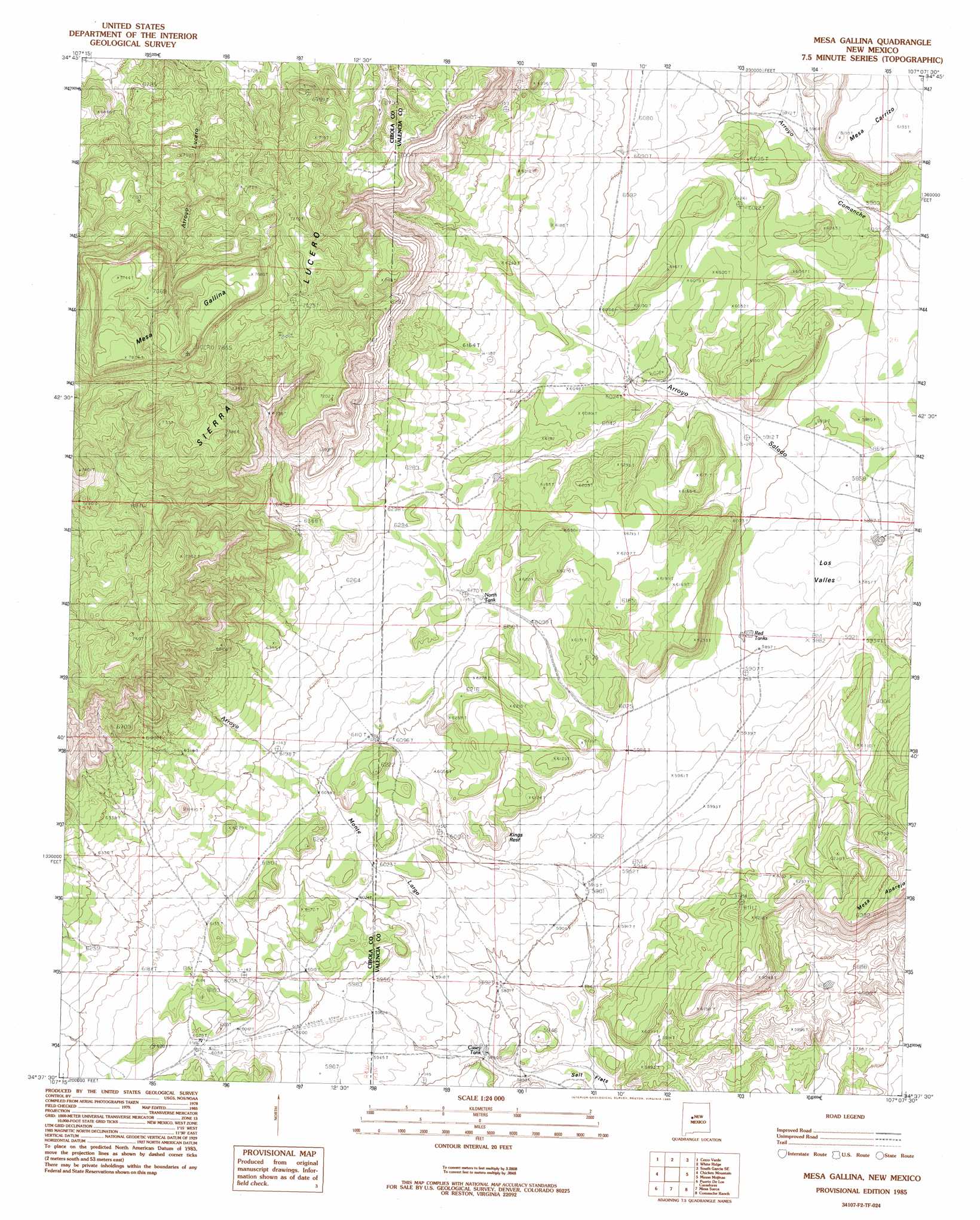
USGS Topo Quad 34107f2 - 1:24,000 scale
| Topo Map Name: | Mesa Gallina |
| USGS Topo Quad ID: | 34107f2 |
| Print Size: | ca. 21 1/4" wide x 27" high |
| Southeast Coordinates: | 34.625° N latitude / 107.125° W longitude |
| Map Center Coordinates: | 34.6875° N latitude / 107.1875° W longitude |
| U.S. State: | NM |
| Filename: | o34107f2.jpg |
| Download Map JPG Image: | Mesa Gallina topo map 1:24,000 scale |
| Map Type: | Topographic |
| Topo Series: | 7.5´ |
| Map Scale: | 1:24,000 |
| Source of Map Images: | United States Geological Survey (USGS) |
| Alternate Map Versions: |
Mesa Gallina NM 1985, updated 1985 Download PDF Buy paper map Mesa Gallina NM 2010 Download PDF Buy paper map Mesa Gallina NM 2013 Download PDF Buy paper map Mesa Gallina NM 2017 Download PDF Buy paper map |
1:24,000 Topo Quads surrounding Mesa Gallina
South Butte |
Dough Mountain |
Correo |
South Garcia |
Dalies Nw |
Marmon Ranch |
Cerro Verde |
White Ridge |
South Garcia Se |
Rio Puerco |
Cerro Del Oro |
Chicken Mountain |
Mesa Gallina |
Mesas Mojinas |
Belen Nw |
Field Ranch |
Puerto De Los Cavadores |
Mesa Sarca |
Comanche Ranch |
Belen Sw |
Puertecito |
La Jara Peak |
Riley |
Ladron Peak |
La Joya Nw |
> Back to 34107e1 at 1:100,000 scale
> Back to 34106a1 at 1:250,000 scale
> Back to U.S. Topo Maps home
Mesa Gallina topo map: Gazetteer
Mesa Gallina: Areas
Kings Rest elevation 1864m 6115′Los Valles elevation 1787m 5862′
Mesa Gallina: Flats
Salt Flats elevation 1784m 5853′Mesa Gallina: Reservoirs
Casey Tank elevation 1790m 5872′North Tank elevation 1877m 6158′
Mesa Gallina: Streams
Rock Creek elevation 1767m 5797′Mesa Gallina: Summits
Cerro del Indio elevation 1901m 6236′Mesa Gallina elevation 2332m 7650′
Mesa Gallina digital topo map on disk
Buy this Mesa Gallina topo map showing relief, roads, GPS coordinates and other geographical features, as a high-resolution digital map file on DVD: