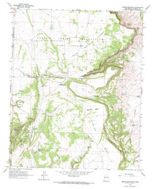
Broom Mountain Topo Map New Mexico
To zoom in, hover over the map of Broom Mountain
USGS Topo Quad 34107f5 - 1:24,000 scale
| Topo Map Name: | Broom Mountain |
| USGS Topo Quad ID: | 34107f5 |
| Print Size: | ca. 21 1/4" wide x 27" high |
| Southeast Coordinates: | 34.625° N latitude / 107.5° W longitude |
| Map Center Coordinates: | 34.6875° N latitude / 107.5625° W longitude |
| U.S. State: | NM |
| Filename: | o34107f5.jpg |
| Download Map JPG Image: | Broom Mountain topo map 1:24,000 scale |
| Map Type: | Topographic |
| Topo Series: | 7.5´ |
| Map Scale: | 1:24,000 |
| Source of Map Images: | United States Geological Survey (USGS) |
| Alternate Map Versions: |
Broom Mountain NM 1964, updated 1968 Download PDF Buy paper map Broom Mountain NM 2010 Download PDF Buy paper map Broom Mountain NM 2013 Download PDF Buy paper map Broom Mountain NM 2017 Download PDF Buy paper map |
1:24,000 Topo Quads surrounding Broom Mountain
> Back to 34107e1 at 1:100,000 scale
> Back to 34106a1 at 1:250,000 scale
> Back to U.S. Topo Maps home
Broom Mountain topo map: Gazetteer
Broom Mountain: Dams
Upper Boulder Detention Dam elevation 2112m 6929′Broom Mountain: Reservoirs
AAA Tank elevation 2161m 7089′Alcon Tank elevation 2110m 6922′
Antelope Tank elevation 2218m 7276′
Bates Tank elevation 2220m 7283′
Blue Water Tank elevation 2150m 7053′
Bull Pasture Tank elevation 1898m 6227′
Carter Tank elevation 2248m 7375′
Henderson Reservoir elevation 2116m 6942′
North Sanchez Tank elevation 2165m 7103′
Red Windmill Tank elevation 2204m 7230′
Rim Tank elevation 2178m 7145′
Sanchez Tank elevation 2175m 7135′
Sheep Tank elevation 2204m 7230′
Ward Canyon Tank elevation 2180m 7152′
Wiley Tank elevation 1890m 6200′
Broom Mountain: Springs
Apache Spring elevation 1867m 6125′Broom Mountain: Summits
Blue Water Mesa elevation 2230m 7316′Broom Mountain elevation 2420m 7939′
Seven Cedar Trees Mesa elevation 2295m 7529′
Ward Mesa elevation 2216m 7270′
Broom Mountain: Valleys
Blue Water Canyon elevation 1948m 6391′The Alcon elevation 2109m 6919′
Broom Mountain: Wells
Henderson Water Well elevation 2113m 6932′Broom Mountain digital topo map on disk
Buy this Broom Mountain topo map showing relief, roads, GPS coordinates and other geographical features, as a high-resolution digital map file on DVD:


