South Garcia Se Topo Map New Mexico
To zoom in, hover over the map of South Garcia Se
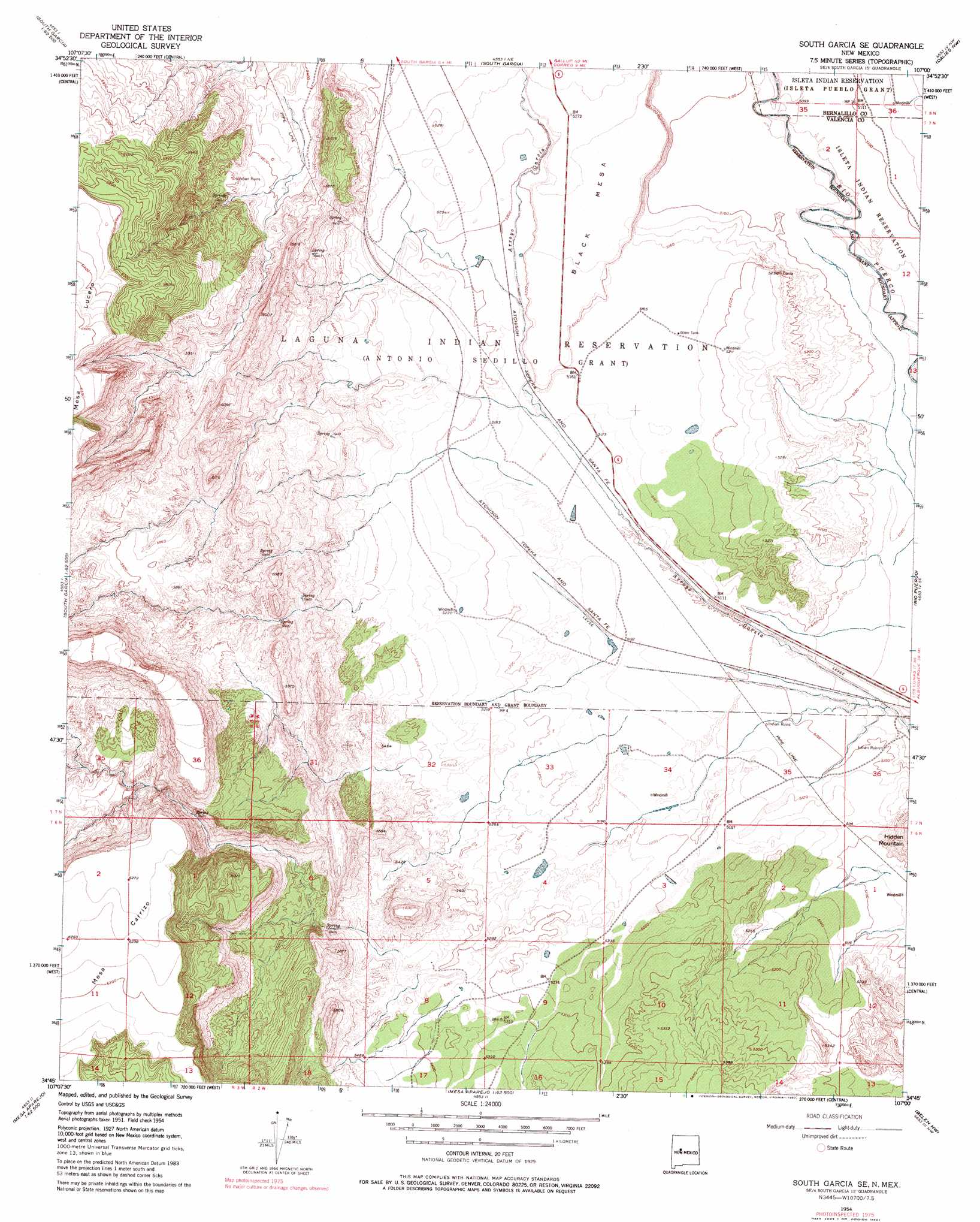
USGS Topo Quad 34107g1 - 1:24,000 scale
| Topo Map Name: | South Garcia Se |
| USGS Topo Quad ID: | 34107g1 |
| Print Size: | ca. 21 1/4" wide x 27" high |
| Southeast Coordinates: | 34.75° N latitude / 107° W longitude |
| Map Center Coordinates: | 34.8125° N latitude / 107.0625° W longitude |
| U.S. State: | NM |
| Filename: | o34107g1.jpg |
| Download Map JPG Image: | South Garcia Se topo map 1:24,000 scale |
| Map Type: | Topographic |
| Topo Series: | 7.5´ |
| Map Scale: | 1:24,000 |
| Source of Map Images: | United States Geological Survey (USGS) |
| Alternate Map Versions: |
South Garcia SE NM 1954, updated 1955 Download PDF Buy paper map South Garcia SE NM 1954, updated 1976 Download PDF Buy paper map South Garcia SE NM 1954, updated 1980 Download PDF Buy paper map South Garcia SE NM 2010 Download PDF Buy paper map South Garcia SE NM 2013 Download PDF Buy paper map South Garcia SE NM 2017 Download PDF Buy paper map |
1:24,000 Topo Quads surrounding South Garcia Se
Mesita |
Mesa Gigante |
Canoncito School |
La Mesita Negra |
La Mesita Negra Se |
Dough Mountain |
Correo |
South Garcia |
Dalies Nw |
Wind Mesa |
Cerro Verde |
White Ridge |
South Garcia Se |
Rio Puerco |
Dalies |
Chicken Mountain |
Mesa Gallina |
Mesas Mojinas |
Belen Nw |
Belen |
Puerto De Los Cavadores |
Mesa Sarca |
Comanche Ranch |
Belen Sw |
Veguita |
> Back to 34107e1 at 1:100,000 scale
> Back to 34106a1 at 1:250,000 scale
> Back to U.S. Topo Maps home
South Garcia Se topo map: Gazetteer
South Garcia Se: Springs
Laguna Pueblo Seeps elevation 1641m 5383′Laguna Pueblo Springs elevation 1624m 5328′
South Garcia Se: Summits
Hidden Mountain elevation 1666m 5465′South Garcia Se digital topo map on disk
Buy this South Garcia Se topo map showing relief, roads, GPS coordinates and other geographical features, as a high-resolution digital map file on DVD: