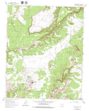
Acoma Pueblo Topo Map New Mexico
To zoom in, hover over the map of Acoma Pueblo
USGS Topo Quad 34107h5 - 1:24,000 scale
| Topo Map Name: | Acoma Pueblo |
| USGS Topo Quad ID: | 34107h5 |
| Print Size: | ca. 21 1/4" wide x 27" high |
| Southeast Coordinates: | 34.875° N latitude / 107.5° W longitude |
| Map Center Coordinates: | 34.9375° N latitude / 107.5625° W longitude |
| U.S. State: | NM |
| Filename: | o34107h5.jpg |
| Download Map JPG Image: | Acoma Pueblo topo map 1:24,000 scale |
| Map Type: | Topographic |
| Topo Series: | 7.5´ |
| Map Scale: | 1:24,000 |
| Source of Map Images: | United States Geological Survey (USGS) |
| Alternate Map Versions: |
Acoma Pueblo NM 1961, updated 1963 Download PDF Buy paper map Acoma Pueblo NM 1961, updated 1979 Download PDF Buy paper map Acoma Pueblo NM 2010 Download PDF Buy paper map Acoma Pueblo NM 2013 Download PDF Buy paper map Acoma Pueblo NM 2017 Download PDF Buy paper map |
1:24,000 Topo Quads surrounding Acoma Pueblo
> Back to 34107e1 at 1:100,000 scale
> Back to 34106a1 at 1:250,000 scale
> Back to U.S. Topo Maps home
Acoma Pueblo topo map: Gazetteer
Acoma Pueblo: Mines
Acomita Pit elevation 1857m 6092′Balo Deposit elevation 1890m 6200′
Limestone Quarry elevation 1857m 6092′
Acoma Pueblo: Parks
Cebolleta Historical Marker elevation 2000m 6561′Pueblo of Acoma Historical Marker elevation 2000m 6561′
Acoma Pueblo: Pillars
Deadmans Rock elevation 2032m 6666′Acoma Pueblo: Populated Places
Acoma Pueblo elevation 2000m 6561′Acoma Village elevation 1936m 6351′
Acoma Pueblo: Springs
Acoma Springs elevation 1915m 6282′Dripping Springs elevation 1899m 6230′
Acoma Pueblo: Summits
Acoma Rock elevation 2013m 6604′Dinosaur Rock elevation 1961m 6433′
Flour Butte elevation 1892m 6207′
Jar Butte elevation 2039m 6689′
Mesa Encantada elevation 2019m 6624′
Rabbit Butte elevation 1894m 6213′
Seama Mesa elevation 2065m 6774′
Woods Mesa elevation 2056m 6745′
Acoma Pueblo: Valleys
Acoma Valley elevation 1851m 6072′Cañada de Cruz elevation 1925m 6315′
Sand Canyon elevation 1842m 6043′
Acoma Pueblo: Wells
Laguna 6 Water Well elevation 1853m 6079′Acoma Pueblo digital topo map on disk
Buy this Acoma Pueblo topo map showing relief, roads, GPS coordinates and other geographical features, as a high-resolution digital map file on DVD:


