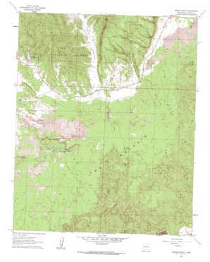
Arrosa Ranch Topo Map New Mexico
To zoom in, hover over the map of Arrosa Ranch
USGS Topo Quad 34107h8 - 1:24,000 scale
| Topo Map Name: | Arrosa Ranch |
| USGS Topo Quad ID: | 34107h8 |
| Print Size: | ca. 21 1/4" wide x 27" high |
| Southeast Coordinates: | 34.875° N latitude / 107.875° W longitude |
| Map Center Coordinates: | 34.9375° N latitude / 107.9375° W longitude |
| U.S. State: | NM |
| Filename: | o34107h8.jpg |
| Download Map JPG Image: | Arrosa Ranch topo map 1:24,000 scale |
| Map Type: | Topographic |
| Topo Series: | 7.5´ |
| Map Scale: | 1:24,000 |
| Source of Map Images: | United States Geological Survey (USGS) |
| Alternate Map Versions: |
Arrosa Ranch NM 1961, updated 1963 Download PDF Buy paper map Arrosa Ranch NM 1995, updated 1998 Download PDF Buy paper map Arrosa Ranch NM 2011 Download PDF Buy paper map Arrosa Ranch NM 2013 Download PDF Buy paper map Arrosa Ranch NM 2017 Download PDF Buy paper map |
| FStopo: | US Forest Service topo Arrosa Ranch is available: Download FStopo PDF Download FStopo TIF |
1:24,000 Topo Quads surrounding Arrosa Ranch
> Back to 34107e1 at 1:100,000 scale
> Back to 34106a1 at 1:250,000 scale
> Back to U.S. Topo Maps home
Arrosa Ranch topo map: Gazetteer
Arrosa Ranch: Areas
Little Hole in the Wall elevation 2165m 7103′The Malpais elevation 2128m 6981′
Arrosa Ranch: Mines
Mack Prospect elevation 2150m 7053′Twenty One Mine elevation 2347m 7700′
Twenty Seven Mine elevation 2194m 7198′
Twenty-One Mine elevation 2339m 7673′
Twenty-Seven Mine elevation 2275m 7463′
Arrosa Ranch: Parks
El Malpais National Monument elevation 2183m 7162′Arrosa Ranch: Ridges
Cerritos de Jaspe elevation 2444m 8018′Arrosa Ranch: Summits
Encerrito elevation 2149m 7050′Arrosa Ranch: Valleys
Bonita Canyon elevation 2115m 6938′Arrosa Ranch: Wells
Arrosa Ranch Water Well elevation 2195m 7201′HQ Water Well elevation 2171m 7122′
Arrosa Ranch digital topo map on disk
Buy this Arrosa Ranch topo map showing relief, roads, GPS coordinates and other geographical features, as a high-resolution digital map file on DVD:


