Tejana Mesa Sw Topo Map New Mexico
To zoom in, hover over the map of Tejana Mesa Sw
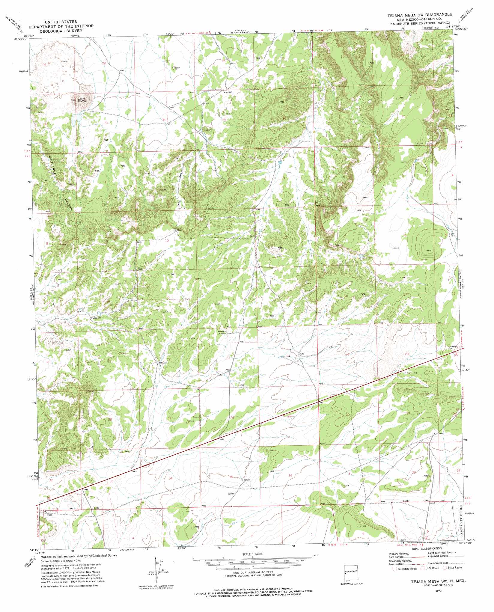
USGS Topo Quad 34108c6 - 1:24,000 scale
| Topo Map Name: | Tejana Mesa Sw |
| USGS Topo Quad ID: | 34108c6 |
| Print Size: | ca. 21 1/4" wide x 27" high |
| Southeast Coordinates: | 34.25° N latitude / 108.625° W longitude |
| Map Center Coordinates: | 34.3125° N latitude / 108.6875° W longitude |
| U.S. State: | NM |
| Filename: | o34108c6.jpg |
| Download Map JPG Image: | Tejana Mesa Sw topo map 1:24,000 scale |
| Map Type: | Topographic |
| Topo Series: | 7.5´ |
| Map Scale: | 1:24,000 |
| Source of Map Images: | United States Geological Survey (USGS) |
| Alternate Map Versions: |
Tejana Mesa SW NM 1999, updated 2002 Download PDF Buy paper map Tejana Mesa SW NM 2011 Download PDF Buy paper map Tejana Mesa SW NM 2013 Download PDF Buy paper map Tejana Mesa SW NM 2017 Download PDF Buy paper map |
| FStopo: | US Forest Service topo Tejana Mesa SW is available: Download FStopo PDF Download FStopo TIF |
1:24,000 Topo Quads surrounding Tejana Mesa Sw
Twentytwo Spring |
Moreno Hill |
Fence Lake Sw |
Cerro Prieto |
Techado |
Salazar Canyon |
Zuni Salt Lake |
Lake Armijo |
Tejana Mesa |
Mariano Springs |
Goat Spring |
Blaines Lake |
Tejana Mesa Sw |
Armstrong Canyon |
Quemado |
Cow Springs |
Red Hill |
Pondersoa Tank |
Largo Mesa |
Escondido Mountains |
Jones Canyon |
Black Peak |
Gallo Mountains West |
Gallo Mountains East |
Slaughter Mesa |
> Back to 34108a1 at 1:100,000 scale
> Back to 34108a1 at 1:250,000 scale
> Back to U.S. Topo Maps home
Tejana Mesa Sw digital topo map on disk
Buy this Tejana Mesa Sw topo map showing relief, roads, GPS coordinates and other geographical features, as a high-resolution digital map file on DVD: