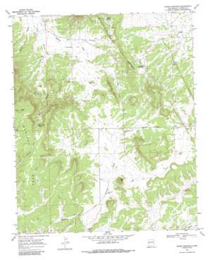
Adams Diggings Topo Map New Mexico
To zoom in, hover over the map of Adams Diggings
USGS Topo Quad 34108d3 - 1:24,000 scale
| Topo Map Name: | Adams Diggings |
| USGS Topo Quad ID: | 34108d3 |
| Print Size: | ca. 21 1/4" wide x 27" high |
| Southeast Coordinates: | 34.375° N latitude / 108.25° W longitude |
| Map Center Coordinates: | 34.4375° N latitude / 108.3125° W longitude |
| U.S. State: | NM |
| Filename: | o34108d3.jpg |
| Download Map JPG Image: | Adams Diggings topo map 1:24,000 scale |
| Map Type: | Topographic |
| Topo Series: | 7.5´ |
| Map Scale: | 1:24,000 |
| Source of Map Images: | United States Geological Survey (USGS) |
| Alternate Map Versions: |
Adams Diggings NM 1967, updated 1971 Download PDF Buy paper map Adams Diggings NM 1967, updated 1986 Download PDF Buy paper map Adams Diggings NM 2010 Download PDF Buy paper map Adams Diggings NM 2013 Download PDF Buy paper map Adams Diggings NM 2017 Download PDF Buy paper map |
1:24,000 Topo Quads surrounding Adams Diggings
> Back to 34108a1 at 1:100,000 scale
> Back to 34108a1 at 1:250,000 scale
> Back to U.S. Topo Maps home
Adams Diggings topo map: Gazetteer
Adams Diggings: Flats
Techado Flat elevation 2202m 7224′Adams Diggings: Post Offices
Adams Diggings Post Office (historical) elevation 2275m 7463′Adams Diggings: Reservoirs
Cat Lake elevation 2248m 7375′Adams Diggings: Springs
Pine Canyon Spring elevation 2353m 7719′Techado Spring elevation 2269m 7444′
Adams Diggings: Summits
Cat Hill elevation 2346m 7696′Mariano Mesa elevation 2472m 8110′
Toms Rock elevation 2235m 7332′
Adams Diggings: Valleys
Cat Draw elevation 2236m 7335′Panther Canyon elevation 2234m 7329′
Adams Diggings: Wells
Cat Well elevation 2233m 7326′Daddy Haynes Well elevation 2244m 7362′
Hayes Well elevation 2226m 7303′
Jensen Well elevation 2325m 7627′
Lee Wright Well elevation 2242m 7355′
Lower Well elevation 2222m 7290′
Moore Well elevation 2238m 7342′
Nelson Well elevation 2268m 7440′
Preacher Well elevation 2263m 7424′
Taylor Well elevation 2279m 7477′
Toms Rock Well elevation 2255m 7398′
Adams Diggings digital topo map on disk
Buy this Adams Diggings topo map showing relief, roads, GPS coordinates and other geographical features, as a high-resolution digital map file on DVD:


