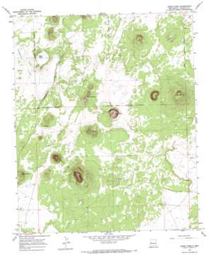
Cerro Pomo Topo Map New Mexico
To zoom in, hover over the map of Cerro Pomo
USGS Topo Quad 34108f3 - 1:24,000 scale
| Topo Map Name: | Cerro Pomo |
| USGS Topo Quad ID: | 34108f3 |
| Print Size: | ca. 21 1/4" wide x 27" high |
| Southeast Coordinates: | 34.625° N latitude / 108.25° W longitude |
| Map Center Coordinates: | 34.6875° N latitude / 108.3125° W longitude |
| U.S. State: | NM |
| Filename: | o34108f3.jpg |
| Download Map JPG Image: | Cerro Pomo topo map 1:24,000 scale |
| Map Type: | Topographic |
| Topo Series: | 7.5´ |
| Map Scale: | 1:24,000 |
| Source of Map Images: | United States Geological Survey (USGS) |
| Alternate Map Versions: |
Cerro Pomo NM 1967, updated 1971 Download PDF Buy paper map Cerro Pomo NM 2010 Download PDF Buy paper map Cerro Pomo NM 2013 Download PDF Buy paper map Cerro Pomo NM 2017 Download PDF Buy paper map |
1:24,000 Topo Quads surrounding Cerro Pomo
> Back to 34108e1 at 1:100,000 scale
> Back to 34108a1 at 1:250,000 scale
> Back to U.S. Topo Maps home
Cerro Pomo topo map: Gazetteer
Cerro Pomo: Flats
Peñasco Flat elevation 2229m 7312′Cerro Pomo: Lakes
Sokno Lake elevation 2221m 7286′Cerro Pomo: Populated Places
Grassie Place elevation 2262m 7421′Hogg Place elevation 2244m 7362′
Cerro Pomo: Reservoirs
Montoso Tank elevation 2232m 7322′Cerro Pomo: Ridges
Cerros de Las Mujeres elevation 2495m 8185′Peñasco Ridge elevation 2247m 7372′
Cerro Pomo: Summits
Cerro Brujos elevation 2328m 7637′Cerro Cantina elevation 2336m 7664′
Cerro Montoso elevation 2423m 7949′
Cerro Pomo elevation 2382m 7814′
Cerro Pomo: Wells
Julian WML Water Well elevation 2211m 7253′Cerro Pomo digital topo map on disk
Buy this Cerro Pomo topo map showing relief, roads, GPS coordinates and other geographical features, as a high-resolution digital map file on DVD:


