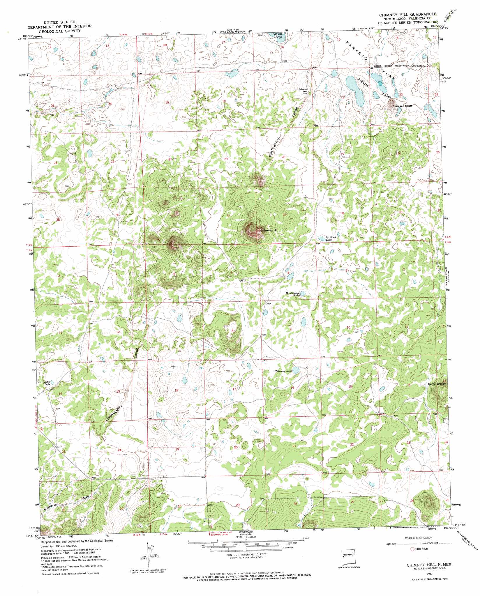
Chimney Hill Topo Map New Mexico
To zoom in, hover over the map of Chimney Hill
USGS Topo Quad 34108f4 - 1:24,000 scale
| Topo Map Name: | Chimney Hill |
| USGS Topo Quad ID: | 34108f4 |
| Print Size: | ca. 21 1/4" wide x 27" high |
| Southeast Coordinates: | 34.625° N latitude / 108.375° W longitude |
| Map Center Coordinates: | 34.6875° N latitude / 108.4375° W longitude |
| U.S. State: | NM |
| Filename: | o34108f4.jpg |
| Download Map JPG Image: | Chimney Hill topo map 1:24,000 scale |
| Map Type: | Topographic |
| Topo Series: | 7.5´ |
| Map Scale: | 1:24,000 |
| Source of Map Images: | United States Geological Survey (USGS) |
| Alternate Map Versions: |
Chimney Hill NM 1967, updated 1971 Download PDF Buy paper map Chimney Hill NM 2010 Download PDF Buy paper map Chimney Hill NM 2013 Download PDF Buy paper map Chimney Hill NM 2017 Download PDF Buy paper map |
1:24,000 Topo Quads surrounding Chimney Hill
Upper Galestina Canyon |
Shoemaker Canyon |
Nicoll Lake |
Goat Hill |
Cerro Hueco |
Mesita De Yeso |
Shoemaker Canyon Se |
Red Lake Mission |
Cerro Alto |
Cerro Brilliante |
Fence Lake |
The Dyke |
Chimney Hill |
Cerro Pomo |
La Rendija |
Fence Lake Sw |
Cerro Prieto |
Techado |
Veteado Mountain |
Trail Lake |
Lake Armijo |
Tejana Mesa |
Mariano Springs |
Adams Diggings |
Blue Hills |
> Back to 34108e1 at 1:100,000 scale
> Back to 34108a1 at 1:250,000 scale
> Back to U.S. Topo Maps home
Chimney Hill topo map: Gazetteer
Chimney Hill: Cliffs
Peñasco Bluff elevation 2249m 7378′Chimney Hill: Lakes
Carpenter Lake elevation 2219m 7280′Chimney Lake elevation 2243m 7358′
La Baca Lake elevation 2250m 7381′
Mantequilla Lake elevation 2247m 7372′
Peñasco Lakes elevation 2219m 7280′
Chimney Hill: Summits
Chimney Hill elevation 2352m 7716′Chimney Hill: Wells
Salvador Well elevation 2239m 7345′Chimney Hill digital topo map on disk
Buy this Chimney Hill topo map showing relief, roads, GPS coordinates and other geographical features, as a high-resolution digital map file on DVD: