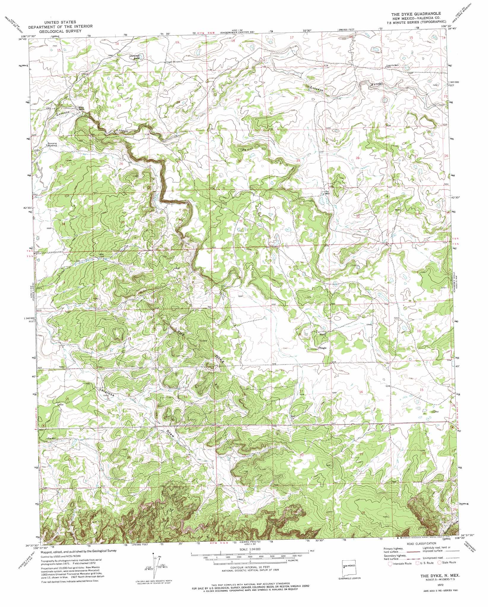
The Dyke Topo Map New Mexico
To zoom in, hover over the map of The Dyke
USGS Topo Quad 34108f5 - 1:24,000 scale
| Topo Map Name: | The Dyke |
| USGS Topo Quad ID: | 34108f5 |
| Print Size: | ca. 21 1/4" wide x 27" high |
| Southeast Coordinates: | 34.625° N latitude / 108.5° W longitude |
| Map Center Coordinates: | 34.6875° N latitude / 108.5625° W longitude |
| U.S. State: | NM |
| Filename: | o34108f5.jpg |
| Download Map JPG Image: | The Dyke topo map 1:24,000 scale |
| Map Type: | Topographic |
| Topo Series: | 7.5´ |
| Map Scale: | 1:24,000 |
| Source of Map Images: | United States Geological Survey (USGS) |
| Alternate Map Versions: |
The Dyke NM 1972, updated 1976 Download PDF Buy paper map The Dyke NM 2010 Download PDF Buy paper map The Dyke NM 2013 Download PDF Buy paper map The Dyke NM 2017 Download PDF Buy paper map |
1:24,000 Topo Quads surrounding The Dyke
Plumasano Basin |
Upper Galestina Canyon |
Shoemaker Canyon |
Nicoll Lake |
Goat Hill |
Atarque Lake |
Mesita De Yeso |
Shoemaker Canyon Se |
Red Lake Mission |
Cerro Alto |
Rincon Hondo |
Fence Lake |
The Dyke |
Chimney Hill |
Cerro Pomo |
Moreno Hill |
Fence Lake Sw |
Cerro Prieto |
Techado |
Veteado Mountain |
Zuni Salt Lake |
Lake Armijo |
Tejana Mesa |
Mariano Springs |
Adams Diggings |
> Back to 34108e1 at 1:100,000 scale
> Back to 34108a1 at 1:250,000 scale
> Back to U.S. Topo Maps home
The Dyke topo map: Gazetteer
The Dyke: Lakes
Jaramie Lake elevation 2165m 7103′The Dyke: Populated Places
Tingle elevation 2211m 7253′The Dyke: Post Offices
Tingle Post Office (historical) elevation 2211m 7253′The Dyke: Ridges
The Dyke elevation 2242m 7355′The Dyke: Wells
Paz Water Well elevation 2185m 7168′Roe Well elevation 2153m 7063′
The Dyke digital topo map on disk
Buy this The Dyke topo map showing relief, roads, GPS coordinates and other geographical features, as a high-resolution digital map file on DVD: