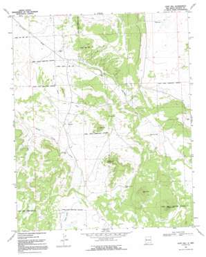
Goat Hill Topo Map New Mexico
To zoom in, hover over the map of Goat Hill
USGS Topo Quad 34108h3 - 1:24,000 scale
| Topo Map Name: | Goat Hill |
| USGS Topo Quad ID: | 34108h3 |
| Print Size: | ca. 21 1/4" wide x 27" high |
| Southeast Coordinates: | 34.875° N latitude / 108.25° W longitude |
| Map Center Coordinates: | 34.9375° N latitude / 108.3125° W longitude |
| U.S. State: | NM |
| Filename: | o34108h3.jpg |
| Download Map JPG Image: | Goat Hill topo map 1:24,000 scale |
| Map Type: | Topographic |
| Topo Series: | 7.5´ |
| Map Scale: | 1:24,000 |
| Source of Map Images: | United States Geological Survey (USGS) |
| Alternate Map Versions: |
Goat Hill NM 1967, updated 1971 Download PDF Buy paper map Goat Hill NM 1967, updated 1992 Download PDF Buy paper map Goat Hill NM 2011 Download PDF Buy paper map Goat Hill NM 2013 Download PDF Buy paper map Goat Hill NM 2017 Download PDF Buy paper map |
1:24,000 Topo Quads surrounding Goat Hill
> Back to 34108e1 at 1:100,000 scale
> Back to 34108a1 at 1:250,000 scale
> Back to U.S. Topo Maps home
Goat Hill topo map: Gazetteer
Goat Hill: Lakes
Laguna Concho elevation 2275m 7463′Pig-a-be-ikiti elevation 2280m 7480′
Goat Hill: Summits
Black Mountain elevation 2401m 7877′Brown Hill elevation 2221m 7286′
Goat Hill elevation 2327m 7634′
Pig-a-ti-ana elevation 2403m 7883′
Red Point elevation 2351m 7713′
White Hill elevation 2282m 7486′
Goat Hill: Valleys
White Rock Draw elevation 2181m 7155′Goat Hill: Wells
Barnes Well elevation 2238m 7342′Black Mountain Well elevation 2288m 7506′
Bonds Well elevation 2183m 7162′
Carrizozo Well elevation 2214m 7263′
Little Oak Well elevation 2228m 7309′
Goat Hill digital topo map on disk
Buy this Goat Hill topo map showing relief, roads, GPS coordinates and other geographical features, as a high-resolution digital map file on DVD:


