Ojo Caliente Reservoir Topo Map New Mexico
To zoom in, hover over the map of Ojo Caliente Reservoir
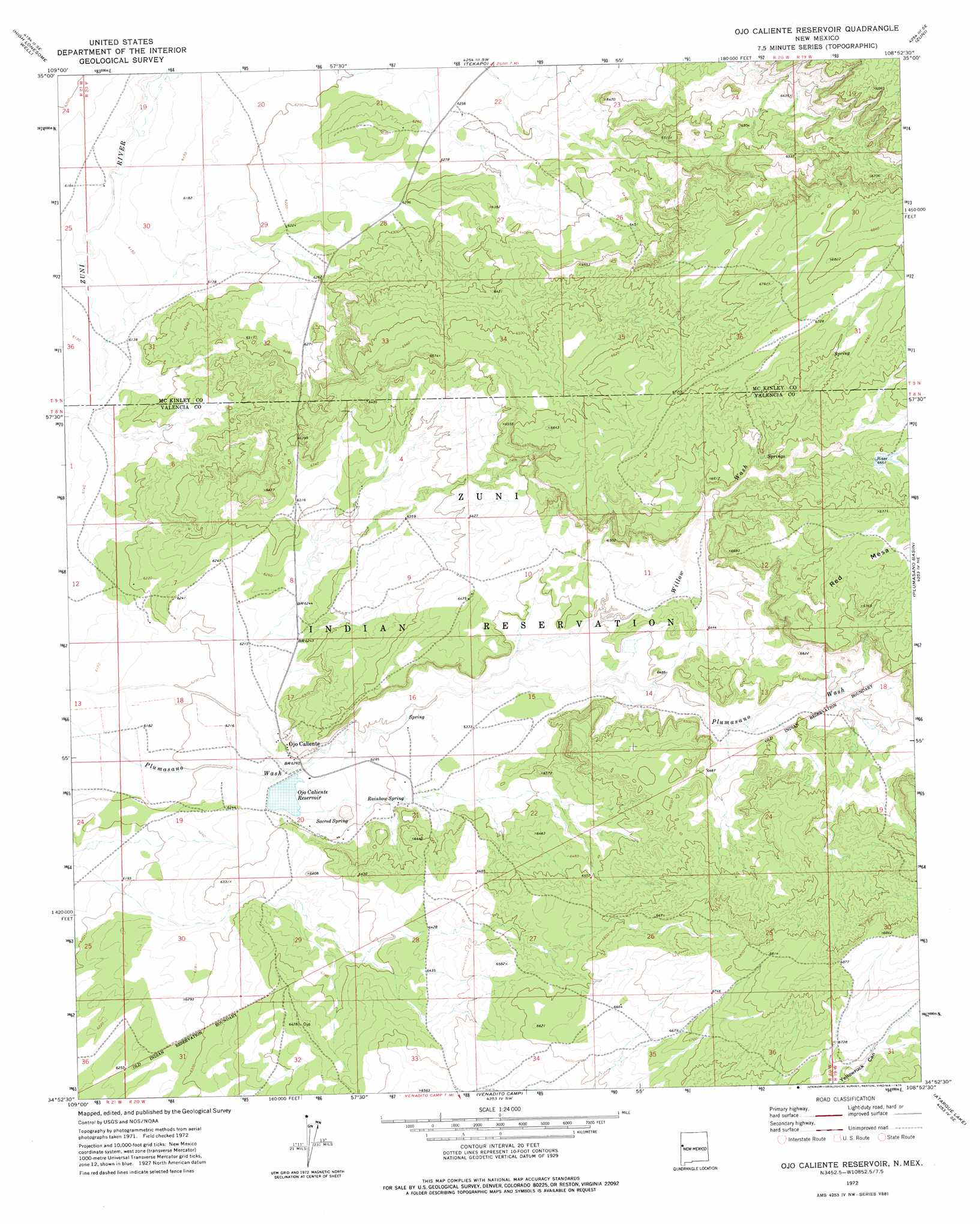
USGS Topo Quad 34108h8 - 1:24,000 scale
| Topo Map Name: | Ojo Caliente Reservoir |
| USGS Topo Quad ID: | 34108h8 |
| Print Size: | ca. 21 1/4" wide x 27" high |
| Southeast Coordinates: | 34.875° N latitude / 108.875° W longitude |
| Map Center Coordinates: | 34.9375° N latitude / 108.9375° W longitude |
| U.S. State: | NM |
| Filename: | o34108h8.jpg |
| Download Map JPG Image: | Ojo Caliente Reservoir topo map 1:24,000 scale |
| Map Type: | Topographic |
| Topo Series: | 7.5´ |
| Map Scale: | 1:24,000 |
| Source of Map Images: | United States Geological Survey (USGS) |
| Alternate Map Versions: |
Ojo Caliente Reservoir NM 1972, updated 1976 Download PDF Buy paper map Ojo Caliente Reservoir NM 2010 Download PDF Buy paper map Ojo Caliente Reservoir NM 2013 Download PDF Buy paper map Ojo Caliente Reservoir NM 2017 Download PDF Buy paper map |
1:24,000 Topo Quads surrounding Ojo Caliente Reservoir
Tolapai Spring |
Chafin Well |
Chi Chil Tah |
Vanderwagen Draw |
Horsehead Canyon Nw |
Deep Lake |
High Lonesome Well |
Tekapo |
Zuni |
Horsehead Canyon |
Wild Cow Lake |
Barth Well |
Ojo Caliente Reservoir |
Plumasano Basin |
Upper Galestina Canyon |
Ceadro Spring |
Ceadro Spring Se |
Venadito Camp |
Atarque Lake |
Mesita De Yeso |
Valle Bonito |
Valle Bonito Ne |
Cantaralo Spring |
Rincon Hondo |
Fence Lake |
> Back to 34108e1 at 1:100,000 scale
> Back to 34108a1 at 1:250,000 scale
> Back to U.S. Topo Maps home
Ojo Caliente Reservoir topo map: Gazetteer
Ojo Caliente Reservoir: Dams
Ojo Caliente Lake Dam elevation 1912m 6272′Ojo Caliente Reservoir: Populated Places
Ojo Caliente elevation 1908m 6259′Ojo Caliente Reservoir: Reservoirs
Ojo Caliente Reservoir elevation 1912m 6272′Ojo Caliente Reservoir: Springs
Rainbow Spring elevation 1927m 6322′Sacred Spring elevation 1920m 6299′
Ojo Caliente Reservoir: Streams
Willow Wash elevation 1928m 6325′Ojo Caliente Reservoir digital topo map on disk
Buy this Ojo Caliente Reservoir topo map showing relief, roads, GPS coordinates and other geographical features, as a high-resolution digital map file on DVD: