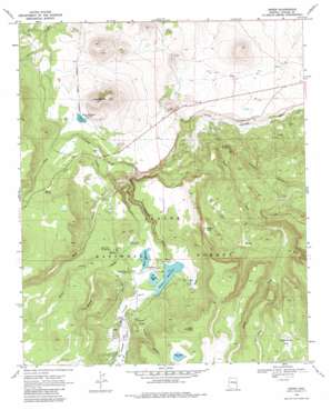
Greer Topo Map Arizona
To zoom in, hover over the map of Greer
USGS Topo Quad 34109a4 - 1:24,000 scale
| Topo Map Name: | Greer |
| USGS Topo Quad ID: | 34109a4 |
| Print Size: | ca. 21 1/4" wide x 27" high |
| Southeast Coordinates: | 34° N latitude / 109.375° W longitude |
| Map Center Coordinates: | 34.0625° N latitude / 109.4375° W longitude |
| U.S. State: | AZ |
| Filename: | o34109a4.jpg |
| Download Map JPG Image: | Greer topo map 1:24,000 scale |
| Map Type: | Topographic |
| Topo Series: | 7.5´ |
| Map Scale: | 1:24,000 |
| Source of Map Images: | United States Geological Survey (USGS) |
| Alternate Map Versions: |
Greer AZ 1969, updated 1972 Download PDF Buy paper map Greer AZ 1969, updated 1980 Download PDF Buy paper map Greer AZ 1997, updated 2000 Download PDF Buy paper map Greer AZ 2011 Download PDF Buy paper map Greer AZ 2014 Download PDF Buy paper map |
| FStopo: | US Forest Service topo Greer is available: Download FStopo PDF Download FStopo TIF |
1:24,000 Topo Quads surrounding Greer
> Back to 34109a1 at 1:100,000 scale
> Back to 34108a1 at 1:250,000 scale
> Back to U.S. Topo Maps home
Greer topo map: Gazetteer
Greer: Canals
Filler Ditch elevation 2526m 8287′Greer: Dams
Bunch Reservoir Dam elevation 2517m 8257′Ellis Wiltbank Dam elevation 2548m 8359′
Mexican Hay Lake Dam elevation 2710m 8891′
River Reservoir Dam elevation 2507m 8225′
River Reservoir Number Three Dam elevation 2507m 8225′
Tunnel Dam elevation 2520m 8267′
Greer: Flats
Amberon Flat elevation 2542m 8339′Dead Horse Flat elevation 2768m 9081′
Greer: Forests
Springerville Ranger District elevation 2666m 8746′Greer: Lakes
Hay Lake elevation 2780m 9120′Hidden Lake elevation 2510m 8234′
Greer: Populated Places
Greer elevation 2547m 8356′Northwoods elevation 2579m 8461′
Greer: Reservoirs
Alpha Tank elevation 2789m 9150′Benny Tank elevation 2736m 8976′
Beta Tank elevation 2772m 9094′
Bigelow Tank elevation 2518m 8261′
Bunch Reservoir elevation 2517m 8257′
Butler Tank elevation 2526m 8287′
Chi Tank elevation 2688m 8818′
De Witt Tank elevation 2762m 9061′
DeWitt Tank elevation 2763m 9064′
Ellis Wiltbank Reservoir elevation 2548m 8359′
Greer Lakes elevation 2507m 8225′
Hidden Tank elevation 2576m 8451′
Hoashead Tank elevation 2767m 9078′
Hobson Tank elevation 2753m 9032′
Lang Creek Tank elevation 2488m 8162′
Phone Line Tank elevation 2528m 8293′
Red Tank elevation 2803m 9196′
River Reservoir elevation 2507m 8225′
River Reservoir elevation 2507m 8225′
Sidehill Tank elevation 2791m 9156′
Spud Patch Tank elevation 2724m 8937′
Steve Tank elevation 2760m 9055′
Trail Spring Tank elevation 2599m 8526′
Tunnel Reservoir elevation 2519m 8264′
Winch Tank elevation 2747m 9012′
Greer: Springs
Bamke Spring elevation 2579m 8461′Basin Spring elevation 2427m 7962′
Brian Spring elevation 2488m 8162′
Butler Canyon Spring elevation 2628m 8622′
Cheese Spring elevation 2646m 8681′
Clay Spring elevation 2760m 9055′
Duke Spring elevation 2568m 8425′
Half Tank Spring elevation 2566m 8418′
Hobson Spring elevation 2759m 9051′
Jake Spring elevation 2533m 8310′
Lone Wolf Spring elevation 2546m 8353′
Luke Spring elevation 2615m 8579′
Melissa Spring elevation 2492m 8175′
P C Spring elevation 2763m 9064′
Shelter Spring elevation 2584m 8477′
Squirrel Spring elevation 2524m 8280′
Ted Seep Spring elevation 2462m 8077′
Trail Spring elevation 2599m 8526′
Greer: Streams
Benny Creek elevation 2396m 7860′Bill Riley Creek elevation 2547m 8356′
East Fork Little Colorado River elevation 2548m 8359′
Fish Creek elevation 2370m 7775′
Hall Creek elevation 2381m 7811′
Lang Creek elevation 2392m 7847′
Rosey Creek elevation 2512m 8241′
South Fork Little Colorado River elevation 2249m 7378′
West Fork Little Colorado River elevation 2548m 8359′
Greer: Summits
Antelope Mountain elevation 2739m 8986′Sizer Knoll elevation 2874m 9429′
Greer: Valleys
Butler Canyon elevation 2550m 8366′Hobson Canyon elevation 2243m 7358′
Joe Baca Draw elevation 2513m 8244′
Twenty Four Draw elevation 2368m 7769′
Greer digital topo map on disk
Buy this Greer topo map showing relief, roads, GPS coordinates and other geographical features, as a high-resolution digital map file on DVD:


