Springerville Topo Map Arizona
To zoom in, hover over the map of Springerville
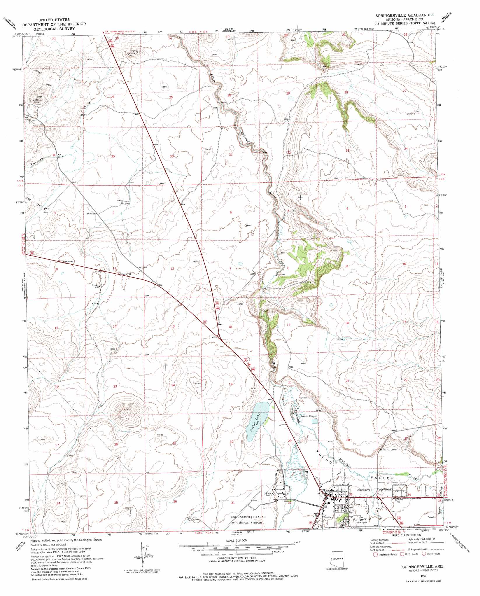
USGS Topo Quad 34109b3 - 1:24,000 scale
| Topo Map Name: | Springerville |
| USGS Topo Quad ID: | 34109b3 |
| Print Size: | ca. 21 1/4" wide x 27" high |
| Southeast Coordinates: | 34.125° N latitude / 109.25° W longitude |
| Map Center Coordinates: | 34.1875° N latitude / 109.3125° W longitude |
| U.S. State: | AZ |
| Filename: | o34109b3.jpg |
| Download Map JPG Image: | Springerville topo map 1:24,000 scale |
| Map Type: | Topographic |
| Topo Series: | 7.5´ |
| Map Scale: | 1:24,000 |
| Source of Map Images: | United States Geological Survey (USGS) |
| Alternate Map Versions: |
Springerville AZ 1969, updated 1972 Download PDF Buy paper map Springerville AZ 1969, updated 1984 Download PDF Buy paper map Springerville AZ 1997, updated 2000 Download PDF Buy paper map Springerville AZ 2011 Download PDF Buy paper map Springerville AZ 2014 Download PDF Buy paper map |
| FStopo: | US Forest Service topo Springerville is available: Download FStopo PDF Download FStopo TIF |
1:24,000 Topo Quads surrounding Springerville
Concho |
Salado |
Saint Johns South |
Mesa Parada Nw |
Mesa Parada |
Cerro Hueco |
Lyman Lake Sw |
Lyman Lake |
Voigt Ranch |
The Rincon |
Whiting Knoll |
Springerville Nw |
Springerville |
Coyote Hills |
Nelson Reservoir Ne |
Greens Peak |
Greer |
Eagar |
Nelson Reservoir |
Loco Knoll |
Mount Baldy |
Big Lake North |
Rudd Knoll |
Nutrioso |
Escudilla Mountain |
> Back to 34109a1 at 1:100,000 scale
> Back to 34108a1 at 1:250,000 scale
> Back to U.S. Topo Maps home
Springerville topo map: Gazetteer
Springerville: Airports
Springerville-Babbitt Field elevation 2146m 7040′Springerville: Lakes
Becker Lake elevation 2107m 6912′Springerville: Parks
Casa Malpais Site elevation 2142m 7027′Springerville: Populated Places
Springerville elevation 2125m 6971′Springerville: Streams
Nutrioso Creek elevation 2108m 6916′Picnic Creek elevation 2131m 6991′
Springerville digital topo map on disk
Buy this Springerville topo map showing relief, roads, GPS coordinates and other geographical features, as a high-resolution digital map file on DVD: