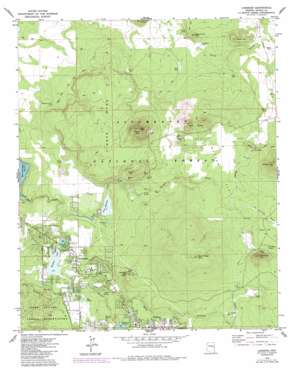
Lakeside Topo Map Arizona
To zoom in, hover over the map of Lakeside
USGS Topo Quad 34109b8 - 1:24,000 scale
| Topo Map Name: | Lakeside |
| USGS Topo Quad ID: | 34109b8 |
| Print Size: | ca. 21 1/4" wide x 27" high |
| Southeast Coordinates: | 34.125° N latitude / 109.875° W longitude |
| Map Center Coordinates: | 34.1875° N latitude / 109.9375° W longitude |
| U.S. State: | AZ |
| Filename: | o34109b8.jpg |
| Download Map JPG Image: | Lakeside topo map 1:24,000 scale |
| Map Type: | Topographic |
| Topo Series: | 7.5´ |
| Map Scale: | 1:24,000 |
| Source of Map Images: | United States Geological Survey (USGS) |
| Alternate Map Versions: |
Lakeside AZ 1976, updated 1977 Download PDF Buy paper map Lakeside AZ 1976, updated 1985 Download PDF Buy paper map Lakeside AZ 1977, updated 1978 Download PDF Buy paper map Lakeside AZ 1998, updated 2001 Download PDF Buy paper map Lakeside AZ 2011 Download PDF Buy paper map Lakeside AZ 2014 Download PDF Buy paper map |
| FStopo: | US Forest Service topo Lakeside is available: Download FStopo PDF Download FStopo TIF |
1:24,000 Topo Quads surrounding Lakeside
> Back to 34109a1 at 1:100,000 scale
> Back to 34108a1 at 1:250,000 scale
> Back to U.S. Topo Maps home
Lakeside topo map: Gazetteer
Lakeside: Dams
Blue Ridge Catchment Dam elevation 2310m 7578′Lake of the Woods Dam elevation 2044m 6706′
Lakeside Dam elevation 2046m 6712′
Scott Dam elevation 2048m 6719′
Woodland Dam elevation 2100m 6889′
Lakeside: Flats
Morgan Flat elevation 2156m 7073′Tenny Flat elevation 2204m 7230′
Lakeside: Populated Places
Lake of the Woods elevation 2054m 6738′Lakeside elevation 2054m 6738′
Pinetop elevation 2121m 6958′
Pinetop-Lakeside elevation 2071m 6794′
Sponseller elevation 2159m 7083′
Lakeside: Reservoirs
Blueridge Tank elevation 2159m 7083′Chet Tank elevation 1999m 6558′
Cholla Tank elevation 2024m 6640′
Dipping Corral Tank elevation 2013m 6604′
Fird Tank elevation 2000m 6561′
Frost Tank elevation 2043m 6702′
Galahad Tank elevation 2043m 6702′
Gawain Tank elevation 2183m 7162′
Grail Tank elevation 2172m 7125′
Gunnybag Tank elevation 2044m 6706′
Jaques Tank elevation 2085m 6840′
Lake of the Woods elevation 2044m 6706′
Morgan Draw Tank elevation 2081m 6827′
Morgan Wash Tank elevation 2081m 6827′
New Tank elevation 2080m 6824′
Peterson Tank elevation 2055m 6742′
Porter Tank elevation 2048m 6719′
Rainbow Lake elevation 2045m 6709′
RB Tank elevation 2189m 7181′
Rock Tanks elevation 2030m 6660′
Sawmill Tank elevation 2035m 6676′
Scott Reservoir elevation 2046m 6712′
Section 15 Tank elevation 2165m 7103′
Section Eleven Tank elevation 2047m 6715′
Section Ten Tank elevation 2019m 6624′
Section Thirty-four Tank elevation 1997m 6551′
Shadowfax Tank elevation 2189m 7181′
Shadowfax Tank elevation 2126m 6975′
Ski Hi Retreat Tank elevation 2185m 7168′
South Tank elevation 2055m 6742′
Sponseller Tank elevation 2147m 7043′
Stewart Tank elevation 2128m 6981′
Whipple Tank elevation 2185m 7168′
Woodland Reservoir elevation 2098m 6883′
Woolhouse Tank elevation 2046m 6712′
Lakeside: Springs
Adair Spring elevation 2073m 6801′Big Spring elevation 2049m 6722′
Jaques Spring elevation 2092m 6863′
Log Cabin Spring elevation 2080m 6824′
Pat Mullen Spring elevation 2188m 7178′
Peterson Spring elevation 2077m 6814′
Peterson Spring elevation 2073m 6801′
Porter Spring elevation 2086m 6843′
Porter Spring elevation 2080m 6824′
Spoonseller Siding elevation 2147m 7043′
Thompson Spring elevation 2182m 7158′
Walnut Spring elevation 2085m 6840′
Lakeside: Streams
Billy Creek elevation 2041m 6696′Morgan Wash elevation 2062m 6765′
Porter Creek elevation 2031m 6663′
Thompson Creek elevation 2121m 6958′
Walnut Creek elevation 2031m 6663′
Lakeside: Summits
Blue Ridge Mountain elevation 2329m 7641′Flume Mountain elevation 2164m 7099′
Jaques Mountain elevation 2125m 6971′
Pat Mullen Mountain elevation 2319m 7608′
Porter Mountain elevation 2311m 7582′
Springer Mountain elevation 2190m 7185′
Timber Mesa elevation 2122m 6961′
Twin Knolls elevation 2249m 7378′
Woolhouse Mountain elevation 2088m 6850′
Lakeside: Swamps
Jaques Marsh elevation 2047m 6715′Lakeside: Valleys
Elk Springs Draw elevation 2171m 7122′Lakeside digital topo map on disk
Buy this Lakeside topo map showing relief, roads, GPS coordinates and other geographical features, as a high-resolution digital map file on DVD:


