Voigt Ranch Topo Map Arizona
To zoom in, hover over the map of Voigt Ranch
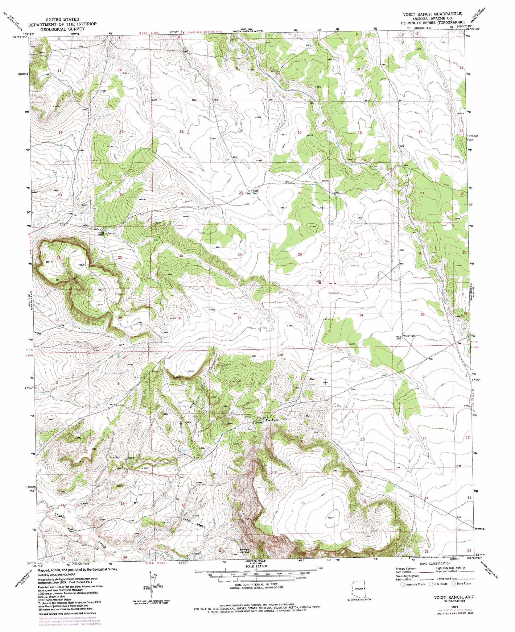
USGS Topo Quad 34109c2 - 1:24,000 scale
| Topo Map Name: | Voigt Ranch |
| USGS Topo Quad ID: | 34109c2 |
| Print Size: | ca. 21 1/4" wide x 27" high |
| Southeast Coordinates: | 34.25° N latitude / 109.125° W longitude |
| Map Center Coordinates: | 34.3125° N latitude / 109.1875° W longitude |
| U.S. State: | AZ |
| Filename: | o34109c2.jpg |
| Download Map JPG Image: | Voigt Ranch topo map 1:24,000 scale |
| Map Type: | Topographic |
| Topo Series: | 7.5´ |
| Map Scale: | 1:24,000 |
| Source of Map Images: | United States Geological Survey (USGS) |
| Alternate Map Versions: |
Voigt Ranch AZ 1971, updated 1973 Download PDF Buy paper map Voigt Ranch AZ 1971, updated 1985 Download PDF Buy paper map Voigt Ranch AZ 2011 Download PDF Buy paper map Voigt Ranch AZ 2014 Download PDF Buy paper map |
1:24,000 Topo Quads surrounding Voigt Ranch
Zion Reservoir |
Saint Johns North |
Kearn Lake |
Carrisito Spring |
Twentytwo Spring |
Salado |
Saint Johns South |
Mesa Parada Nw |
Mesa Parada |
Salazar Canyon |
Lyman Lake Sw |
Lyman Lake |
Voigt Ranch |
The Rincon |
Goat Spring |
Springerville Nw |
Springerville |
Coyote Hills |
Nelson Reservoir Ne |
Cow Springs |
Greer |
Eagar |
Nelson Reservoir |
Loco Knoll |
Jones Canyon |
> Back to 34109a1 at 1:100,000 scale
> Back to 34108a1 at 1:250,000 scale
> Back to U.S. Topo Maps home
Voigt Ranch digital topo map on disk
Buy this Voigt Ranch topo map showing relief, roads, GPS coordinates and other geographical features, as a high-resolution digital map file on DVD: