Stinking Springs Topo Map Arizona
To zoom in, hover over the map of Stinking Springs
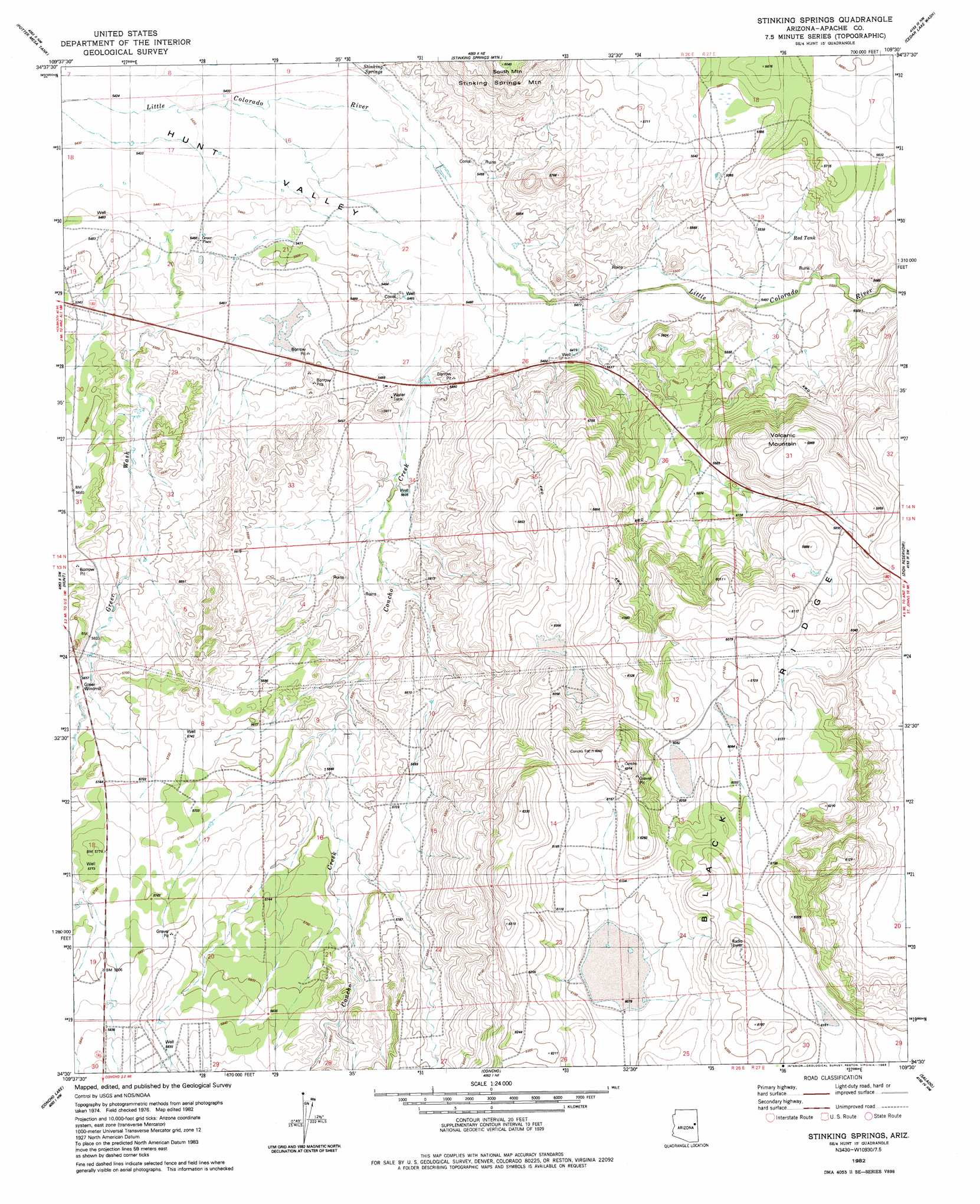
USGS Topo Quad 34109e5 - 1:24,000 scale
| Topo Map Name: | Stinking Springs |
| USGS Topo Quad ID: | 34109e5 |
| Print Size: | ca. 21 1/4" wide x 27" high |
| Southeast Coordinates: | 34.5° N latitude / 109.5° W longitude |
| Map Center Coordinates: | 34.5625° N latitude / 109.5625° W longitude |
| U.S. State: | AZ |
| Filename: | o34109e5.jpg |
| Download Map JPG Image: | Stinking Springs topo map 1:24,000 scale |
| Map Type: | Topographic |
| Topo Series: | 7.5´ |
| Map Scale: | 1:24,000 |
| Source of Map Images: | United States Geological Survey (USGS) |
| Alternate Map Versions: |
Adamana 4 SE AZ 1955, updated 1957 Download PDF Buy paper map Stinking Springs AZ 1982, updated 1983 Download PDF Buy paper map Stinking Springs AZ 2011 Download PDF Buy paper map Stinking Springs AZ 2014 Download PDF Buy paper map |
1:24,000 Topo Quads surrounding Stinking Springs
Agate House |
Milky Ranch |
Seven Springs |
Long H Ranch |
Prospect Spring |
Little Milky Wash |
Potter Mesa Tank |
Stinking Springs Mountain |
Cedar Lake Wash |
Schnebly Well |
Manuel Seep |
Hunt |
Stinking Springs |
Zion Reservoir |
Saint Johns North |
Mesa Redonda |
Concho Lake |
Concho |
Salado |
Saint Johns South |
Ortega Mountain |
Vernon |
Cerro Hueco |
Lyman Lake Sw |
Lyman Lake |
> Back to 34109e1 at 1:100,000 scale
> Back to 34108a1 at 1:250,000 scale
> Back to U.S. Topo Maps home
Stinking Springs topo map: Gazetteer
Stinking Springs: Flats
Rogers Lake elevation 1669m 5475′Soda Lake elevation 1666m 5465′
Stinking Springs: Populated Places
Greer Place elevation 1665m 5462′Stinking Springs: Reservoirs
Red Tank elevation 1686m 5531′Rogers Lake elevation 1671m 5482′
Soda Lake elevation 1667m 5469′
Stinking Springs: Ridges
Black Ridge elevation 1855m 6085′Stinking Springs: Springs
Stinking Springs elevation 1663m 5456′Stinking Springs: Streams
Concho Creek elevation 1668m 5472′Stinking Springs: Summits
Volcanic Mountain elevation 1816m 5958′Stinking Springs: Wells
Greer Windmill elevation 1726m 5662′Stinking Springs digital topo map on disk
Buy this Stinking Springs topo map showing relief, roads, GPS coordinates and other geographical features, as a high-resolution digital map file on DVD: