Point Of The Mountain Topo Map Arizona
To zoom in, hover over the map of Point Of The Mountain
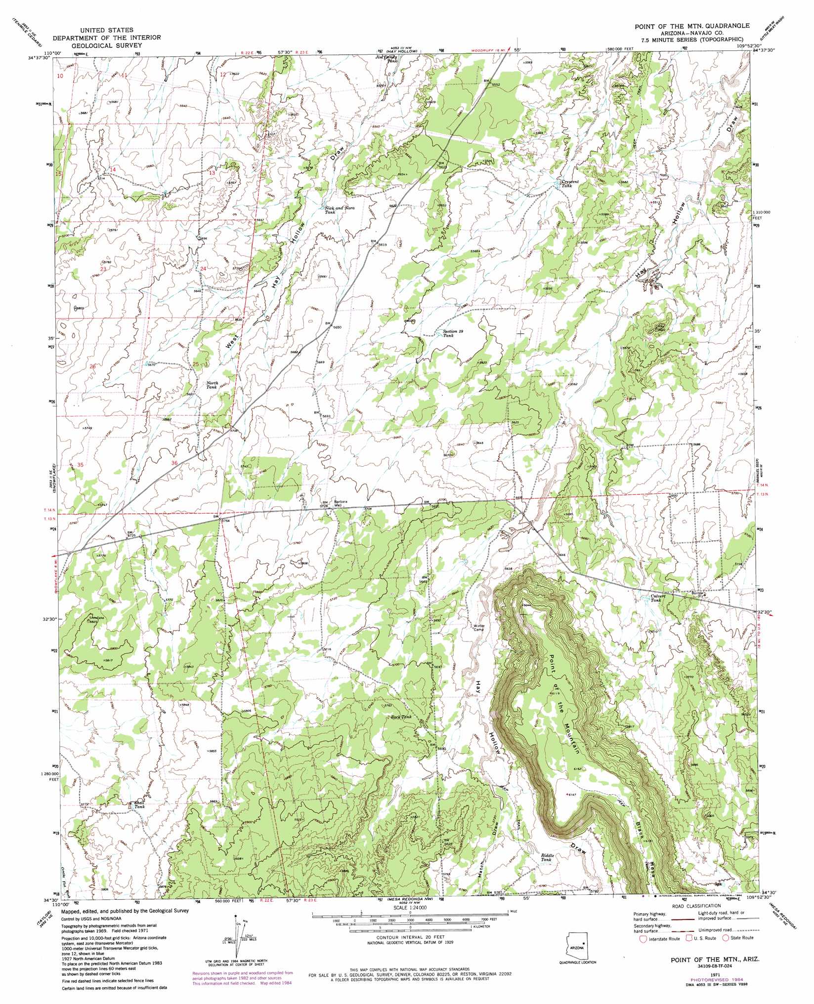
USGS Topo Quad 34109e8 - 1:24,000 scale
| Topo Map Name: | Point Of The Mountain |
| USGS Topo Quad ID: | 34109e8 |
| Print Size: | ca. 21 1/4" wide x 27" high |
| Southeast Coordinates: | 34.5° N latitude / 109.875° W longitude |
| Map Center Coordinates: | 34.5625° N latitude / 109.9375° W longitude |
| U.S. State: | AZ |
| Filename: | o34109e8.jpg |
| Download Map JPG Image: | Point Of The Mountain topo map 1:24,000 scale |
| Map Type: | Topographic |
| Topo Series: | 7.5´ |
| Map Scale: | 1:24,000 |
| Source of Map Images: | United States Geological Survey (USGS) |
| Alternate Map Versions: |
Point of the Mtn AZ 1971, updated 1973 Download PDF Buy paper map Point of the Mtn AZ 1971, updated 1984 Download PDF Buy paper map Point of the Mountain AZ 2011 Download PDF Buy paper map Point of the Mountain AZ 2014 Download PDF Buy paper map |
1:24,000 Topo Quads surrounding Point Of The Mountain
Porter Canyon |
Woodruff |
Padilla Tank |
Agate House |
Milky Ranch |
Flattop Hill |
Tenmile Cedars |
Hay Hollow |
Little Milky Wash |
Potter Mesa Tank |
Second Knolls |
Snowflake |
Point Of The Mountain |
Manuel Seep |
Hunt |
Cactus Flat |
Taylor |
Mesa Redonda Nw |
Mesa Redonda |
Concho Lake |
Pinedale |
Show Low North |
Silver Springs |
Ortega Mountain |
Vernon |
> Back to 34109e1 at 1:100,000 scale
> Back to 34108a1 at 1:250,000 scale
> Back to U.S. Topo Maps home
Point Of The Mountain topo map: Gazetteer
Point Of The Mountain: Cliffs
Point of the Mountain elevation 1866m 6122′Point Of The Mountain: Reservoirs
Crescent Tank elevation 1678m 5505′Culvert Tank elevation 1726m 5662′
Nick and Nora Tank elevation 1696m 5564′
North Tank elevation 1718m 5636′
Riddle Tank elevation 1755m 5757′
Rock Tank elevation 1742m 5715′
Section Twenty Tank elevation 0m 0′
Shelf Tank elevation 0m 0′
Point Of The Mountain: Valleys
Hatch Draw elevation 1739m 5705′Point Of The Mountain: Wells
Barbara Well elevation 1746m 5728′Point Of The Mountain digital topo map on disk
Buy this Point Of The Mountain topo map showing relief, roads, GPS coordinates and other geographical features, as a high-resolution digital map file on DVD: