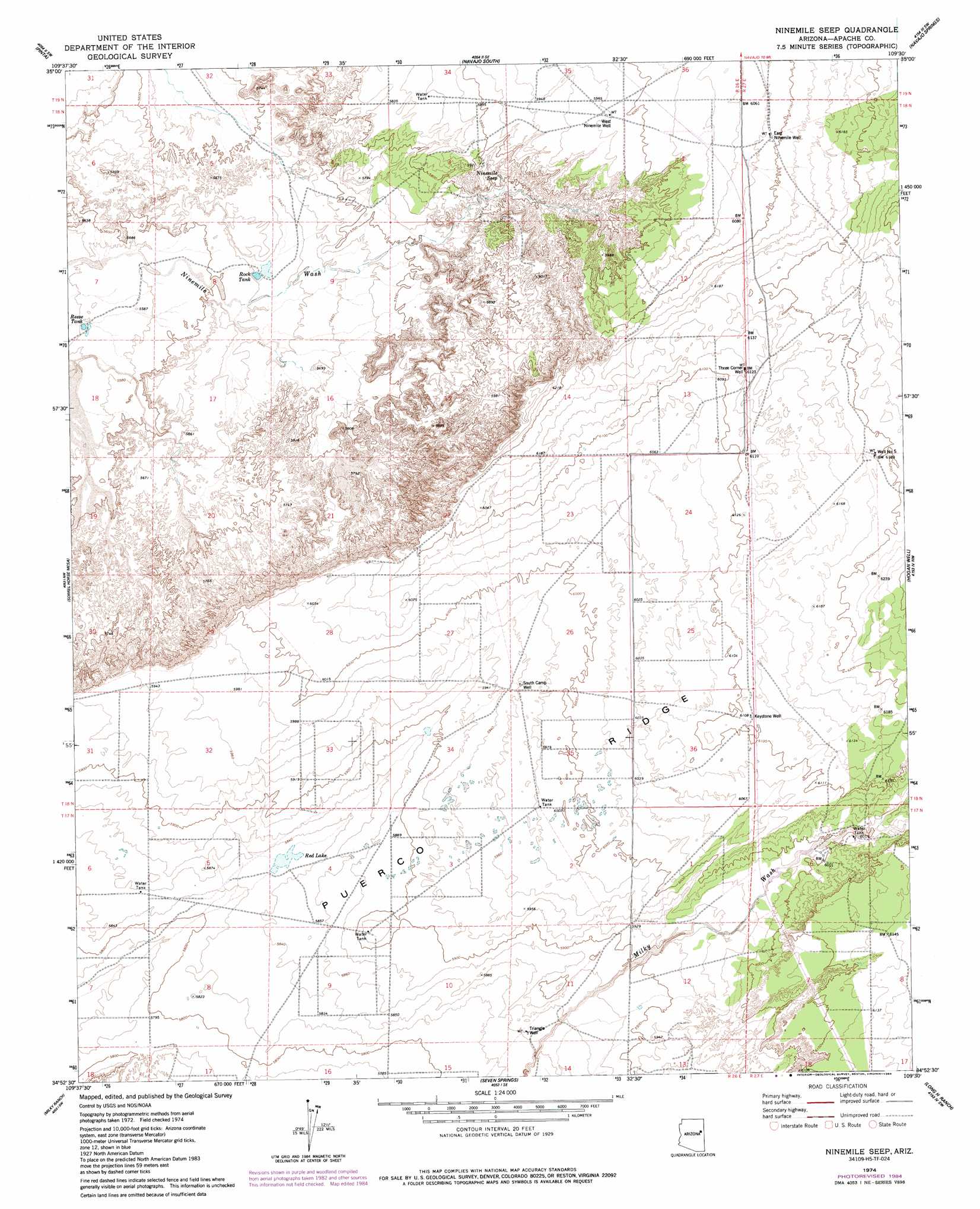
Ninemile Seep Topo Map Arizona
To zoom in, hover over the map of Ninemile Seep
USGS Topo Quad 34109h5 - 1:24,000 scale
| Topo Map Name: | Ninemile Seep |
| USGS Topo Quad ID: | 34109h5 |
| Print Size: | ca. 21 1/4" wide x 27" high |
| Southeast Coordinates: | 34.875° N latitude / 109.5° W longitude |
| Map Center Coordinates: | 34.9375° N latitude / 109.5625° W longitude |
| U.S. State: | AZ |
| Filename: | o34109h5.jpg |
| Download Map JPG Image: | Ninemile Seep topo map 1:24,000 scale |
| Map Type: | Topographic |
| Topo Series: | 7.5´ |
| Map Scale: | 1:24,000 |
| Source of Map Images: | United States Geological Survey (USGS) |
| Alternate Map Versions: |
Ninemile Seep AZ 1974, updated 1977 Download PDF Buy paper map Ninemile Seep AZ 1974, updated 1984 Download PDF Buy paper map Ninemile Seep AZ 2011 Download PDF Buy paper map Ninemile Seep AZ 2014 Download PDF Buy paper map |
1:24,000 Topo Quads surrounding Ninemile Seep
Chinde Mesa |
North Mill Well |
Navajo North |
Chambers |
Sanders |
Kachina Point |
Pinta |
Navajo South |
Navajo Springs |
Beacon Well |
Adamana |
Sorrel Horse Mesa |
Ninemile Seep |
Hogan Well |
Fairchild Well |
Agate House |
Milky Ranch |
Seven Springs |
Long H Ranch |
Prospect Spring |
Little Milky Wash |
Potter Mesa Tank |
Stinking Springs Mountain |
Cedar Lake Wash |
Schnebly Well |
> Back to 34109e1 at 1:100,000 scale
> Back to 34108a1 at 1:250,000 scale
> Back to U.S. Topo Maps home
Ninemile Seep topo map: Gazetteer
Ninemile Seep: Lakes
Red Lake elevation 1779m 5836′Ninemile Seep: Reservoirs
Reese Tank elevation 1701m 5580′Rock Tank elevation 1714m 5623′
Ninemile Seep: Ridges
Puerco Ridge elevation 1820m 5971′Ninemile Seep: Springs
Ninemile Seep elevation 1776m 5826′Ninemile Seep: Wells
East Ninemile Well elevation 1856m 6089′Keystone Well elevation 1862m 6108′
South Camp Well elevation 1817m 5961′
Three Corner Well elevation 1866m 6122′
Triangle Well elevation 1782m 5846′
Well Number Five elevation 1888m 6194′
West Ninemile Well elevation 1823m 5980′
Ninemile Seep digital topo map on disk
Buy this Ninemile Seep topo map showing relief, roads, GPS coordinates and other geographical features, as a high-resolution digital map file on DVD: