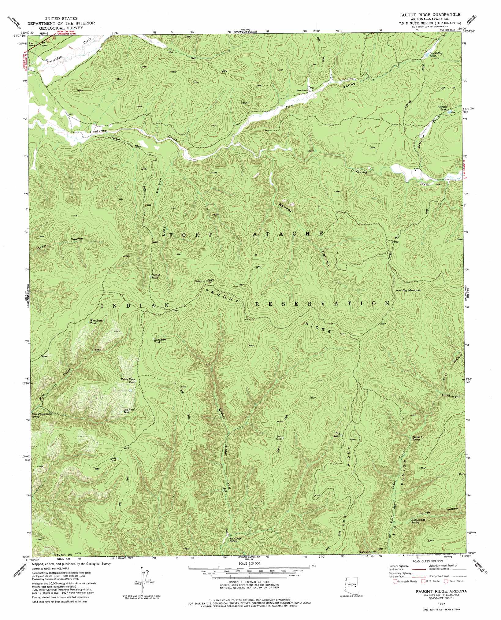
Faught Ridge Topo Map Arizona
To zoom in, hover over the map of Faught Ridge
USGS Topo Quad 34110a1 - 1:24,000 scale
| Topo Map Name: | Faught Ridge |
| USGS Topo Quad ID: | 34110a1 |
| Print Size: | ca. 21 1/4" wide x 27" high |
| Southeast Coordinates: | 34° N latitude / 110° W longitude |
| Map Center Coordinates: | 34.0625° N latitude / 110.0625° W longitude |
| U.S. State: | AZ |
| Filename: | o34110a1.jpg |
| Download Map JPG Image: | Faught Ridge topo map 1:24,000 scale |
| Map Type: | Topographic |
| Topo Series: | 7.5´ |
| Map Scale: | 1:24,000 |
| Source of Map Images: | United States Geological Survey (USGS) |
| Alternate Map Versions: |
Faught Ridge AZ 1977, updated 1978 Download PDF Buy paper map Faught Ridge AZ 2011 Download PDF Buy paper map Faught Ridge AZ 2014 Download PDF Buy paper map |
1:24,000 Topo Quads surrounding Faught Ridge
Clay Springs |
Pinedale |
Show Low North |
Silver Springs |
Ortega Mountain |
Limestone Canyon North |
Red Top Mountain |
Show Low South |
Lakeside |
Sponseller Mountain |
Limestone Canyon South |
Long Tom Canyon |
Faught Ridge |
Indian Pine |
Mcnary |
Carrizo |
Cedar Creek |
Round Top Mountain |
Alchesay Flat |
Hawley Lake West |
Carrizo Se |
Cone Butte |
Canyon Day |
Whiteriver |
Corn Creek Plateau |
> Back to 34110a1 at 1:100,000 scale
> Back to 34110a1 at 1:250,000 scale
> Back to U.S. Topo Maps home
Faught Ridge topo map: Gazetteer
Faught Ridge: Lakes
Dry Lake elevation 2025m 6643′Faught Ridge: Reservoirs
Dry Valley Tank elevation 1941m 6368′East Burn Tank elevation 2086m 6843′
Heavy Burn Tank elevation 2130m 6988′
Lake Tank elevation 2113m 6932′
Log Road Tank elevation 2083m 6833′
Petrified Tank elevation 1962m 6437′
Salt Tank elevation 0m 0′
West Burn Tank elevation 2100m 6889′
Faught Ridge: Ridges
Faught Ridge elevation 2108m 6916′Lake Ridge elevation 2094m 6870′
Faught Ridge: Springs
Cattail Rush elevation 2065m 6774′Rattlesnake Spring elevation 1847m 6059′
Salt Trap Spring elevation 0m 0′
Twentyfour-Dart Spring elevation 1852m 6076′
Faught Ridge: Streams
Petrified Creek elevation 1915m 6282′Faught Ridge: Summits
Big Mountain elevation 2143m 7030′Faught Ridge: Valleys
Beaver Canyon elevation 1852m 6076′Dry Valley elevation 1860m 6102′
First Hollow elevation 1908m 6259′
Fourth Hollow elevation 1819m 5967′
Lucy Canyon elevation 1832m 6010′
Third Hollow elevation 1900m 6233′
Faught Ridge digital topo map on disk
Buy this Faught Ridge topo map showing relief, roads, GPS coordinates and other geographical features, as a high-resolution digital map file on DVD: