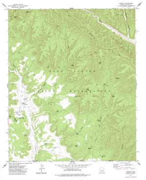
Cibecue Topo Map Arizona
To zoom in, hover over the map of Cibecue
USGS Topo Quad 34110a4 - 1:24,000 scale
| Topo Map Name: | Cibecue |
| USGS Topo Quad ID: | 34110a4 |
| Print Size: | ca. 21 1/4" wide x 27" high |
| Southeast Coordinates: | 34° N latitude / 110.375° W longitude |
| Map Center Coordinates: | 34.0625° N latitude / 110.4375° W longitude |
| U.S. State: | AZ |
| Filename: | o34110a4.jpg |
| Download Map JPG Image: | Cibecue topo map 1:24,000 scale |
| Map Type: | Topographic |
| Topo Series: | 7.5´ |
| Map Scale: | 1:24,000 |
| Source of Map Images: | United States Geological Survey (USGS) |
| Alternate Map Versions: |
Cibecue AZ 1977, updated 1978 Download PDF Buy paper map Cibecue AZ 2011 Download PDF Buy paper map Cibecue AZ 2014 Download PDF Buy paper map |
1:24,000 Topo Quads surrounding Cibecue
> Back to 34110a1 at 1:100,000 scale
> Back to 34110a1 at 1:250,000 scale
> Back to U.S. Topo Maps home
Cibecue topo map: Gazetteer
Cibecue: Populated Places
Cibecue elevation 1500m 4921′Cibecue: Reservoirs
Holding Pen Tank elevation 1513m 4963′Ice Cream Cone Tank elevation 1671m 5482′
Red Canyon Tank elevation 1639m 5377′
Valley View Tank elevation 1652m 5419′
Wildhorse Tank elevation 1617m 5305′
Cibecue: Springs
Box Spring elevation 1582m 5190′Clay Spring elevation 1694m 5557′
Clearwater Spring elevation 1648m 5406′
Cottonwood Spring elevation 1488m 4881′
DeHose Spring elevation 1762m 5780′
Grape Spring elevation 1730m 5675′
Indian Spring elevation 1754m 5754′
Locust Spring elevation 1901m 6236′
N Five Spring elevation 1480m 4855′
Pine Spring elevation 1583m 5193′
Poison Ivy Spring elevation 1893m 6210′
Red Rock Spring elevation 1601m 5252′
V Spring elevation 1748m 5734′
Walnut Spring elevation 1584m 5196′
Cibecue: Streams
C One Wash elevation 1499m 4917′Day School Wash elevation 1525m 5003′
Mud Creek elevation 1582m 5190′
Salt Creek elevation 0m 0′
V Eighteen Wash elevation 1473m 4832′
Cibecue: Summits
Valley View Point elevation 2012m 6601′Cibecue: Valleys
Jumpoff Canyon elevation 1592m 5223′Cibecue digital topo map on disk
Buy this Cibecue topo map showing relief, roads, GPS coordinates and other geographical features, as a high-resolution digital map file on DVD:


