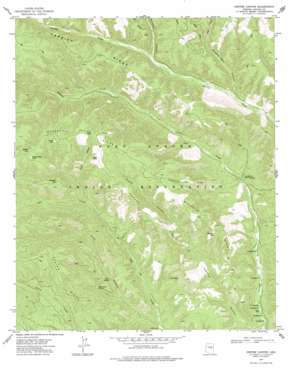
Pepper Canyon Topo Map Arizona
To zoom in, hover over the map of Pepper Canyon
USGS Topo Quad 34110b5 - 1:24,000 scale
| Topo Map Name: | Pepper Canyon |
| USGS Topo Quad ID: | 34110b5 |
| Print Size: | ca. 21 1/4" wide x 27" high |
| Southeast Coordinates: | 34.125° N latitude / 110.5° W longitude |
| Map Center Coordinates: | 34.1875° N latitude / 110.5625° W longitude |
| U.S. State: | AZ |
| Filename: | o34110b5.jpg |
| Download Map JPG Image: | Pepper Canyon topo map 1:24,000 scale |
| Map Type: | Topographic |
| Topo Series: | 7.5´ |
| Map Scale: | 1:24,000 |
| Source of Map Images: | United States Geological Survey (USGS) |
| Alternate Map Versions: |
Pepper Canyon AZ 1977, updated 1978 Download PDF Buy paper map Pepper Canyon AZ 2011 Download PDF Buy paper map Pepper Canyon AZ 2014 Download PDF Buy paper map |
1:24,000 Topo Quads surrounding Pepper Canyon
> Back to 34110a1 at 1:100,000 scale
> Back to 34110a1 at 1:250,000 scale
> Back to U.S. Topo Maps home
Pepper Canyon topo map: Gazetteer
Pepper Canyon: Lakes
Donkey Lake elevation 2174m 7132′Louse Lake elevation 2134m 7001′
Pepper Lake elevation 2148m 7047′
Pryce Lake elevation 2121m 6958′
Pumpkin Lake elevation 2119m 6952′
Wagon Wheel Lake elevation 2156m 7073′
Whitetail Lake elevation 2040m 6692′
Pepper Canyon: Ridges
Carrizo Ridge elevation 2055m 6742′Pepper Ridge elevation 2081m 6827′
Telephone Line Ridge elevation 2111m 6925′
Whitetail Ridge elevation 2160m 7086′
Pepper Canyon: Springs
C T Spring elevation 1638m 5374′K P Spring elevation 1804m 5918′
Rock Point Spring elevation 1801m 5908′
Twin Springs elevation 1772m 5813′
White Spring elevation 1743m 5718′
Pepper Canyon: Valleys
Buckskin Canyon elevation 1884m 6181′East Fork Phoenix Park Canyon elevation 1889m 6197′
Ivins Canyon elevation 1677m 5501′
Pepper Canyon elevation 1622m 5321′
Phoenix Park Canyon elevation 1813m 5948′
Pryce Canyon elevation 1890m 6200′
West Fork Phoenix Park Canyon elevation 1888m 6194′
Pepper Canyon digital topo map on disk
Buy this Pepper Canyon topo map showing relief, roads, GPS coordinates and other geographical features, as a high-resolution digital map file on DVD:


