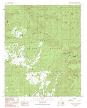
Oxbow Mountain Topo Map Arizona
To zoom in, hover over the map of Oxbow Mountain
USGS Topo Quad 34110b8 - 1:24,000 scale
| Topo Map Name: | Oxbow Mountain |
| USGS Topo Quad ID: | 34110b8 |
| Print Size: | ca. 21 1/4" wide x 27" high |
| Southeast Coordinates: | 34.125° N latitude / 110.875° W longitude |
| Map Center Coordinates: | 34.1875° N latitude / 110.9375° W longitude |
| U.S. State: | AZ |
| Filename: | o34110b8.jpg |
| Download Map JPG Image: | Oxbow Mountain topo map 1:24,000 scale |
| Map Type: | Topographic |
| Topo Series: | 7.5´ |
| Map Scale: | 1:24,000 |
| Source of Map Images: | United States Geological Survey (USGS) |
| Alternate Map Versions: |
Oxbow Mountain AZ 1990, updated 1991 Download PDF Buy paper map Oxbow Mountain AZ 1990, updated 1991 Download PDF Buy paper map Oxbow Mountain AZ 2004, updated 2006 Download PDF Buy paper map Oxbow Mountain AZ 2011 Download PDF Buy paper map Oxbow Mountain AZ 2014 Download PDF Buy paper map |
| FStopo: | US Forest Service topo Oxbow Mountain is available: Download FStopo PDF Download FStopo TIF |
1:24,000 Topo Quads surrounding Oxbow Mountain
> Back to 34110a1 at 1:100,000 scale
> Back to 34110a1 at 1:250,000 scale
> Back to U.S. Topo Maps home
Oxbow Mountain topo map: Gazetteer
Oxbow Mountain: Airports
Pleasant Valley Airstrip elevation 1725m 5659′Waldrip Airstrip elevation 1698m 5570′
Oxbow Mountain: Cliffs
Naegelin Rim elevation 2100m 6889′Oxbow Mountain: Mines
Cook Mine elevation 1791m 5875′Oxbow Mountain: Reservoirs
Bar X Tank elevation 1635m 5364′Caine Tank elevation 1751m 5744′
Cherry Creek Tank elevation 1602m 5255′
Clark Tank elevation 1626m 5334′
Cline Pasture Tank elevation 1620m 5314′
Cooks Trick Tank elevation 1748m 5734′
Cross Y Tank elevation 1695m 5561′
Crouch Mesa elevation 1844m 6049′
Dry Creek Tank elevation 1892m 6207′
Dry Creek Trough elevation 1689m 5541′
Fillmore Tank elevation 1753m 5751′
Grasshopper Tank elevation 1633m 5357′
Hog Tank elevation 1754m 5754′
Hog Tank elevation 1871m 6138′
Lower PV Trick Tank elevation 1649m 5410′
Martin Tank elevation 1655m 5429′
McInturf Trick Tank elevation 1739m 5705′
Mexican Hat Tank elevation 1599m 5246′
Oxbow Mountain Tank elevation 1850m 6069′
Oxbow Tank elevation 1890m 6200′
Rim Tank elevation 1669m 5475′
Ruth Tank elevation 1680m 5511′
Steve Tank elevation 1683m 5521′
Trail Tank elevation 1693m 5554′
Oxbow Mountain: Springs
Gruwell Spring elevation 1712m 5616′Lost Salt Spring Number One elevation 1891m 6204′
Lost Salt Spring Number Two elevation 1900m 6233′
McInturf Spring elevation 1772m 5813′
Naegelin Spring elevation 1832m 6010′
Saunders Spring elevation 1802m 5912′
Slide Spring elevation 1667m 5469′
Oxbow Mountain: Streams
Dry Creek elevation 1596m 5236′Gordon Canyon Creek elevation 1689m 5541′
Pine Creek elevation 1605m 5265′
Oxbow Mountain: Summits
Oxbow Mountain elevation 1954m 6410′Round Mountain elevation 1976m 6482′
Oxbow Mountain: Trails
Chamberlain Trail elevation 1610m 5282′Oxbow Mountain: Valleys
Colcord Canyon elevation 1770m 5807′Gruwell Canyon elevation 1634m 5360′
Lost Salt Canyon elevation 1836m 6023′
Naegelin Canyon elevation 1744m 5721′
Naegelin Spring Canyon elevation 1660m 5446′
Parallel Canyon elevation 1712m 5616′
Saunders Canyon elevation 1706m 5597′
Oxbow Mountain: Wells
Pine Creek Well elevation 1670m 5479′Oxbow Mountain digital topo map on disk
Buy this Oxbow Mountain topo map showing relief, roads, GPS coordinates and other geographical features, as a high-resolution digital map file on DVD:


