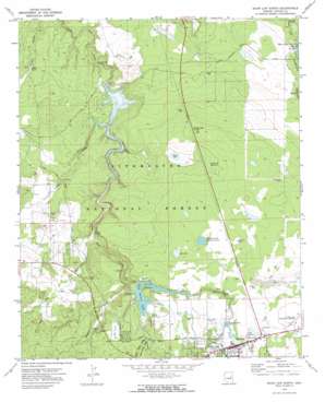
Show Low North Topo Map Arizona
To zoom in, hover over the map of Show Low North
USGS Topo Quad 34110c1 - 1:24,000 scale
| Topo Map Name: | Show Low North |
| USGS Topo Quad ID: | 34110c1 |
| Print Size: | ca. 21 1/4" wide x 27" high |
| Southeast Coordinates: | 34.25° N latitude / 110° W longitude |
| Map Center Coordinates: | 34.3125° N latitude / 110.0625° W longitude |
| U.S. State: | AZ |
| Filename: | o34110c1.jpg |
| Download Map JPG Image: | Show Low North topo map 1:24,000 scale |
| Map Type: | Topographic |
| Topo Series: | 7.5´ |
| Map Scale: | 1:24,000 |
| Source of Map Images: | United States Geological Survey (USGS) |
| Alternate Map Versions: |
Show Low North AZ 1970, updated 1973 Download PDF Buy paper map Show Low North AZ 1970, updated 1973 Download PDF Buy paper map Show Low North AZ 1998, updated 2000 Download PDF Buy paper map Show Low North AZ 2011 Download PDF Buy paper map Show Low North AZ 2014 Download PDF Buy paper map |
| FStopo: | US Forest Service topo Show Low North is available: Download FStopo PDF Download FStopo TIF |
1:24,000 Topo Quads surrounding Show Low North
> Back to 34110a1 at 1:100,000 scale
> Back to 34110a1 at 1:250,000 scale
> Back to U.S. Topo Maps home
Show Low North topo map: Gazetteer
Show Low North: Airports
Show Low Municipal Airport elevation 1954m 6410′Show Low North: Basins
Lone Pine Gravel Pit elevation 1813m 5948′Show Low North: Dams
Daggs Dam elevation 1817m 5961′Fool Hollow Dam elevation 1898m 6227′
Lone Pine Dam elevation 1819m 5967′
Trophy Lake Dam elevation 1836m 6023′
Show Low North: Forests
Lakeside Ranger District elevation 1947m 6387′Show Low North: Lakes
Bills Lake elevation 1841m 6040′Deep Lake elevation 1921m 6302′
Ned Lake elevation 1929m 6328′
Pintail Lake elevation 1939m 6361′
Sink Hole Lake elevation 1872m 6141′
Telephone Lake elevation 1937m 6354′
White Lake elevation 1898m 6227′
Show Low North: Populated Places
Robinson Trail Crossing elevation 1781m 5843′Roundy Crossing elevation 1838m 6030′
Show Low elevation 1927m 6322′
Show Low North: Post Offices
Show Low Post Office elevation 1931m 6335′Show Low North: Reservoirs
Alix Tank elevation 1898m 6227′Daggs Reservoir elevation 1817m 5961′
Deep Tank elevation 1921m 6302′
Fool Stock Tank elevation 1854m 6082′
Fools Hollow Lake elevation 1908m 6259′
Fools Hollow Well elevation 1875m 6151′
Malapai Tank elevation 1934m 6345′
Robinson Trail Tank elevation 1781m 5843′
Section Five Tank elevation 1945m 6381′
Section Four Tank elevation 1945m 6381′
Section Twentynine Reservoir elevation 1908m 6259′
Substation Tank elevation 1945m 6381′
Thistle Tank elevation 1797m 5895′
Trophy Lake elevation 1836m 6023′
White Lake Tank elevation 1898m 6227′
Show Low North: Ridges
White Lake Divide elevation 1934m 6345′Show Low North: Streams
Hog Wash elevation 1842m 6043′Show Low North: Swamps
Bosque Mojado elevation 1925m 6315′Redhead Marsh elevation 1909m 6263′
Show Low North: Valleys
Bagnal Draw elevation 1881m 6171′Fools Hollow elevation 1908m 6259′
Linden Draw elevation 1802m 5912′
Right Hand Draw elevation 1918m 6292′
Show Low North: Wells
Deep Well elevation 1927m 6322′Divide Well elevation 1903m 6243′
Lone Pine Well elevation 1872m 6141′
Whipple Well elevation 1939m 6361′
Show Low North digital topo map on disk
Buy this Show Low North topo map showing relief, roads, GPS coordinates and other geographical features, as a high-resolution digital map file on DVD:


