Flattop Hill Topo Map Arizona
To zoom in, hover over the map of Flattop Hill
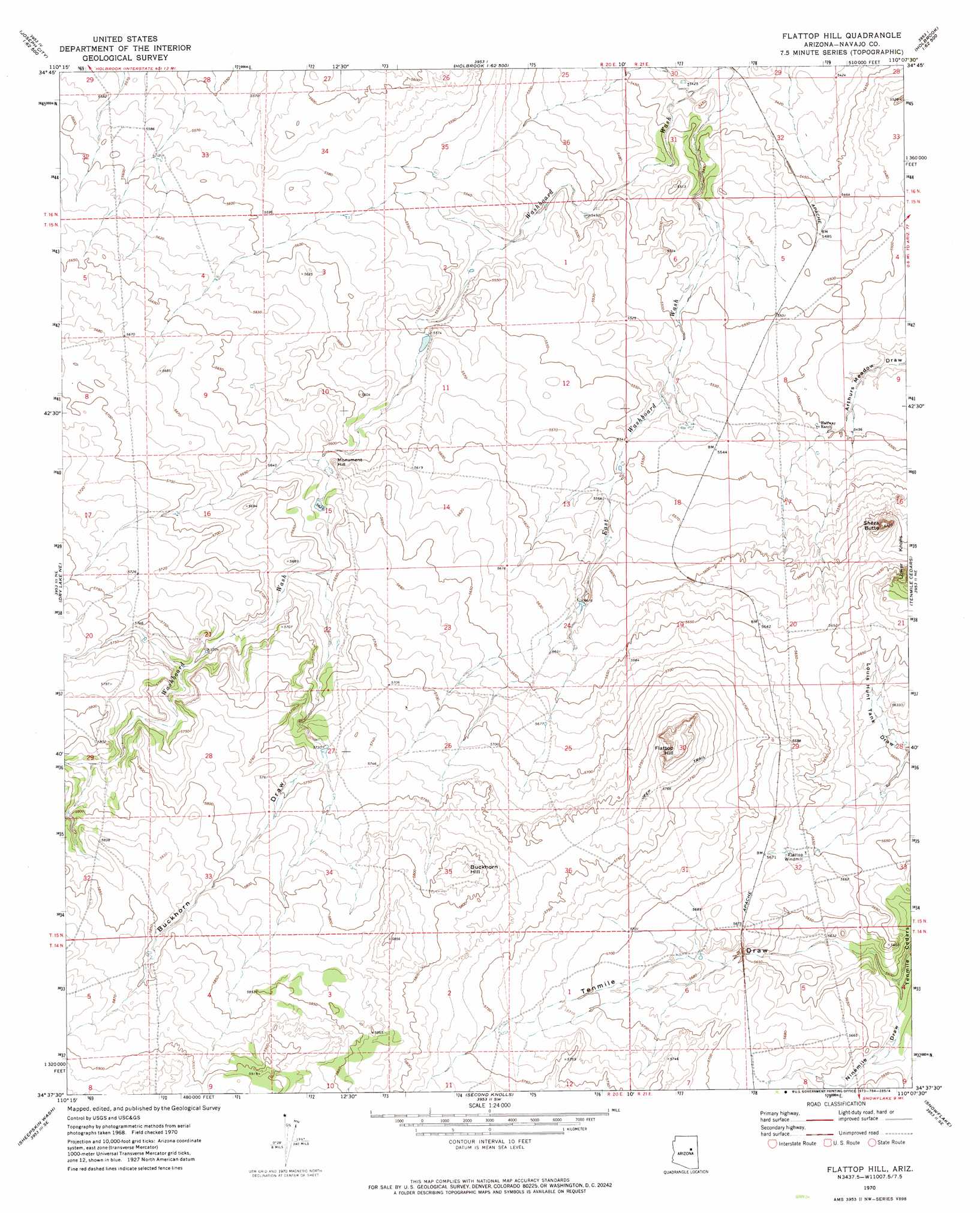
USGS Topo Quad 34110f2 - 1:24,000 scale
| Topo Map Name: | Flattop Hill |
| USGS Topo Quad ID: | 34110f2 |
| Print Size: | ca. 21 1/4" wide x 27" high |
| Southeast Coordinates: | 34.625° N latitude / 110.125° W longitude |
| Map Center Coordinates: | 34.6875° N latitude / 110.1875° W longitude |
| U.S. State: | AZ |
| Filename: | o34110f2.jpg |
| Download Map JPG Image: | Flattop Hill topo map 1:24,000 scale |
| Map Type: | Topographic |
| Topo Series: | 7.5´ |
| Map Scale: | 1:24,000 |
| Source of Map Images: | United States Geological Survey (USGS) |
| Alternate Map Versions: |
Flattop Hill AZ 1970, updated 1973 Download PDF Buy paper map Flattop Hill AZ 2011 Download PDF Buy paper map Flattop Hill AZ 2014 Download PDF Buy paper map |
1:24,000 Topo Quads surrounding Flattop Hill
Apache Butte |
Joseph City |
Holbrook |
Sun Valley |
Carrizo Butte |
Chimney Canyon |
Saunders Draw |
Porter Canyon |
Woodruff |
Padilla Tank |
Dry Lake Nw |
Dry Lake Ne |
Flattop Hill |
Tenmile Cedars |
Hay Hollow |
Zeniff |
Sheepskin Wash |
Second Knolls |
Snowflake |
Point Of The Mountain |
Aripine |
Big Pug Tank |
Cactus Flat |
Taylor |
Mesa Redonda Nw |
> Back to 34110e1 at 1:100,000 scale
> Back to 34110a1 at 1:250,000 scale
> Back to U.S. Topo Maps home
Flattop Hill topo map: Gazetteer
Flattop Hill: Reservoirs
Buckhorn Tank elevation 1782m 5846′Flattop Hill: Summits
Buckhorn Hill elevation 1778m 5833′Flattop Hill elevation 1782m 5846′
Monument Hill elevation 1715m 5626′
Sheza Butte elevation 0m 0′
Flattop Hill: Valleys
Buckhorn Draw elevation 1722m 5649′Ninemile Draw elevation 1705m 5593′
Flattop Hill digital topo map on disk
Buy this Flattop Hill topo map showing relief, roads, GPS coordinates and other geographical features, as a high-resolution digital map file on DVD: