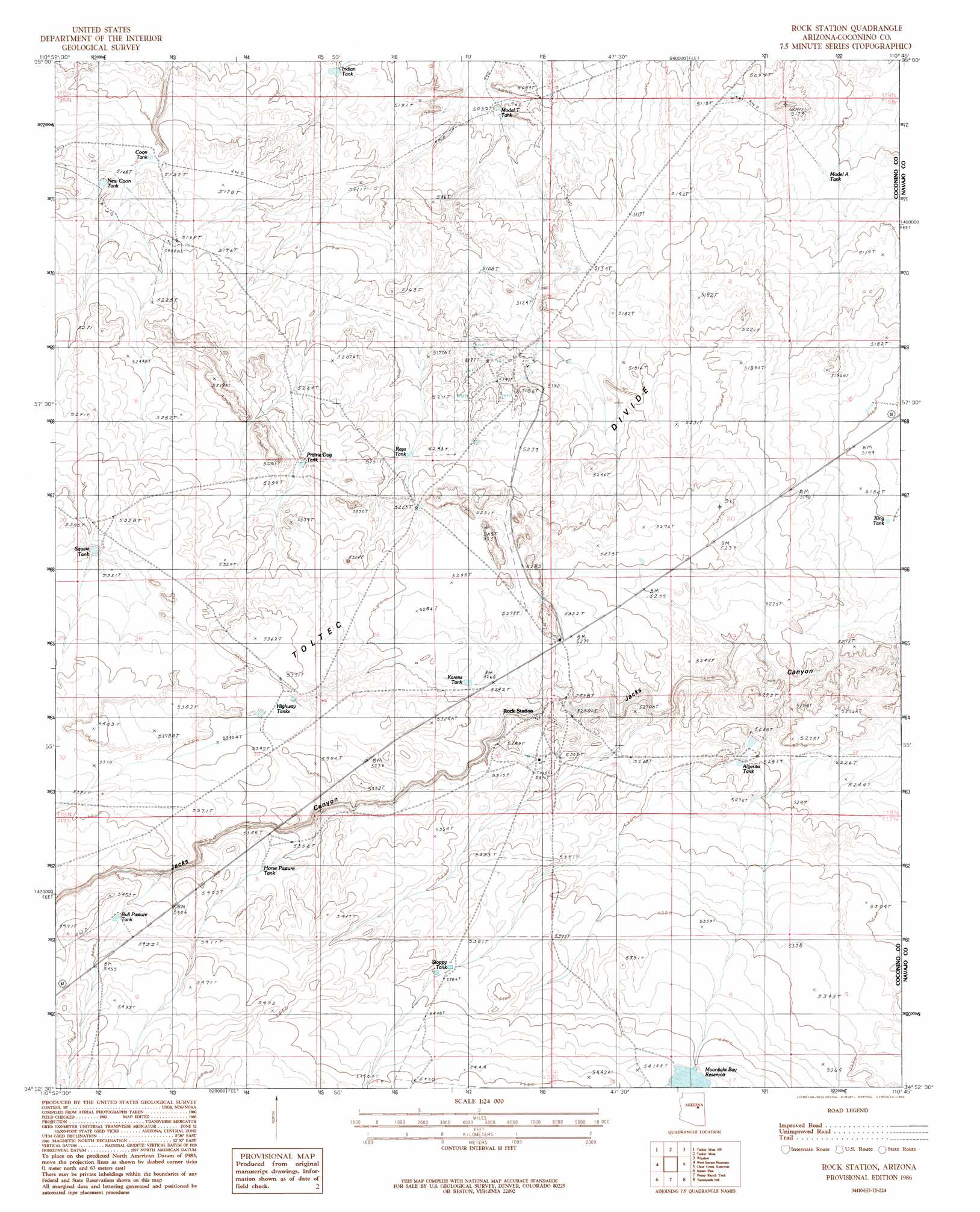
Rock Station Topo Map Arizona
To zoom in, hover over the map of Rock Station
USGS Topo Quad 34110h7 - 1:24,000 scale
| Topo Map Name: | Rock Station |
| USGS Topo Quad ID: | 34110h7 |
| Print Size: | ca. 21 1/4" wide x 27" high |
| Southeast Coordinates: | 34.875° N latitude / 110.75° W longitude |
| Map Center Coordinates: | 34.9375° N latitude / 110.8125° W longitude |
| U.S. State: | AZ |
| Filename: | o34110h7.jpg |
| Download Map JPG Image: | Rock Station topo map 1:24,000 scale |
| Map Type: | Topographic |
| Topo Series: | 7.5´ |
| Map Scale: | 1:24,000 |
| Source of Map Images: | United States Geological Survey (USGS) |
| Alternate Map Versions: |
Rock Station AZ 1986, updated 1986 Download PDF Buy paper map Rock Station AZ 2011 Download PDF Buy paper map Rock Station AZ 2014 Download PDF Buy paper map |
1:24,000 Topo Quads surrounding Rock Station
Canyon Diablo |
Tucker Mesa Nw |
Tucker Mesa Ne |
Winslow Nw |
Winslow Ne |
Meteor Crater |
Tucker Mesa Sw |
Tucker Mesa |
Winslow |
Rincon Ranch |
Chavez Mountain Ne |
West Sunset Mountain |
Rock Station |
Clear Creek Reservoir |
Hibbard |
Chavez Mountain East |
Sunset Pass |
Pump Ranch Tank |
Twentymile Hill |
Mccauley Sinks |
Quayle Hill |
Hamilton Crossing |
Chevelon Butte |
Potato Wash North |
Potato Wash Ne |
> Back to 34110e1 at 1:100,000 scale
> Back to 34110a1 at 1:250,000 scale
> Back to U.S. Topo Maps home
Rock Station topo map: Gazetteer
Rock Station: Reservoirs
Coon Tank elevation 1579m 5180′Highway Tanks elevation 1626m 5334′
Moonlight Bay Reservoir elevation 1650m 5413′
Prairie Dog Tank elevation 1602m 5255′
Rock Station digital topo map on disk
Buy this Rock Station topo map showing relief, roads, GPS coordinates and other geographical features, as a high-resolution digital map file on DVD: