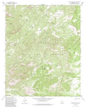
Sheep Basin Mountain Topo Map Arizona
To zoom in, hover over the map of Sheep Basin Mountain
USGS Topo Quad 34111a2 - 1:24,000 scale
| Topo Map Name: | Sheep Basin Mountain |
| USGS Topo Quad ID: | 34111a2 |
| Print Size: | ca. 21 1/4" wide x 27" high |
| Southeast Coordinates: | 34° N latitude / 111.125° W longitude |
| Map Center Coordinates: | 34.0625° N latitude / 111.1875° W longitude |
| U.S. State: | AZ |
| Filename: | o34111a2.jpg |
| Download Map JPG Image: | Sheep Basin Mountain topo map 1:24,000 scale |
| Map Type: | Topographic |
| Topo Series: | 7.5´ |
| Map Scale: | 1:24,000 |
| Source of Map Images: | United States Geological Survey (USGS) |
| Alternate Map Versions: |
Sheep Basin Mtn. AZ 1972, updated 1974 Download PDF Buy paper map Sheep Basin Mtn. AZ 1972, updated 1985 Download PDF Buy paper map Sheep Basin Mountain AZ 2004, updated 2006 Download PDF Buy paper map Sheep Basin Mountain AZ 2011 Download PDF Buy paper map Sheep Basin Mountain AZ 2014 Download PDF Buy paper map |
| FStopo: | US Forest Service topo Sheep Basin Mountain is available: Download FStopo PDF Download FStopo TIF |
1:24,000 Topo Quads surrounding Sheep Basin Mountain
> Back to 34111a1 at 1:100,000 scale
> Back to 34110a1 at 1:250,000 scale
> Back to U.S. Topo Maps home
Sheep Basin Mountain topo map: Gazetteer
Sheep Basin Mountain: Cliffs
Dead Boy Point elevation 1382m 4534′Sheep Basin Mountain: Flats
Turkey Flat elevation 1641m 5383′Sheep Basin Mountain: Mines
Pigeon Tank elevation 1558m 5111′Sheep Basin Mountain: Populated Places
Coffeepot elevation 1548m 5078′Gallups elevation 1266m 4153′
Sheep Basin Mountain: Reservoirs
Armer Tank elevation 1664m 5459′Blackjack Tank elevation 1378m 4520′
Breadpan Tank elevation 1822m 5977′
Brushy Hollow Tank elevation 1354m 4442′
Brushy Tank elevation 1397m 4583′
Buck Basin Tank elevation 1564m 5131′
Coffeepot Tank elevation 1547m 5075′
Cottonwood Tank elevation 1295m 4248′
Double Corral Tank elevation 1710m 5610′
Duck Tank elevation 1484m 4868′
Duck Tank elevation 1475m 4839′
Ernie Tank elevation 1341m 4399′
Fresno Tank elevation 1524m 5000′
Gun Tank elevation 1645m 5396′
Header Tank elevation 1604m 5262′
Houdon Tank elevation 1717m 5633′
Leaky Tank elevation 1533m 5029′
Lost Tank elevation 1339m 4393′
Neal Mountain Tank elevation 1390m 4560′
Neal Mountain Tank elevation 1446m 4744′
Neal Tank Number Two elevation 1479m 4852′
Round Tank elevation 1448m 4750′
Sam Tank elevation 1713m 5620′
Sand Tank elevation 1492m 4895′
Sheep Basin Mountain: Ridges
Reef Ridge elevation 1547m 5075′Skunk Tank Ridge elevation 1728m 5669′
Sheep Basin Mountain: Springs
Conway Spring elevation 1455m 4773′Upper Water Spring elevation 1452m 4763′
Sheep Basin Mountain: Streams
Pigeon Creek elevation 1296m 4251′Sheep Basin Mountain: Summits
Breadpan Mountain elevation 1927m 6322′Felton Mountain elevation 1298m 4258′
Gisela Mountain elevation 1635m 5364′
Houdon Mountain elevation 1800m 5905′
Neal Mountain elevation 1649m 5410′
Rattlesnake Bluff elevation 1377m 4517′
Robbers Roost Mountain elevation 1786m 5859′
Sheep Basin Mountain elevation 1909m 6263′
Soldier Camp Mountain elevation 1555m 5101′
Sheep Basin Mountain: Trails
Del Shay Trail elevation 1200m 3937′Old Mail Trail elevation 1300m 4265′
Sheep Basin Mountain: Valleys
Buck Tank Canyon elevation 1511m 4957′Coffeepot Canyon elevation 1474m 4835′
Sorrel Horse Canyon elevation 1449m 4753′
Sheep Basin Mountain digital topo map on disk
Buy this Sheep Basin Mountain topo map showing relief, roads, GPS coordinates and other geographical features, as a high-resolution digital map file on DVD:


