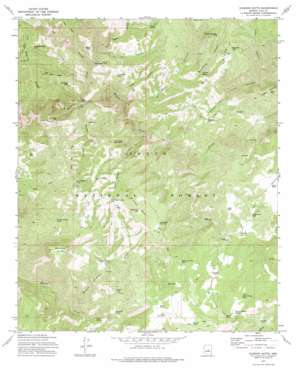
Diamond Butte Topo Map Arizona
To zoom in, hover over the map of Diamond Butte
USGS Topo Quad 34111b1 - 1:24,000 scale
| Topo Map Name: | Diamond Butte |
| USGS Topo Quad ID: | 34111b1 |
| Print Size: | ca. 21 1/4" wide x 27" high |
| Southeast Coordinates: | 34.125° N latitude / 111° W longitude |
| Map Center Coordinates: | 34.1875° N latitude / 111.0625° W longitude |
| U.S. State: | AZ |
| Filename: | o34111b1.jpg |
| Download Map JPG Image: | Diamond Butte topo map 1:24,000 scale |
| Map Type: | Topographic |
| Topo Series: | 7.5´ |
| Map Scale: | 1:24,000 |
| Source of Map Images: | United States Geological Survey (USGS) |
| Alternate Map Versions: |
Diamond Butte AZ 1973, updated 1975 Download PDF Buy paper map Diamond Butte AZ 2004, updated 2006 Download PDF Buy paper map Diamond Butte AZ 2011 Download PDF Buy paper map Diamond Butte AZ 2014 Download PDF Buy paper map |
| FStopo: | US Forest Service topo Diamond Butte is available: Download FStopo PDF Download FStopo TIF |
1:24,000 Topo Quads surrounding Diamond Butte
> Back to 34111a1 at 1:100,000 scale
> Back to 34110a1 at 1:250,000 scale
> Back to U.S. Topo Maps home
Diamond Butte topo map: Gazetteer
Diamond Butte: Gaps
Hells Gate elevation 1310m 4297′Diamond Butte: Mines
Ellison Mine elevation 1550m 5085′Diamond Butte: Populated Places
Spurlock elevation 1595m 5232′Diamond Butte: Reservoirs
Baker Tank elevation 1668m 5472′Big Ridge Tank elevation 1751m 5744′
Board Tank elevation 1716m 5629′
Brush Pasture Tank elevation 1673m 5488′
El Grande Tank elevation 1436m 4711′
Elmer Tank elevation 1388m 4553′
Fuller Mesa Tank elevation 1753m 5751′
Fuller Mesa Tank Number Two elevation 1720m 5643′
Goswick Canyon Tank elevation 1639m 5377′
Granite Tank elevation 1599m 5246′
Haught Tank elevation 1705m 5593′
Hell Tank elevation 1336m 4383′
Hells Gate Trail Tank elevation 1695m 5561′
Jake Tank elevation 1568m 5144′
Leo Canyon Tank elevation 1485m 4872′
Lost Camp Canyon Tank elevation 1620m 5314′
Lost Camp Mountain Tank elevation 1648m 5406′
Lost Tank elevation 1620m 5314′
Lower Bull Canyon Tank elevation 1449m 4753′
Marsh Creek Tank elevation 1567m 5141′
Mesa Tank elevation 1704m 5590′
Mesa Tank Number Two elevation 1697m 5567′
Oxbow Tank elevation 1804m 5918′
Rascoe Tank elevation 1632m 5354′
Ripper Tank elevation 1446m 4744′
Smoky Hollow Tank elevation 1621m 5318′
South Horse Mountain Tank elevation 1815m 5954′
Thurlo Tank elevation 1652m 5419′
Thurlo Wildlife Tanks elevation 1645m 5396′
Zachariae Tank elevation 1543m 5062′
Diamond Butte: Ridges
Apache Ridge elevation 1750m 5741′Big Ridge elevation 1684m 5524′
Hells Gate Ridge elevation 1520m 4986′
Diamond Butte: Springs
Cherry Spring elevation 1486m 4875′Jones Spring elevation 1333m 4373′
Peveler Chimney Spring elevation 1511m 4957′
Sycamore Spring elevation 1529m 5016′
Diamond Butte: Streams
Haigler Creek elevation 1206m 3956′Marsh Creek elevation 1377m 4517′
Diamond Butte: Summits
Diamond Butte elevation 1929m 6328′Fuller Mesa elevation 1790m 5872′
Lost Camp Mountain elevation 1710m 5610′
Diamond Butte: Valleys
Board Cabin Draw elevation 1222m 4009′Bull Tank Canyon elevation 1291m 4235′
Dry Canyon elevation 1284m 4212′
Gold Gulch elevation 1423m 4668′
Gordon Canyon elevation 1354m 4442′
Haigler Canyon elevation 1224m 4015′
Hog Canyon elevation 1523m 4996′
Leo Canyon elevation 1266m 4153′
Lost Camp Canyon elevation 1308m 4291′
Salt Canyon elevation 1267m 4156′
Salt Lick Canyon elevation 1255m 4117′
Smoky Hollow elevation 1236m 4055′
Sycamore Canyon elevation 1415m 4642′
Diamond Butte: Wells
Winter Camp Well elevation 1477m 4845′Diamond Butte digital topo map on disk
Buy this Diamond Butte topo map showing relief, roads, GPS coordinates and other geographical features, as a high-resolution digital map file on DVD:


