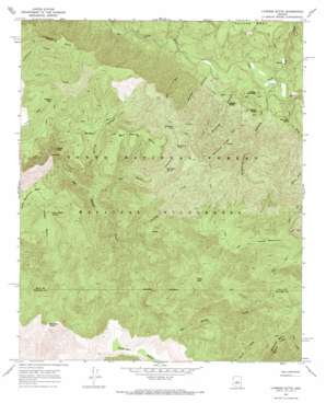
Cypress Butte Topo Map Arizona
To zoom in, hover over the map of Cypress Butte
USGS Topo Quad 34111b5 - 1:24,000 scale
| Topo Map Name: | Cypress Butte |
| USGS Topo Quad ID: | 34111b5 |
| Print Size: | ca. 21 1/4" wide x 27" high |
| Southeast Coordinates: | 34.125° N latitude / 111.5° W longitude |
| Map Center Coordinates: | 34.1875° N latitude / 111.5625° W longitude |
| U.S. State: | AZ |
| Filename: | o34111b5.jpg |
| Download Map JPG Image: | Cypress Butte topo map 1:24,000 scale |
| Map Type: | Topographic |
| Topo Series: | 7.5´ |
| Map Scale: | 1:24,000 |
| Source of Map Images: | United States Geological Survey (USGS) |
| Alternate Map Versions: |
Cypress Butte AZ 1967, updated 1968 Download PDF Buy paper map Cypress Butte AZ 2004, updated 2006 Download PDF Buy paper map Cypress Butte AZ 2011 Download PDF Buy paper map Cypress Butte AZ 2014 Download PDF Buy paper map |
| FStopo: | US Forest Service topo Cypress Butte is available: Download FStopo PDF Download FStopo TIF |
1:24,000 Topo Quads surrounding Cypress Butte
> Back to 34111a1 at 1:100,000 scale
> Back to 34110a1 at 1:250,000 scale
> Back to U.S. Topo Maps home
Cypress Butte topo map: Gazetteer
Cypress Butte: Basins
Cedar Basin elevation 1422m 4665′Cypress Butte: Reservoirs
Blackburn Tank elevation 1521m 4990′Cottonwood Tank elevation 1490m 4888′
Meteor Tank elevation 1367m 4484′
Red Metal Tank elevation 1537m 5042′
Cypress Butte: Ridges
Bullfrog Ridge elevation 1546m 5072′Cypress Butte: Springs
Brush Spring elevation 1583m 5193′Bull Spring elevation 1402m 4599′
Bull Trap Spring elevation 1378m 4520′
Bullfrog Spring elevation 1075m 3526′
Cedar Basin Spring elevation 1463m 4799′
Chalk Spring elevation 1426m 4678′
Childers Seep elevation 1455m 4773′
Childers Spring elevation 1426m 4678′
Clover Spring elevation 1374m 4507′
Fuller Seep elevation 1613m 5291′
Mine Road Spring elevation 1078m 3536′
Oak Thicket Spring elevation 1124m 3687′
Polk Spring elevation 1046m 3431′
Red Metal Spring elevation 1436m 4711′
Trail Spring elevation 1549m 5082′
Cypress Butte: Streams
Houston Creek elevation 1340m 4396′Rock Creek elevation 999m 3277′
Cypress Butte: Summits
Bull Spring Mesa elevation 1684m 5524′Copper Mountain elevation 1125m 3690′
Cypress Butte elevation 1677m 5501′
Knob Mountain elevation 1904m 6246′
Limestone Hills elevation 1516m 4973′
Midnight Mesa elevation 1723m 5652′
Cypress Butte: Valleys
Boardinghouse Canyon elevation 1012m 3320′Buffalo Canyon elevation 992m 3254′
Bull Spring Canyon elevation 1254m 4114′
Bullfrog Canyon elevation 988m 3241′
Red Metal Canyon elevation 1255m 4117′
Tub Draw elevation 1012m 3320′
Cypress Butte digital topo map on disk
Buy this Cypress Butte topo map showing relief, roads, GPS coordinates and other geographical features, as a high-resolution digital map file on DVD:


