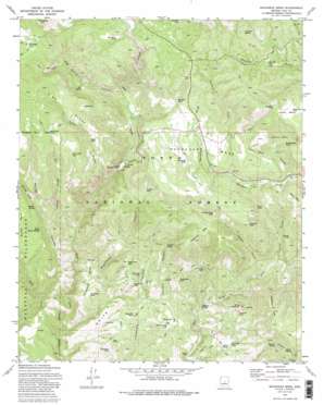
Buckhead Mesa Topo Map Arizona
To zoom in, hover over the map of Buckhead Mesa
USGS Topo Quad 34111c4 - 1:24,000 scale
| Topo Map Name: | Buckhead Mesa |
| USGS Topo Quad ID: | 34111c4 |
| Print Size: | ca. 21 1/4" wide x 27" high |
| Southeast Coordinates: | 34.25° N latitude / 111.375° W longitude |
| Map Center Coordinates: | 34.3125° N latitude / 111.4375° W longitude |
| U.S. State: | AZ |
| Filename: | o34111c4.jpg |
| Download Map JPG Image: | Buckhead Mesa topo map 1:24,000 scale |
| Map Type: | Topographic |
| Topo Series: | 7.5´ |
| Map Scale: | 1:24,000 |
| Source of Map Images: | United States Geological Survey (USGS) |
| Alternate Map Versions: |
Buckhead Mesa AZ 1973, updated 1975 Download PDF Buy paper map Buckhead Mesa AZ 1973, updated 1986 Download PDF Buy paper map Buckhead Mesa AZ 1973, updated 1986 Download PDF Buy paper map Buckhead Mesa AZ 2004, updated 2006 Download PDF Buy paper map Buckhead Mesa AZ 2011 Download PDF Buy paper map Buckhead Mesa AZ 2014 Download PDF Buy paper map |
| FStopo: | US Forest Service topo Buckhead Mesa is available: Download FStopo PDF Download FStopo TIF |
1:24,000 Topo Quads surrounding Buckhead Mesa
> Back to 34111a1 at 1:100,000 scale
> Back to 34110a1 at 1:250,000 scale
> Back to U.S. Topo Maps home
Buckhead Mesa topo map: Gazetteer
Buckhead Mesa: Arches
Tonto Natural Bridge elevation 1367m 4484′Buckhead Mesa: Basins
Brushy Basin elevation 1510m 4954′Buckhead Mesa: Benches
Horsethief Bench elevation 1341m 4399′Buckhead Mesa: Flats
Cedar Flat elevation 1194m 3917′Maverick Flat elevation 1270m 4166′
Buckhead Mesa: Mines
Crackerjack Mine elevation 1454m 4770′Gowan Mine elevation 1194m 3917′
Summit Mine elevation 1546m 5072′
White Mountain Mine elevation 1382m 4534′
Buckhead Mesa: Parks
Tonto Natural Bridge State Park elevation 1367m 4484′Buckhead Mesa: Ranges
White Hills elevation 1283m 4209′Buckhead Mesa: Reservoirs
Bee Seep Tank elevation 1659m 5442′Big Tank elevation 1222m 4009′
Bradshaw Tank elevation 1640m 5380′
Bridge Tank elevation 1597m 5239′
Brushy Basin Tank elevation 1512m 4960′
Brushy Tank elevation 1463m 4799′
Buckhead Tank elevation 1573m 5160′
Buckhead Tank elevation 1318m 4324′
Cedar Flat Tank elevation 1251m 4104′
Cedar Mesa Tank elevation 1695m 5561′
Connally Point Tank elevation 1574m 5164′
Contact Trick Tank elevation 1369m 4491′
Crackerjack Tank elevation 1367m 4484′
Donahue Tank elevation 1722m 5649′
East Tank elevation 1801m 5908′
Horsethief Tank elevation 1282m 4206′
Juniper Tank elevation 1487m 4878′
Limestone Tank elevation 1354m 4442′
Maverick Flat Tank elevation 1259m 4130′
Pilot Knob Tank elevation 1187m 3894′
Pine Ridge Tank elevation 1864m 6115′
Point Tank elevation 1692m 5551′
Point Tank elevation 1564m 5131′
Red Hill Tank elevation 1638m 5374′
Red Rock Tank elevation 1636m 5367′
Ridge Tank elevation 1730m 5675′
Tank Gulch Tank elevation 1711m 5613′
Thirtysix Tank elevation 1235m 4051′
Tip Tank elevation 1296m 4251′
White Hills Tank elevation 1377m 4517′
White Mountain Tank elevation 1305m 4281′
White Tank elevation 1293m 4242′
Buckhead Mesa: Ridges
Crackerjack Ridge elevation 1574m 5164′Pine Ridge elevation 1804m 5918′
Buckhead Mesa: Springs
Clover Spring elevation 1820m 5971′Contact Spring elevation 1432m 4698′
Dripping Springs elevation 1235m 4051′
Oak Spring elevation 1586m 5203′
Red Rock Spring elevation 1835m 6020′
South Walnut Spring elevation 1364m 4475′
Summit Spring elevation 1430m 4691′
Walnut Spring elevation 1380m 4527′
Water Spring elevation 1460m 4790′
Buckhead Mesa: Summits
Black Mesa elevation 1614m 5295′Buckhead Mesa elevation 1639m 5377′
Cedar Mesa elevation 1713m 5620′
Connally Point elevation 1684m 5524′
Crackerjack Mesa elevation 1671m 5482′
Pilot Knob elevation 1241m 4071′
White Mountain elevation 1481m 4858′
Buckhead Mesa: Valleys
Bear Canyon elevation 1639m 5377′Brushy Canyon elevation 1315m 4314′
Buckhead Canyon elevation 1095m 3592′
Buckhead Draw elevation 1487m 4878′
Cedar Mesa Canyon elevation 1430m 4691′
Contact Canyon elevation 1268m 4160′
Cypress Canyon elevation 1292m 4238′
Dead Cow Canyon elevation 1389m 4557′
East Walnut Canyon elevation 1323m 4340′
Oak Spring Canyon elevation 1431m 4694′
Rock Canyon elevation 1191m 3907′
Tank Gulch elevation 1259m 4130′
The Narrows elevation 1566m 5137′
Walnut Canyon elevation 1181m 3874′
Buckhead Mesa digital topo map on disk
Buy this Buckhead Mesa topo map showing relief, roads, GPS coordinates and other geographical features, as a high-resolution digital map file on DVD:


