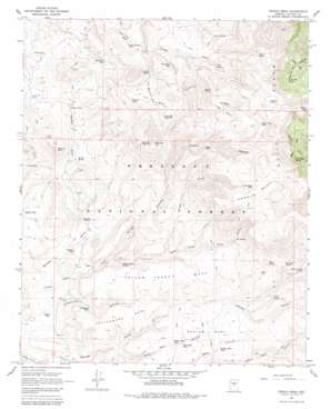
Arnold Mesa Topo Map Arizona
To zoom in, hover over the map of Arnold Mesa
USGS Topo Quad 34111d8 - 1:24,000 scale
| Topo Map Name: | Arnold Mesa |
| USGS Topo Quad ID: | 34111d8 |
| Print Size: | ca. 21 1/4" wide x 27" high |
| Southeast Coordinates: | 34.375° N latitude / 111.875° W longitude |
| Map Center Coordinates: | 34.4375° N latitude / 111.9375° W longitude |
| U.S. State: | AZ |
| Filename: | o34111d8.jpg |
| Download Map JPG Image: | Arnold Mesa topo map 1:24,000 scale |
| Map Type: | Topographic |
| Topo Series: | 7.5´ |
| Map Scale: | 1:24,000 |
| Source of Map Images: | United States Geological Survey (USGS) |
| Alternate Map Versions: |
Arnold Mesa AZ 1967, updated 1968 Download PDF Buy paper map Arnold Mesa AZ 1967, updated 1982 Download PDF Buy paper map Arnold Mesa AZ 2012 Download PDF Buy paper map Arnold Mesa AZ 2014 Download PDF Buy paper map |
| FStopo: | US Forest Service topo Arnold Mesa is available: Download FStopo PDF Download FStopo TIF |
1:24,000 Topo Quads surrounding Arnold Mesa
> Back to 34111a1 at 1:100,000 scale
> Back to 34110a1 at 1:250,000 scale
> Back to U.S. Topo Maps home
Arnold Mesa topo map: Gazetteer
Arnold Mesa: Basins
Brushy Basin elevation 1527m 5009′Hog Basin elevation 1646m 5400′
North Hole elevation 1522m 4993′
South Hole elevation 1551m 5088′
Topaz Basin elevation 1472m 4829′
Arnold Mesa: Populated Places
Arnold Place elevation 1569m 5147′Cedar Mill elevation 1392m 4566′
Arnold Mesa: Reservoirs
Arnold Mesa Tank elevation 1766m 5793′Bald Hill Tank Number One elevation 1559m 5114′
Bald Hill Tank Number Two elevation 1719m 5639′
Beehouse Tank elevation 1462m 4796′
Big Flat Tank elevation 1299m 4261′
Black Hill Tank elevation 1395m 4576′
Box T Tank elevation 1767m 5797′
Cedar Tank elevation 1405m 4609′
Cottonwood Tank elevation 1290m 4232′
Dogtown Tank elevation 1272m 4173′
Gyetta Tank elevation 1236m 4055′
Hells Hole Tank elevation 1653m 5423′
Hog Basin Tank elevation 1670m 5479′
Layton Tank elevation 1803m 5915′
Little Horner Tank elevation 1523m 4996′
Marlow Mesa Tank elevation 1408m 4619′
Middle Mesa Tank elevation 1390m 4560′
Mill Point Tank elevation 1449m 4753′
Moebes Tank elevation 1493m 4898′
Phoebes Tank elevation 1386m 4547′
Plaza Tank elevation 1474m 4835′
Reimer Tank elevation 1401m 4596′
South Pasture Tank elevation 1475m 4839′
Squaw Peak Tank elevation 1736m 5695′
Watters Tank elevation 1530m 5019′
Wids Tank elevation 1501m 4924′
Wire Gold Tank elevation 1513m 4963′
Arnold Mesa: Springs
Arnold Place Spring elevation 1561m 5121′Arnold Spring elevation 1458m 4783′
Ash Spring elevation 1305m 4281′
Box T Spring elevation 1551m 5088′
Gulch Water elevation 1500m 4921′
Horner Cabin Spring elevation 1548m 5078′
Joe Best Spring elevation 1485m 4872′
North Hole Spring elevation 1599m 5246′
Reimer Spring elevation 1357m 4452′
Rice Spring elevation 1512m 4960′
South Hole Spring elevation 1601m 5252′
Sycamore Spring elevation 1549m 5082′
Wells Spring elevation 1574m 5164′
Wilson Spring elevation 1571m 5154′
Wire Spring elevation 1516m 4973′
Yellow Jacket Spring elevation 1322m 4337′
Arnold Mesa: Summits
Arnold Mesa elevation 1774m 5820′Bald Hill elevation 1854m 6082′
Cottonwood Mesa elevation 1395m 4576′
Marlow Mesa elevation 1441m 4727′
Reimer Peak elevation 1528m 5013′
Squaw Peak elevation 1989m 6525′
Yellow Jacket Mesa elevation 1448m 4750′
Arnold Mesa: Valleys
Arnold Canyon elevation 1297m 4255′Bootleg Canyon elevation 1332m 4370′
Cottonwood Canyon elevation 1219m 3999′
Reimer Draw elevation 1232m 4041′
Rice Gulch elevation 1400m 4593′
Spring Gulch elevation 1361m 4465′
Arnold Mesa: Wells
Bald Hill Well elevation 1427m 4681′Hooker Well elevation 1292m 4238′
Arnold Mesa digital topo map on disk
Buy this Arnold Mesa topo map showing relief, roads, GPS coordinates and other geographical features, as a high-resolution digital map file on DVD:


