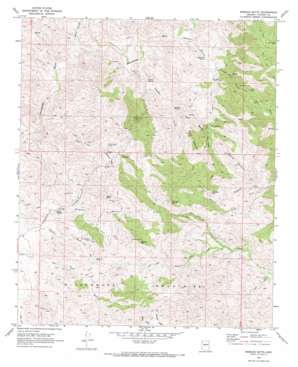
Morgan Butte Topo Map Arizona
To zoom in, hover over the map of Morgan Butte
USGS Topo Quad 34112a5 - 1:24,000 scale
| Topo Map Name: | Morgan Butte |
| USGS Topo Quad ID: | 34112a5 |
| Print Size: | ca. 21 1/4" wide x 27" high |
| Southeast Coordinates: | 34° N latitude / 112.5° W longitude |
| Map Center Coordinates: | 34.0625° N latitude / 112.5625° W longitude |
| U.S. State: | AZ |
| Filename: | o34112a5.jpg |
| Download Map JPG Image: | Morgan Butte topo map 1:24,000 scale |
| Map Type: | Topographic |
| Topo Series: | 7.5´ |
| Map Scale: | 1:24,000 |
| Source of Map Images: | United States Geological Survey (USGS) |
| Alternate Map Versions: |
Morgan Butte AZ 1969, updated 1972 Download PDF Buy paper map Morgan Butte AZ 1969, updated 1972 Download PDF Buy paper map Morgan Butte AZ 1969, updated 1973 Download PDF Buy paper map Morgan Butte AZ 2011 Download PDF Buy paper map Morgan Butte AZ 2014 Download PDF Buy paper map |
1:24,000 Topo Quads surrounding Morgan Butte
> Back to 34112a1 at 1:100,000 scale
> Back to 34112a1 at 1:250,000 scale
> Back to U.S. Topo Maps home
Morgan Butte topo map: Gazetteer
Morgan Butte: Mines
Abe Lincoln Mine elevation 1192m 3910′Black Rock Mine elevation 999m 3277′
Camp B Mine elevation 1091m 3579′
Crown Point Mine elevation 1139m 3736′
Gold Bar Mine elevation 1038m 3405′
Keystone Mine elevation 1172m 3845′
King Solomon Mine elevation 1136m 3727′
Monte Cristo Mine elevation 1058m 3471′
Swallow Mine elevation 1051m 3448′
Morgan Butte: Populated Places
Constellation elevation 1085m 3559′Morgan Butte: Ranges
Wickenburg Mountains elevation 1343m 4406′Morgan Butte: Springs
Amazon Spring elevation 944m 3097′Buckskin Spring elevation 926m 3038′
Corner Spring elevation 891m 2923′
Iron Spring elevation 1048m 3438′
Sayer Spring elevation 0m 0′
Morgan Butte: Streams
Mahoney Wash elevation 962m 3156′Slim Jim Creek elevation 769m 2522′
Morgan Butte: Summits
Black Rock elevation 1271m 4169′Denver Hill elevation 1343m 4406′
Grooms Hill elevation 1285m 4215′
Morgan Butte elevation 1404m 4606′
Swallow Mountain elevation 1377m 4517′
Table Mountain elevation 1296m 4251′
Morgan Butte: Valleys
Amazon Gulch elevation 866m 2841′Buckskin Canyon elevation 862m 2828′
Crown Point Gulch elevation 952m 3123′
Hawk Spring Gulch elevation 948m 3110′
Jesus Canyon elevation 817m 2680′
O'Brien Gulch elevation 866m 2841′
Morgan Butte digital topo map on disk
Buy this Morgan Butte topo map showing relief, roads, GPS coordinates and other geographical features, as a high-resolution digital map file on DVD:


