Congress Sw Topo Map Arizona
To zoom in, hover over the map of Congress Sw
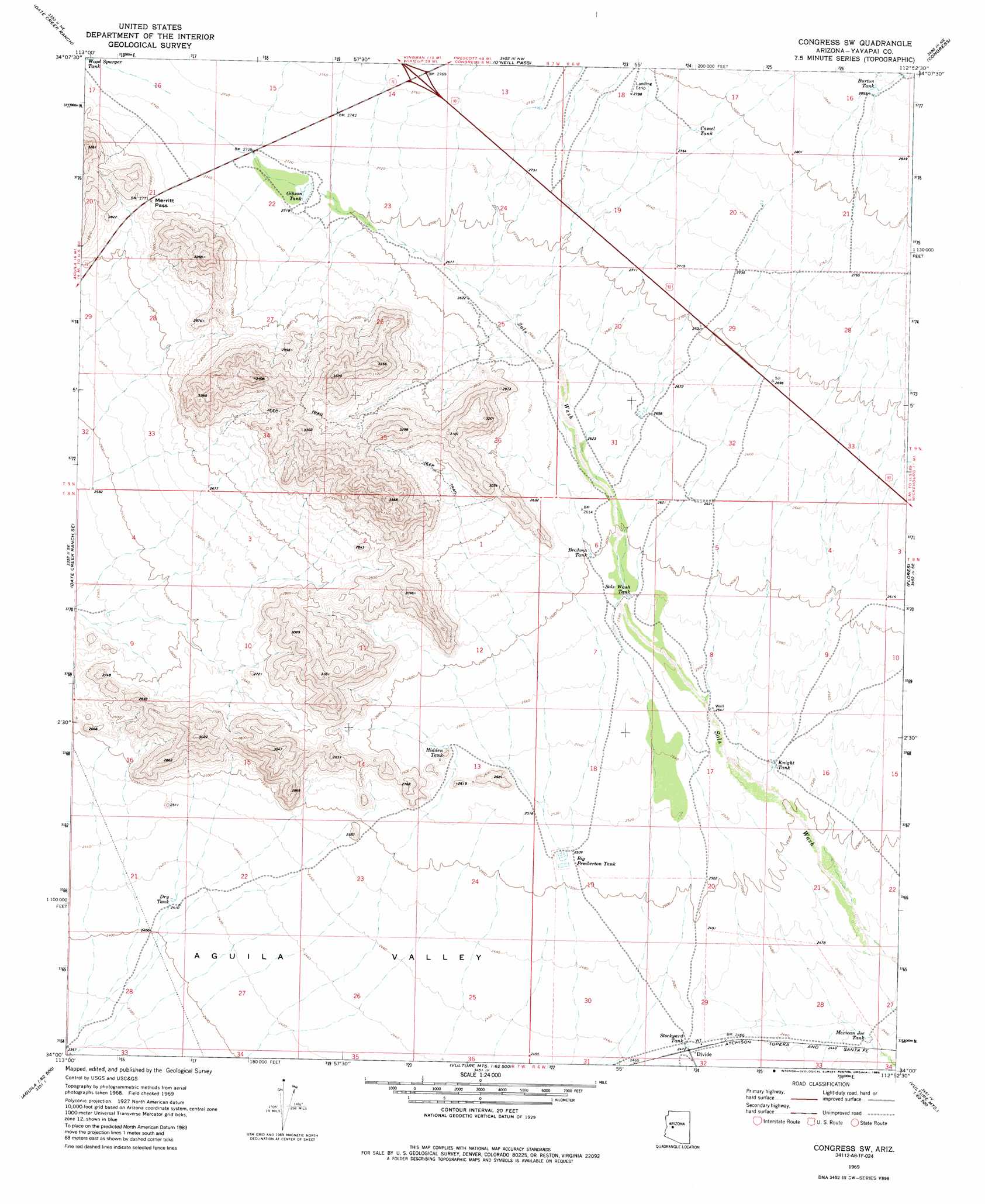
USGS Topo Quad 34112a8 - 1:24,000 scale
| Topo Map Name: | Congress Sw |
| USGS Topo Quad ID: | 34112a8 |
| Print Size: | ca. 21 1/4" wide x 27" high |
| Southeast Coordinates: | 34° N latitude / 112.875° W longitude |
| Map Center Coordinates: | 34.0625° N latitude / 112.9375° W longitude |
| U.S. State: | AZ |
| Filename: | o34112a8.jpg |
| Download Map JPG Image: | Congress Sw topo map 1:24,000 scale |
| Map Type: | Topographic |
| Topo Series: | 7.5´ |
| Map Scale: | 1:24,000 |
| Source of Map Images: | United States Geological Survey (USGS) |
| Alternate Map Versions: |
Congress SW AZ 1969, updated 1972 Download PDF Buy paper map Congress SW AZ 1969, updated 1985 Download PDF Buy paper map Congress SW AZ 2011 Download PDF Buy paper map Congress SW AZ 2014 Download PDF Buy paper map |
1:24,000 Topo Quads surrounding Congress Sw
Ives Peak |
Malpais Mesa |
Date |
Weaver Peak |
Peeples Valley |
Date Creek Ranch Nw |
Date Creek Ranch |
O'Neill Pass |
Congress |
Yarnell |
Date Creek Ranch Sw |
Date Creek Ranch Se |
Congress Sw |
Flores |
Sam Powell Peak |
Aguila |
Forepaugh Peak |
Outlaw Hill |
Vulture Peak |
Wickenburg |
Tiger Well |
Black Butte |
Wildcat Well |
Vulture Mine |
Wickenburg Sw |
> Back to 34112a1 at 1:100,000 scale
> Back to 34112a1 at 1:250,000 scale
> Back to U.S. Topo Maps home
Congress Sw topo map: Gazetteer
Congress Sw: Gaps
Merritt Pass elevation 847m 2778′Congress Sw: Reservoirs
Big Pemberton Tank elevation 765m 2509′Brahma Tank elevation 793m 2601′
Burton Tank elevation 871m 2857′
Camel Tank elevation 847m 2778′
Dry Tank elevation 735m 2411′
Gibson Tank elevation 827m 2713′
Hidden Tank elevation 779m 2555′
Knight Tank elevation 769m 2522′
Mexican Joe Tank elevation 744m 2440′
Sols Wash Tank elevation 788m 2585′
Stockyard Tank elevation 752m 2467′
Congress Sw digital topo map on disk
Buy this Congress Sw topo map showing relief, roads, GPS coordinates and other geographical features, as a high-resolution digital map file on DVD: