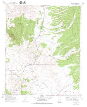
Kirkland Topo Map Arizona
To zoom in, hover over the map of Kirkland
USGS Topo Quad 34112d6 - 1:24,000 scale
| Topo Map Name: | Kirkland |
| USGS Topo Quad ID: | 34112d6 |
| Print Size: | ca. 21 1/4" wide x 27" high |
| Southeast Coordinates: | 34.375° N latitude / 112.625° W longitude |
| Map Center Coordinates: | 34.4375° N latitude / 112.6875° W longitude |
| U.S. State: | AZ |
| Filename: | o34112d6.jpg |
| Download Map JPG Image: | Kirkland topo map 1:24,000 scale |
| Map Type: | Topographic |
| Topo Series: | 7.5´ |
| Map Scale: | 1:24,000 |
| Source of Map Images: | United States Geological Survey (USGS) |
| Alternate Map Versions: |
Kirkland AZ 1969, updated 1972 Download PDF Buy paper map Kirkland AZ 1969, updated 1979 Download PDF Buy paper map Kirkland AZ 2011 Download PDF Buy paper map Kirkland AZ 2014 Download PDF Buy paper map |
| FStopo: | US Forest Service topo Kirkland is available: Download FStopo PDF Download FStopo TIF |
1:24,000 Topo Quads surrounding Kirkland
> Back to 34112a1 at 1:100,000 scale
> Back to 34112a1 at 1:250,000 scale
> Back to U.S. Topo Maps home
Kirkland topo map: Gazetteer
Kirkland: Populated Places
Kirkland elevation 1198m 3930′Kirkland: Reservoirs
Elmer Tank elevation 1321m 4333′Middle Tank elevation 1396m 4580′
Kirkland: Streams
Copper Basin Wash elevation 1219m 3999′Finch Wash elevation 1262m 4140′
Skull Valley Wash elevation 1177m 3861′
Kirkland: Summits
Kirkland Peak elevation 1696m 5564′Kirkland: Valleys
Coughran Canyon elevation 1287m 4222′Skull Valley elevation 1268m 4160′
Kirkland: Wells
California Well elevation 1265m 4150′Charlie Well elevation 1412m 4632′
Cort Well elevation 1460m 4790′
Delia Well elevation 1292m 4238′
Lower Ranch Well elevation 1306m 4284′
Railroad Well elevation 1283m 4209′
Kirkland digital topo map on disk
Buy this Kirkland topo map showing relief, roads, GPS coordinates and other geographical features, as a high-resolution digital map file on DVD:


