Bismarck Mesa Topo Map Arizona
To zoom in, hover over the map of Bismarck Mesa
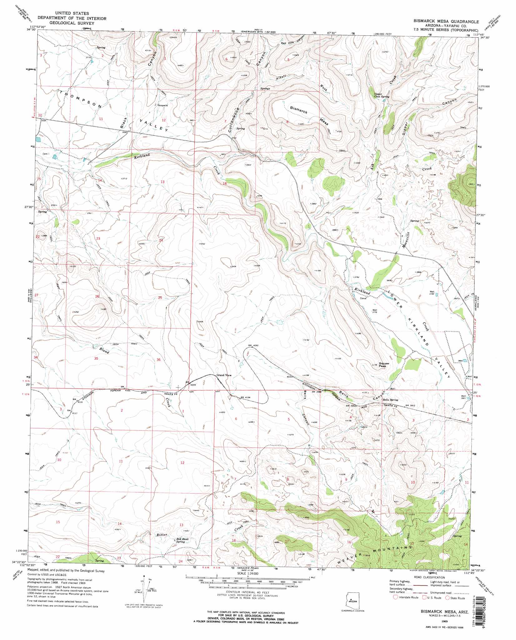
USGS Topo Quad 34112d7 - 1:24,000 scale
| Topo Map Name: | Bismarck Mesa |
| USGS Topo Quad ID: | 34112d7 |
| Print Size: | ca. 21 1/4" wide x 27" high |
| Southeast Coordinates: | 34.375° N latitude / 112.75° W longitude |
| Map Center Coordinates: | 34.4375° N latitude / 112.8125° W longitude |
| U.S. State: | AZ |
| Filename: | o34112d7.jpg |
| Download Map JPG Image: | Bismarck Mesa topo map 1:24,000 scale |
| Map Type: | Topographic |
| Topo Series: | 7.5´ |
| Map Scale: | 1:24,000 |
| Source of Map Images: | United States Geological Survey (USGS) |
| Alternate Map Versions: |
Bismarck Mesa AZ 1969, updated 1972 Download PDF Buy paper map Bismarck Mesa AZ 2011 Download PDF Buy paper map Bismarck Mesa AZ 2014 Download PDF Buy paper map |
1:24,000 Topo Quads surrounding Bismarck Mesa
Behm Mesa |
Sheridan Mountain |
Smith Mesa |
Mount Josh |
Jerome Canyon |
Big Shipp Mountain |
Muleshoe Ranch |
Martin Mountain |
Skull Valley |
Iron Springs |
Malpais Mesa Ne |
Hillside |
Bismarck Mesa |
Kirkland |
Wilhoit |
Malpais Mesa |
Date |
Weaver Peak |
Peeples Valley |
Walnut Grove |
Date Creek Ranch |
O'Neill Pass |
Congress |
Yarnell |
Wagoner |
> Back to 34112a1 at 1:100,000 scale
> Back to 34112a1 at 1:250,000 scale
> Back to U.S. Topo Maps home
Bismarck Mesa topo map: Gazetteer
Bismarck Mesa: Populated Places
Grand View elevation 1291m 4235′Bismarck Mesa: Ranges
Kendrick Mountains elevation 1275m 4183′Bismarck Mesa: Springs
Bells Spring elevation 1199m 3933′Red Bank Spring elevation 1295m 4248′
Upper Cook Spring elevation 1310m 4297′
Bismarck Mesa: Streams
Alkali Wash elevation 1179m 3868′Ash Creek elevation 1135m 3723′
Moonville Creek elevation 1146m 3759′
Wood Creek elevation 1114m 3654′
Bismarck Mesa: Summits
Bismarck Mesa elevation 1441m 4727′Squaw Peak elevation 1254m 4114′
Bismarck Mesa: Valleys
Bells Canyon elevation 1159m 3802′Black Canyon elevation 1086m 3562′
Cottonwood Canyon elevation 1106m 3628′
Dipper Canyon elevation 1234m 4048′
Lower Kirkland Valley elevation 1147m 3763′
Red Hills Canyon elevation 1211m 3973′
Bismarck Mesa digital topo map on disk
Buy this Bismarck Mesa topo map showing relief, roads, GPS coordinates and other geographical features, as a high-resolution digital map file on DVD: