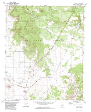
Paulden Topo Map Arizona
To zoom in, hover over the map of Paulden
USGS Topo Quad 34112h4 - 1:24,000 scale
| Topo Map Name: | Paulden |
| USGS Topo Quad ID: | 34112h4 |
| Print Size: | ca. 21 1/4" wide x 27" high |
| Southeast Coordinates: | 34.875° N latitude / 112.375° W longitude |
| Map Center Coordinates: | 34.9375° N latitude / 112.4375° W longitude |
| U.S. State: | AZ |
| Filename: | o34112h4.jpg |
| Download Map JPG Image: | Paulden topo map 1:24,000 scale |
| Map Type: | Topographic |
| Topo Series: | 7.5´ |
| Map Scale: | 1:24,000 |
| Source of Map Images: | United States Geological Survey (USGS) |
| Alternate Map Versions: |
Paulden AZ 1979, updated 1985 Download PDF Buy paper map Paulden AZ 1979, updated 1985 Download PDF Buy paper map Paulden AZ 2012 Download PDF Buy paper map Paulden AZ 2014 Download PDF Buy paper map |
| FStopo: | US Forest Service topo Paulden is available: Download FStopo PDF Download FStopo TIF |
1:24,000 Topo Quads surrounding Paulden
> Back to 34112e1 at 1:100,000 scale
> Back to 34112a1 at 1:250,000 scale
> Back to U.S. Topo Maps home
Paulden topo map: Gazetteer
Paulden: Populated Places
Abra elevation 1384m 4540′Drake elevation 1420m 4658′
Paulden elevation 1344m 4409′
Paulden: Reservoirs
Cement Tank elevation 1436m 4711′Drake Tank elevation 1420m 4658′
Lower Limestone Tank elevation 1555m 5101′
Peavine Tank elevation 1489m 4885′
Railroad Tank elevation 1496m 4908′
Roper Tank elevation 1397m 4583′
Telephone Tank elevation 1409m 4622′
Tovera Tank elevation 1464m 4803′
Trick Tank elevation 1510m 4954′
White Hills Tank elevation 1528m 5013′
Yarbo Tank elevation 1414m 4639′
Paulden: Streams
Big Chino Wash elevation 1329m 4360′Williamson Valley Wash elevation 1329m 4360′
Paulden: Summits
Rock Butte elevation 1653m 5423′Paulden: Valleys
Limestone Canyon elevation 1370m 4494′Paulden: Wells
Hells Well elevation 1415m 4642′Paulden digital topo map on disk
Buy this Paulden topo map showing relief, roads, GPS coordinates and other geographical features, as a high-resolution digital map file on DVD:


