Date Creek Ranch Se Topo Map Arizona
To zoom in, hover over the map of Date Creek Ranch Se
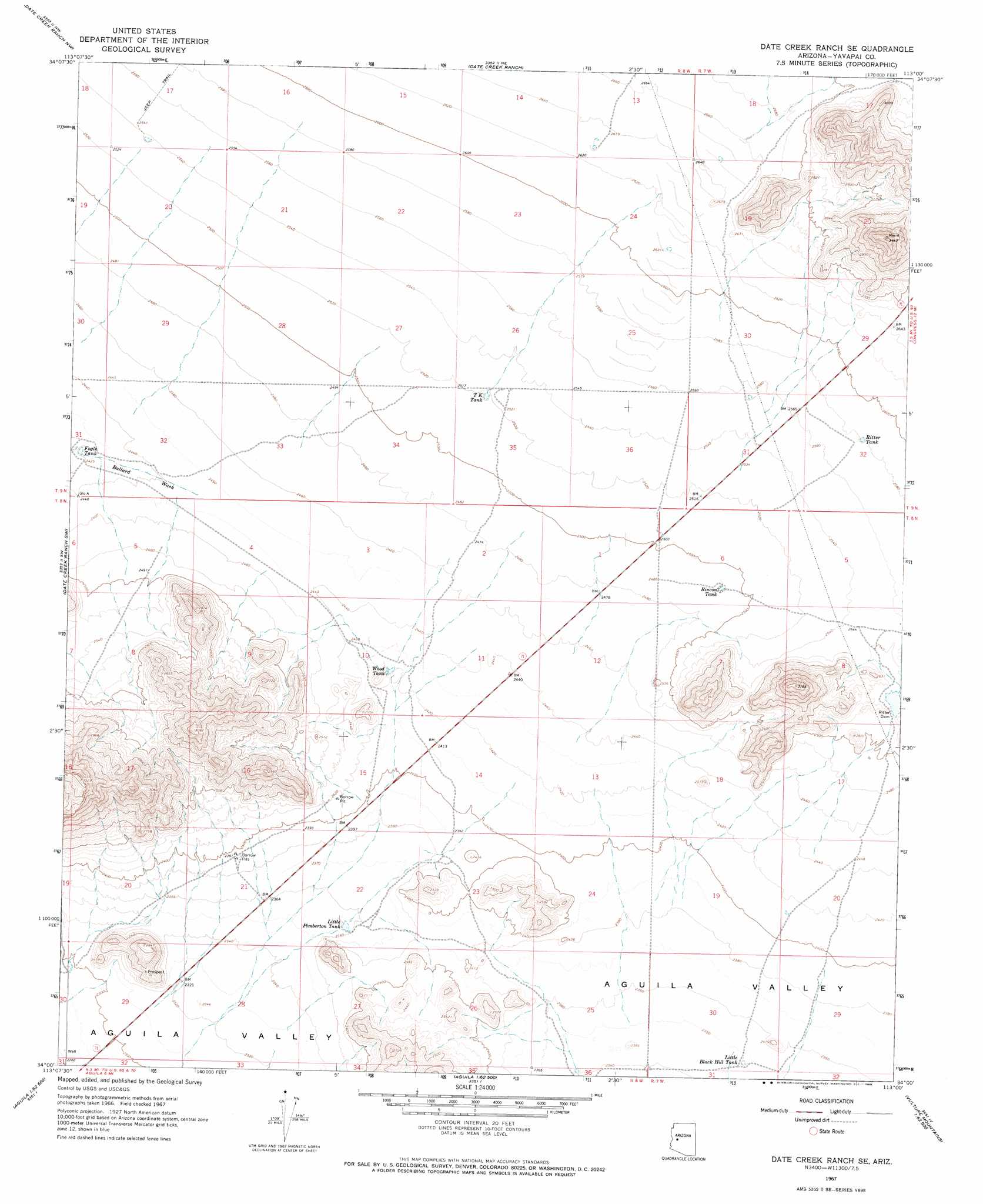
USGS Topo Quad 34113a1 - 1:24,000 scale
| Topo Map Name: | Date Creek Ranch Se |
| USGS Topo Quad ID: | 34113a1 |
| Print Size: | ca. 21 1/4" wide x 27" high |
| Southeast Coordinates: | 34° N latitude / 113° W longitude |
| Map Center Coordinates: | 34.0625° N latitude / 113.0625° W longitude |
| U.S. State: | AZ |
| Filename: | o34113a1.jpg |
| Download Map JPG Image: | Date Creek Ranch Se topo map 1:24,000 scale |
| Map Type: | Topographic |
| Topo Series: | 7.5´ |
| Map Scale: | 1:24,000 |
| Source of Map Images: | United States Geological Survey (USGS) |
| Alternate Map Versions: |
Date Creek Ranch SE AZ 1967, updated 1969 Download PDF Buy paper map Date Creek Ranch SE AZ 2011 Download PDF Buy paper map Date Creek Ranch SE AZ 2014 Download PDF Buy paper map |
1:24,000 Topo Quads surrounding Date Creek Ranch Se
Arrastra Mountain Se |
Ives Peak |
Malpais Mesa |
Date |
Weaver Peak |
Smith Peak Ne |
Date Creek Ranch Nw |
Date Creek Ranch |
O'Neill Pass |
Congress |
Smith Peak |
Date Creek Ranch Sw |
Date Creek Ranch Se |
Congress Sw |
Flores |
Gladden |
Aguila |
Forepaugh Peak |
Outlaw Hill |
Vulture Peak |
Harquahala Mountain |
Tiger Well |
Black Butte |
Wildcat Well |
Vulture Mine |
> Back to 34113a1 at 1:100,000 scale
> Back to 34112a1 at 1:250,000 scale
> Back to U.S. Topo Maps home
Date Creek Ranch Se topo map: Gazetteer
Date Creek Ranch Se: Dams
Ritter Dam elevation 770m 2526′Date Creek Ranch Se: Reservoirs
Fogle Tank elevation 739m 2424′Little Black Hill Tank elevation 717m 2352′
Little Pimberton Tank elevation 720m 2362′
Rincon Tank elevation 761m 2496′
Ritter Tank elevation 788m 2585′
T K Tank elevation 768m 2519′
Wood Tank elevation 740m 2427′
Date Creek Ranch Se digital topo map on disk
Buy this Date Creek Ranch Se topo map showing relief, roads, GPS coordinates and other geographical features, as a high-resolution digital map file on DVD: