Greenwood Peak Topo Map Arizona
To zoom in, hover over the map of Greenwood Peak
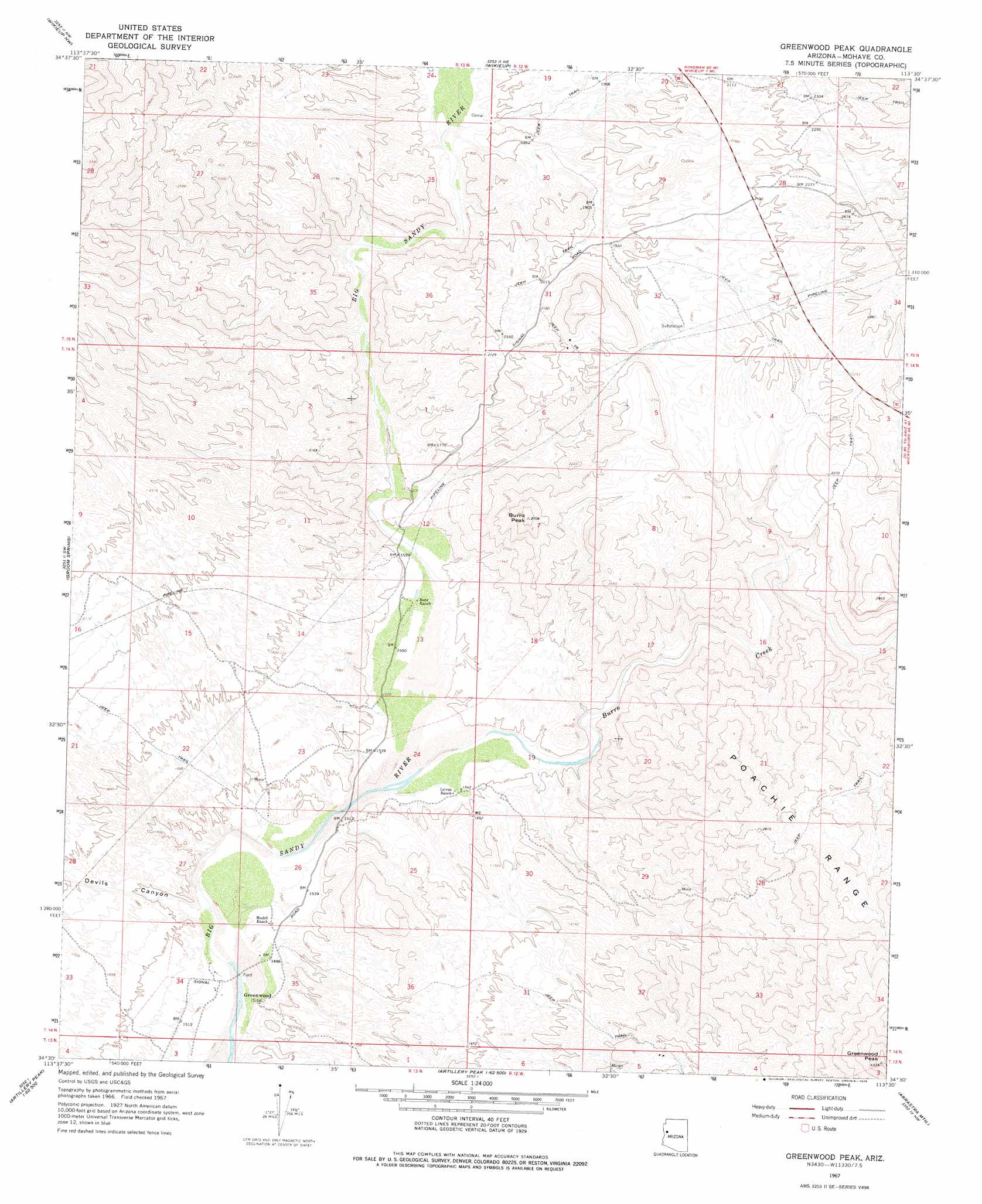
USGS Topo Quad 34113e5 - 1:24,000 scale
| Topo Map Name: | Greenwood Peak |
| USGS Topo Quad ID: | 34113e5 |
| Print Size: | ca. 21 1/4" wide x 27" high |
| Southeast Coordinates: | 34.5° N latitude / 113.5° W longitude |
| Map Center Coordinates: | 34.5625° N latitude / 113.5625° W longitude |
| U.S. State: | AZ |
| Filename: | o34113e5.jpg |
| Download Map JPG Image: | Greenwood Peak topo map 1:24,000 scale |
| Map Type: | Topographic |
| Topo Series: | 7.5´ |
| Map Scale: | 1:24,000 |
| Source of Map Images: | United States Geological Survey (USGS) |
| Alternate Map Versions: |
Greenwood Peak AZ 1967, updated 1970 Download PDF Buy paper map Greenwood Peak AZ 1967, updated 1978 Download PDF Buy paper map Greenwood Peak AZ 2011 Download PDF Buy paper map Greenwood Peak AZ 2014 Download PDF Buy paper map |
1:24,000 Topo Quads surrounding Greenwood Peak
Diamond Joe Peak |
Gunsight Canyon |
Tule Wash |
Cedar Basin |
Pilot Knob |
Beecher Canyon |
Aubrey Peak |
Wikieup |
Elephant Mountain |
Negro Ed |
Dutch Flat Se |
Groom Spring |
Greenwood Peak |
Kaiser Spring |
Grayback Mountains |
Mccracken Peak |
Signal |
Signal Mountain |
Arrastra Mountain |
Arrastra Mountain Ne |
Centennial Wash |
Rawhide Wash |
Artillery Peak |
Palmerita Ranch |
Arrastra Mountain Se |
> Back to 34113e1 at 1:100,000 scale
> Back to 34112a1 at 1:250,000 scale
> Back to U.S. Topo Maps home
Greenwood Peak topo map: Gazetteer
Greenwood Peak: Populated Places
Greenwood elevation 457m 1499′Greenwood Peak: Streams
Box Canyon Wash elevation 525m 1722′Burro Creek elevation 462m 1515′
Greenwood Peak: Summits
Burro Peak elevation 824m 2703′Greenwood Peak elevation 1311m 4301′
Greenwood Peak: Valleys
Devils Canyon elevation 451m 1479′Greenwood Peak digital topo map on disk
Buy this Greenwood Peak topo map showing relief, roads, GPS coordinates and other geographical features, as a high-resolution digital map file on DVD: