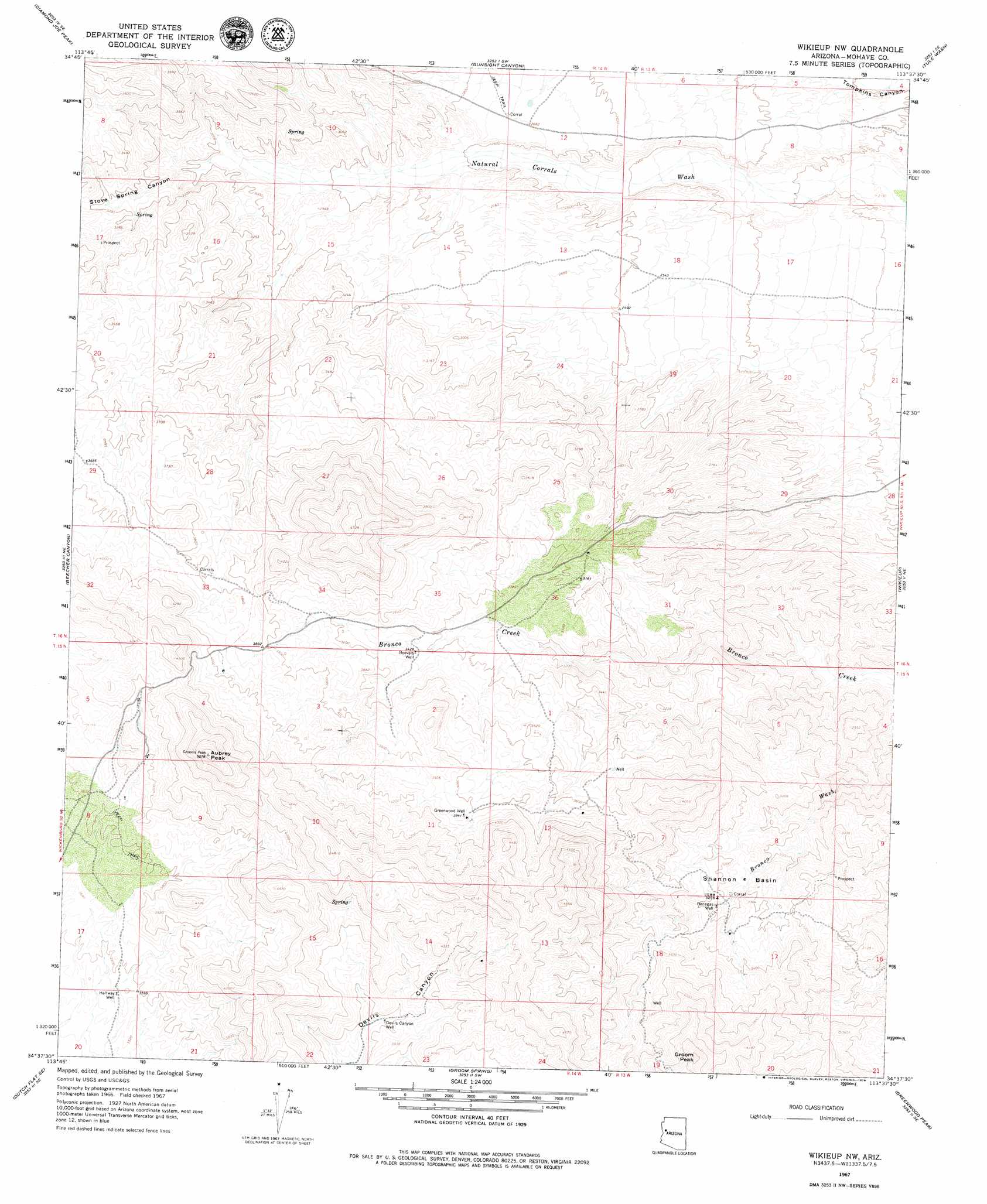
Aubrey Peak Topo Map Arizona
To zoom in, hover over the map of Aubrey Peak
USGS Topo Quad 34113f6 - 1:24,000 scale
| Topo Map Name: | Aubrey Peak |
| USGS Topo Quad ID: | 34113f6 |
| Print Size: | ca. 21 1/4" wide x 27" high |
| Southeast Coordinates: | 34.625° N latitude / 113.625° W longitude |
| Map Center Coordinates: | 34.6875° N latitude / 113.6875° W longitude |
| U.S. State: | AZ |
| Filename: | o34113f6.jpg |
| Download Map JPG Image: | Aubrey Peak topo map 1:24,000 scale |
| Map Type: | Topographic |
| Topo Series: | 7.5´ |
| Map Scale: | 1:24,000 |
| Source of Map Images: | United States Geological Survey (USGS) |
| Alternate Map Versions: |
Wikieup NW AZ 1967, updated 1969 Download PDF Buy paper map Aubrey Peak AZ 2011 Download PDF Buy paper map Aubrey Peak AZ 2014 Download PDF Buy paper map |
1:24,000 Topo Quads surrounding Aubrey Peak
Wabayuma Peak |
Hibernia Peak |
Pilgrim Wash |
Tom Brown Canyon |
Gonzales Wash |
Creamery Canyon |
Diamond Joe Peak |
Gunsight Canyon |
Tule Wash |
Cedar Basin |
Dutch Flat Nw |
Beecher Canyon |
Aubrey Peak |
Wikieup |
Elephant Mountain |
Dutch Flat Sw |
Dutch Flat Se |
Groom Spring |
Greenwood Peak |
Kaiser Spring |
Castaneda Hills |
Mccracken Peak |
Signal |
Signal Mountain |
Arrastra Mountain |
> Back to 34113e1 at 1:100,000 scale
> Back to 34112a1 at 1:250,000 scale
> Back to U.S. Topo Maps home
Aubrey Peak topo map: Gazetteer
Aubrey Peak: Basins
Shannon Basin elevation 0m 0′Aubrey Peak: Summits
Aubrey Peak elevation 1540m 5052′Groom Peak elevation 1430m 4691′
Aubrey Peak: Valleys
Stove Spring Canyon elevation 912m 2992′Aubrey Peak: Wells
Banegas Well elevation 966m 3169′Boevers Well elevation 1045m 3428′
Devils Canyon Well elevation 1145m 3756′
Greenwood Well elevation 1172m 3845′
Halfway Well elevation 1083m 3553′
Aubrey Peak digital topo map on disk
Buy this Aubrey Peak topo map showing relief, roads, GPS coordinates and other geographical features, as a high-resolution digital map file on DVD: