Wabayuma Peak Topo Map Arizona
To zoom in, hover over the map of Wabayuma Peak
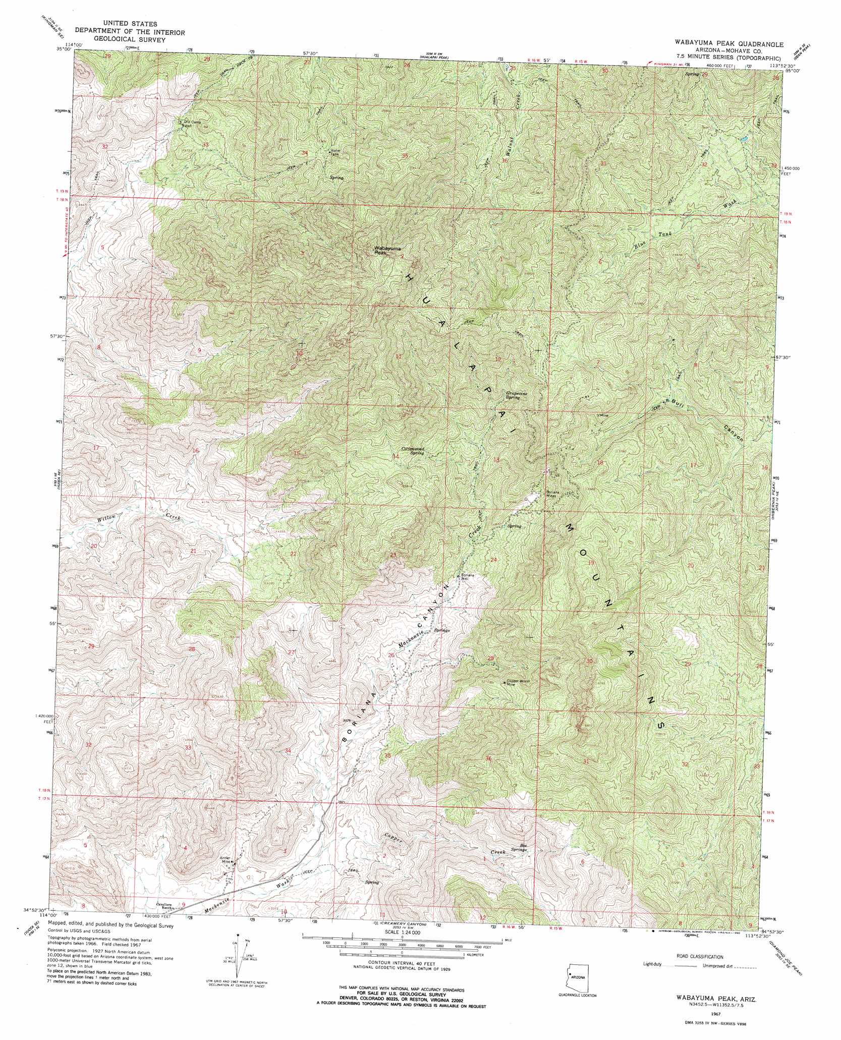
USGS Topo Quad 34113h8 - 1:24,000 scale
| Topo Map Name: | Wabayuma Peak |
| USGS Topo Quad ID: | 34113h8 |
| Print Size: | ca. 21 1/4" wide x 27" high |
| Southeast Coordinates: | 34.875° N latitude / 113.875° W longitude |
| Map Center Coordinates: | 34.9375° N latitude / 113.9375° W longitude |
| U.S. State: | AZ |
| Filename: | o34113h8.jpg |
| Download Map JPG Image: | Wabayuma Peak topo map 1:24,000 scale |
| Map Type: | Topographic |
| Topo Series: | 7.5´ |
| Map Scale: | 1:24,000 |
| Source of Map Images: | United States Geological Survey (USGS) |
| Alternate Map Versions: |
Wabayuma Peak AZ 1967, updated 1970 Download PDF Buy paper map Wabayuma Peak AZ 1967, updated 1980 Download PDF Buy paper map Wabayuma Peak AZ 2011 Download PDF Buy paper map Wabayuma Peak AZ 2014 Download PDF Buy paper map |
1:24,000 Topo Quads surrounding Wabayuma Peak
Kingman Nw |
Kingman |
Rattlesnake Hill |
Hualapai Spring |
Tin Mountain Nw |
Kingman Sw |
Kingman Se |
Hualapai Peak |
Dean Peak |
Bottleneck Wash |
Yucca Nw |
Yucca Ne |
Wabayuma Peak |
Hibernia Peak |
Pilgrim Wash |
Yucca |
Yucca Se |
Creamery Canyon |
Diamond Joe Peak |
Gunsight Canyon |
Buck Mountains |
Buck Mountains Ne |
Dutch Flat Nw |
Beecher Canyon |
Aubrey Peak |
> Back to 34113e1 at 1:100,000 scale
> Back to 34112a1 at 1:250,000 scale
> Back to U.S. Topo Maps home
Wabayuma Peak topo map: Gazetteer
Wabayuma Peak: Mines
Antler Mine elevation 992m 3254′Boriana Mines elevation 1558m 5111′
Copper World Mine elevation 1579m 5180′
Wabayuma Peak: Ranges
Hualapai Mountains elevation 1652m 5419′Wabayuma Peak: Springs
Bee Springs elevation 1376m 4514′Cottonwood Spring elevation 1618m 5308′
Grapevine Spring elevation 1633m 5357′
Wabayuma Peak: Streams
Copper Creek elevation 1000m 3280′Mackenzie Creek elevation 1000m 3280′
Wabayuma Peak: Summits
Wabayuma Peak elevation 2291m 7516′Wabayuma Peak: Valleys
Boriana Canyon elevation 1068m 3503′Wabayuma Peak: Wells
Boriana Well elevation 1332m 4370′Old Camp Well elevation 1404m 4606′
Wabayuma Peak digital topo map on disk
Buy this Wabayuma Peak topo map showing relief, roads, GPS coordinates and other geographical features, as a high-resolution digital map file on DVD: