Arica Mountains Topo Map California
To zoom in, hover over the map of Arica Mountains
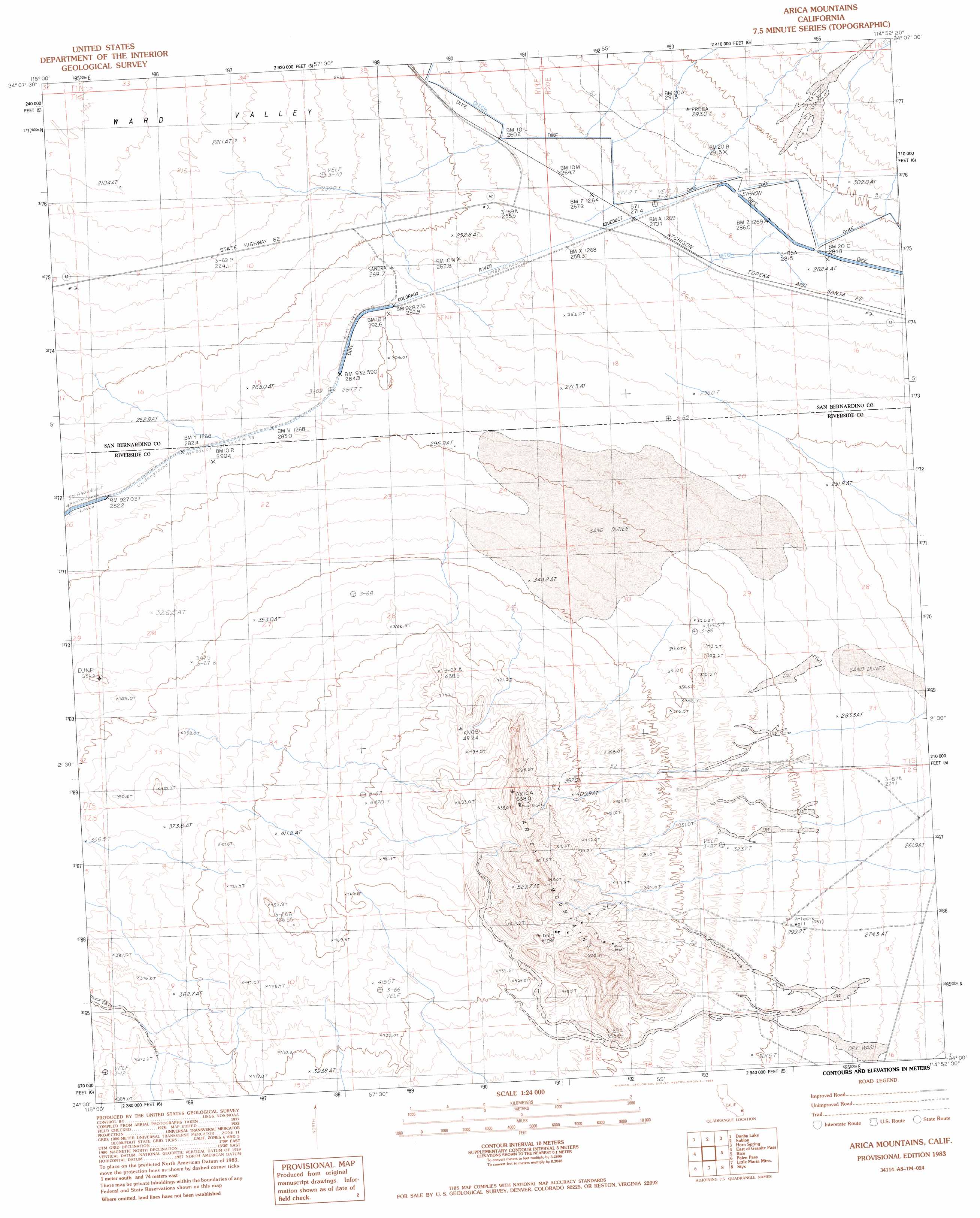
USGS Topo Quad 34114a8 - 1:24,000 scale
| Topo Map Name: | Arica Mountains |
| USGS Topo Quad ID: | 34114a8 |
| Print Size: | ca. 21 1/4" wide x 27" high |
| Southeast Coordinates: | 34° N latitude / 114.875° W longitude |
| Map Center Coordinates: | 34.0625° N latitude / 114.9375° W longitude |
| U.S. State: | CA |
| Filename: | o34114a8.jpg |
| Download Map JPG Image: | Arica Mountains topo map 1:24,000 scale |
| Map Type: | Topographic |
| Topo Series: | 7.5´ |
| Map Scale: | 1:24,000 |
| Source of Map Images: | United States Geological Survey (USGS) |
| Alternate Map Versions: |
Arica Mountains CA 1983, updated 1983 Download PDF Buy paper map Arica Mountains CA 2012 Download PDF Buy paper map Arica Mountains CA 2015 Download PDF Buy paper map |
1:24,000 Topo Quads surrounding Arica Mountains
Milligan |
East Of Milligan |
Martins Well |
Mopah Peaks |
Savahia Peak Sw |
Iron Mountains |
Danby Lake |
Sablon |
Horn Spring |
Vidal Nw |
Granite Pass |
East Of Granite Pass |
Arica Mountains |
Rice |
Grommet |
West Of Palen Pass |
Palen Pass |
Little Maria Mountains |
Styx |
Big Maria Mountains Nw |
Palen Lake |
Palen Mountains |
Arlington Mine |
Inca |
Big Maria Mountains Sw |
> Back to 34114a1 at 1:100,000 scale
> Back to 34114a1 at 1:250,000 scale
> Back to U.S. Topo Maps home
Arica Mountains topo map: Gazetteer
Arica Mountains: Mines
Priest Mine elevation 459m 1505′Arica Mountains: Populated Places
Freda elevation 272m 892′Arica Mountains: Ranges
Arica Mountains elevation 626m 2053′Arica Mountains: Wells
Priests Well elevation 299m 980′Arica Mountains digital topo map on disk
Buy this Arica Mountains topo map showing relief, roads, GPS coordinates and other geographical features, as a high-resolution digital map file on DVD: