Parker Topo Map California
To zoom in, hover over the map of Parker
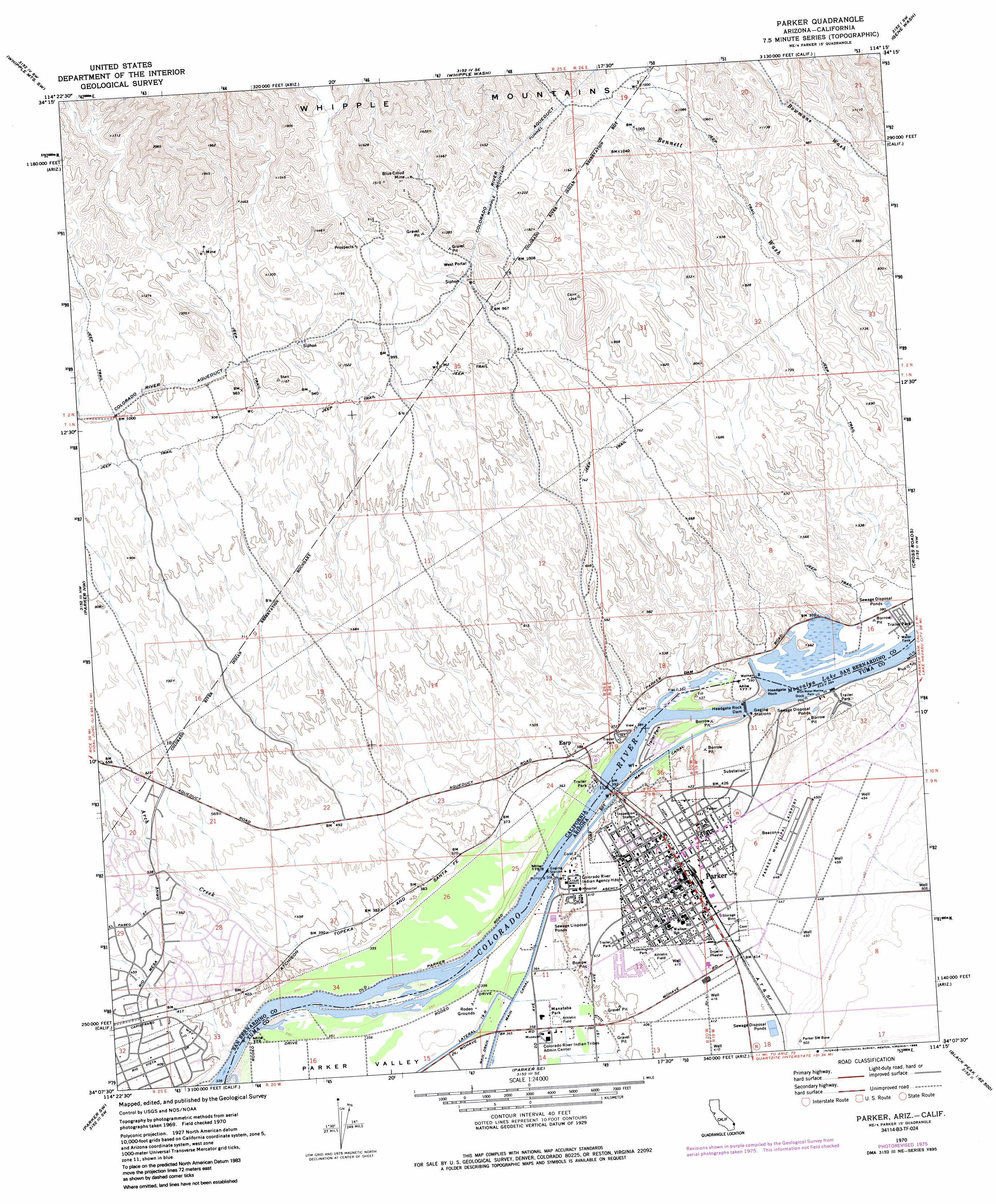
USGS Topo Quad 34114b3 - 1:24,000 scale
| Topo Map Name: | Parker |
| USGS Topo Quad ID: | 34114b3 |
| Print Size: | ca. 21 1/4" wide x 27" high |
| Southeast Coordinates: | 34.125° N latitude / 114.25° W longitude |
| Map Center Coordinates: | 34.1875° N latitude / 114.3125° W longitude |
| U.S. States: | CA, AZ |
| Filename: | o34114b3.jpg |
| Download Map JPG Image: | Parker topo map 1:24,000 scale |
| Map Type: | Topographic |
| Topo Series: | 7.5´ |
| Map Scale: | 1:24,000 |
| Source of Map Images: | United States Geological Survey (USGS) |
| Alternate Map Versions: |
Parker AZ 1970, updated 1973 Download PDF Buy paper map Parker AZ 1970, updated 1977 Download PDF Buy paper map Parker AZ 1970, updated 1985 Download PDF Buy paper map Parker AZ 2011 Download PDF Buy paper map Parker AZ 2014 Download PDF Buy paper map |
1:24,000 Topo Quads surrounding Parker
Savahia Peak Ne |
Havasu Lake |
Lake Havasu City South |
Standard Wash |
Mohave Springs |
Savahia Peak |
Whipple Mountains Sw |
Whipple Wash |
Gene Wash |
Monkeys Head |
Vidal Junction |
Parker Nw |
Parker |
Cross Roads |
Osborne Well |
Vidal |
Parker Sw |
Parker Se |
Black Peak |
Bobs Well |
Big Maria Mountains Ne |
Poston |
Moon Mountain Ne |
Bouse Nw |
Bouse |
> Back to 34114a1 at 1:100,000 scale
> Back to 34114a1 at 1:250,000 scale
> Back to U.S. Topo Maps home
Parker topo map: Gazetteer
Parker: Airports
Avi Suquilla Airport elevation 137m 449′Parker Community Hospital Heliport elevation 127m 416′
Parker Municipal Airport elevation 137m 449′
Parker: Dams
Headgate Rock Dam elevation 113m 370′Parker: Mines
Blue Cloud Mine elevation 378m 1240′Parker: Parks
Blue Water Marina Park elevation 112m 367′Manataba Park elevation 110m 360′
Parker Rodeo Grounds elevation 131m 429′
Pop Harvey Park elevation 127m 416′
Western Park elevation 131m 429′
Parker: Populated Places
Big River elevation 134m 439′Bluewater elevation 123m 403′
Bluewater elevation 112m 367′
Earp elevation 121m 396′
Parker elevation 129m 423′
Parker: Post Offices
Eart Post Office elevation 123m 403′Parker Post Office elevation 128m 419′
Parker: Reservoirs
Moovalya Lake elevation 112m 367′Moovalya Lake elevation 113m 370′
Parker: Streams
Arch Creek elevation 110m 360′Parker: Summits
Headgate Rock elevation 113m 370′Parker digital topo map on disk
Buy this Parker topo map showing relief, roads, GPS coordinates and other geographical features, as a high-resolution digital map file on DVD: