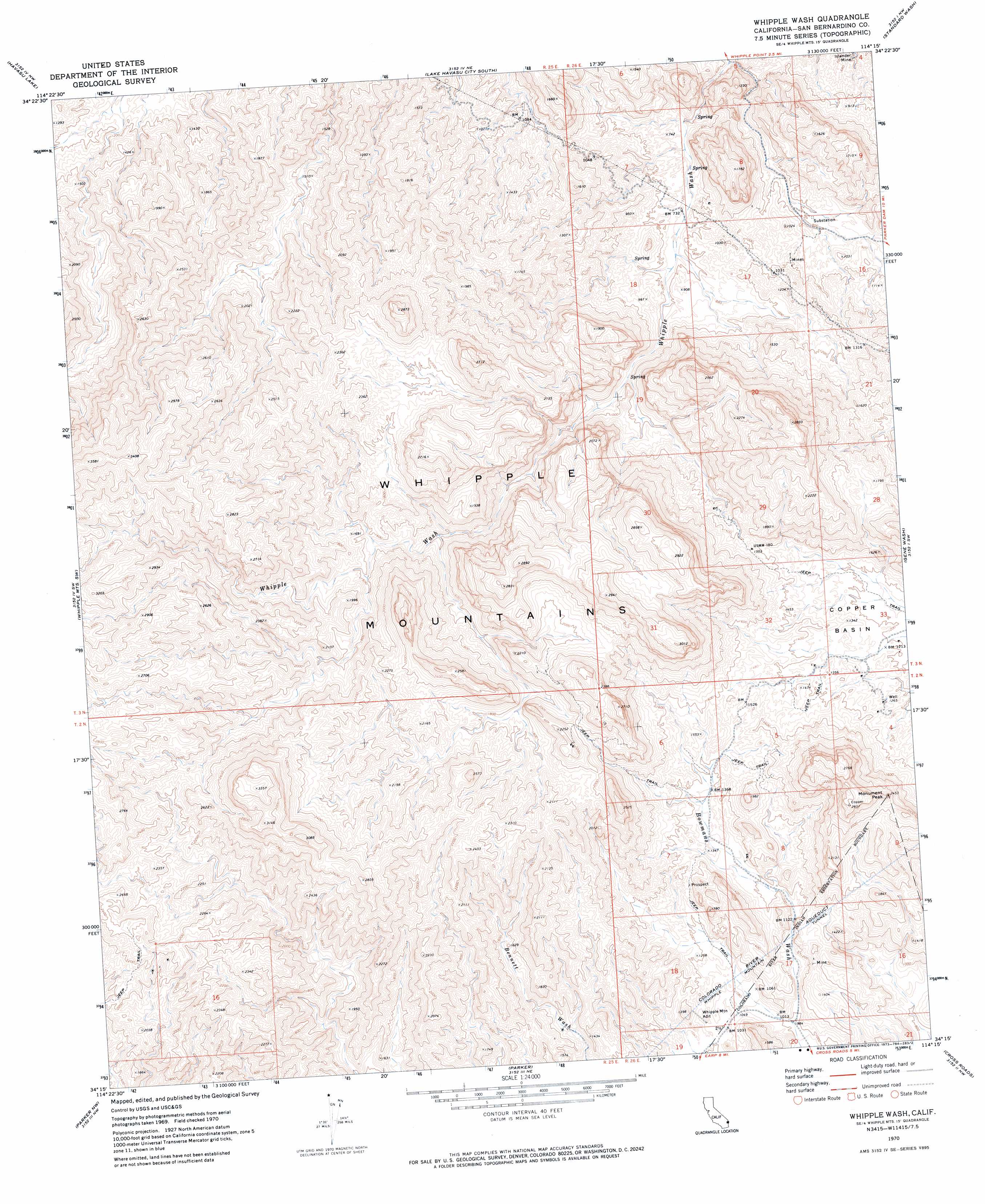
Whipple Wash Topo Map California
To zoom in, hover over the map of Whipple Wash
USGS Topo Quad 34114c3 - 1:24,000 scale
| Topo Map Name: | Whipple Wash |
| USGS Topo Quad ID: | 34114c3 |
| Print Size: | ca. 21 1/4" wide x 27" high |
| Southeast Coordinates: | 34.25° N latitude / 114.25° W longitude |
| Map Center Coordinates: | 34.3125° N latitude / 114.3125° W longitude |
| U.S. State: | CA |
| Filename: | o34114c3.jpg |
| Download Map JPG Image: | Whipple Wash topo map 1:24,000 scale |
| Map Type: | Topographic |
| Topo Series: | 7.5´ |
| Map Scale: | 1:24,000 |
| Source of Map Images: | United States Geological Survey (USGS) |
| Alternate Map Versions: |
Whipple Wash CA 1970, updated 1973 Download PDF Buy paper map Whipple Wash CA 1970, updated 1973 Download PDF Buy paper map Whipple Wash CA 2012 Download PDF Buy paper map Whipple Wash CA 2015 Download PDF Buy paper map |
1:24,000 Topo Quads surrounding Whipple Wash
Chemehuevi Peak |
Castle Rock |
Lake Havasu City North |
Crossman Peak |
Buck Mountains Se |
Savahia Peak Ne |
Havasu Lake |
Lake Havasu City South |
Standard Wash |
Mohave Springs |
Savahia Peak |
Whipple Mountains Sw |
Whipple Wash |
Gene Wash |
Monkeys Head |
Vidal Junction |
Parker Nw |
Parker |
Cross Roads |
Osborne Well |
Vidal |
Parker Sw |
Parker Se |
Black Peak |
Bobs Well |
> Back to 34114a1 at 1:100,000 scale
> Back to 34114a1 at 1:250,000 scale
> Back to U.S. Topo Maps home
Whipple Wash topo map: Gazetteer
Whipple Wash: Basins
Copper Basin elevation 365m 1197′Whipple Wash: Mines
Islander Mine elevation 184m 603′Whipple Wash: Populated Places
Tin Shack (historical) elevation 184m 603′Whipple Wash: Springs
Willow Spring elevation 207m 679′Whipple Wash: Summits
Monument Peak elevation 725m 2378′Whipple Wash: Tunnels
Whipple Mountain Adit elevation 327m 1072′Whipple Mountain Tunnel elevation 338m 1108′
Whipple Wash digital topo map on disk
Buy this Whipple Wash topo map showing relief, roads, GPS coordinates and other geographical features, as a high-resolution digital map file on DVD: