Stepladder Mountains Topo Map California
To zoom in, hover over the map of Stepladder Mountains
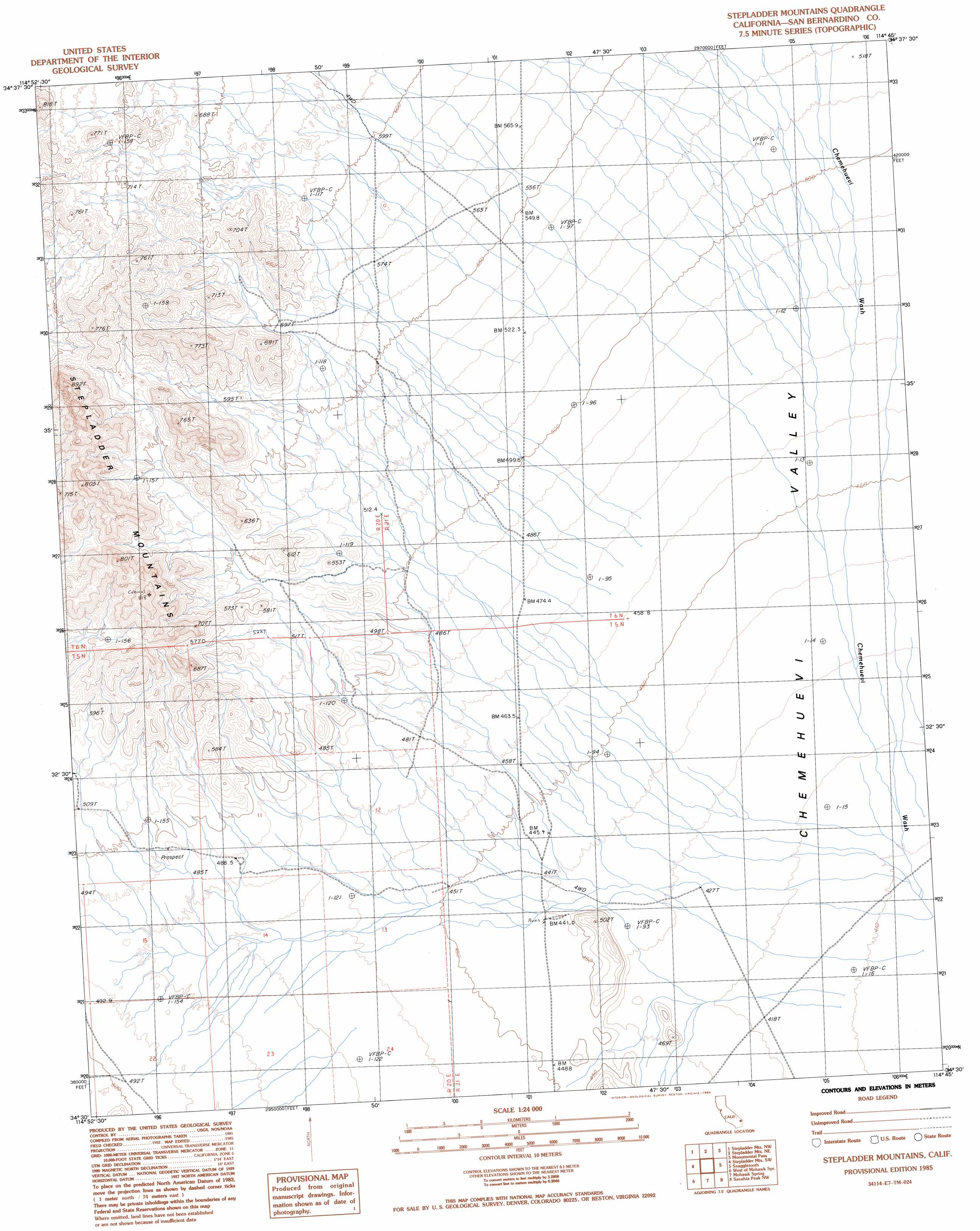
USGS Topo Quad 34114e7 - 1:24,000 scale
| Topo Map Name: | Stepladder Mountains |
| USGS Topo Quad ID: | 34114e7 |
| Print Size: | ca. 21 1/4" wide x 27" high |
| Southeast Coordinates: | 34.5° N latitude / 114.75° W longitude |
| Map Center Coordinates: | 34.5625° N latitude / 114.8125° W longitude |
| U.S. State: | CA |
| Filename: | o34114e7.jpg |
| Download Map JPG Image: | Stepladder Mountains topo map 1:24,000 scale |
| Map Type: | Topographic |
| Topo Series: | 7.5´ |
| Map Scale: | 1:24,000 |
| Source of Map Images: | United States Geological Survey (USGS) |
| Alternate Map Versions: |
Stepladder Mountains CA 1985, updated 1985 Download PDF Buy paper map Stepladder Mountains CA 2012 Download PDF Buy paper map Stepladder Mountains CA 2015 Download PDF Buy paper map |
1:24,000 Topo Quads surrounding Stepladder Mountains
Fenner Spring |
West Of Flattop Mountain |
Flattop Mountain |
Needles Sw |
Needles |
Little Piute Mountains |
Stepladder Mountains Nw |
Stepladder Mountains Ne |
Monumental Pass |
Whale Mountain |
Painted Rock Wash |
Stepladder Mountains Sw |
Stepladder Mountains |
Snaggletooth |
Chemehuevi Peak |
Wilhelm Spring |
West Of Mohawk Spring |
Mohawk Spring |
Savahia Peak Nw |
Savahia Peak Ne |
East Of Milligan |
Martins Well |
Mopah Peaks |
Savahia Peak Sw |
Savahia Peak |
> Back to 34114e1 at 1:100,000 scale
> Back to 34114a1 at 1:250,000 scale
> Back to U.S. Topo Maps home
Stepladder Mountains topo map: Gazetteer
Stepladder Mountains: Ranges
Stepladder Mountains elevation 806m 2644′Stepladder Mountains digital topo map on disk
Buy this Stepladder Mountains topo map showing relief, roads, GPS coordinates and other geographical features, as a high-resolution digital map file on DVD: