Yucca Ne Topo Map Arizona
To zoom in, hover over the map of Yucca Ne
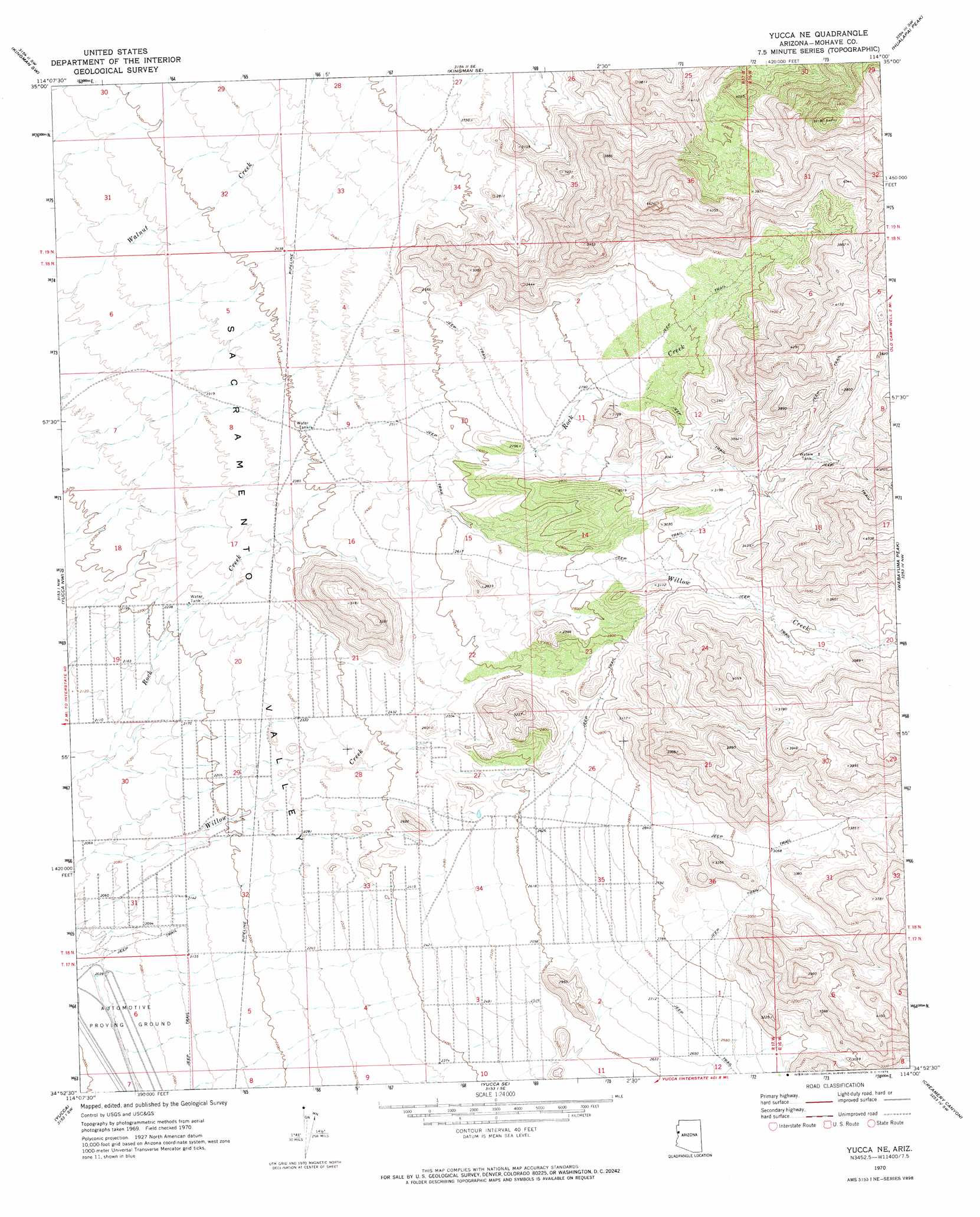
USGS Topo Quad 34114h1 - 1:24,000 scale
| Topo Map Name: | Yucca Ne |
| USGS Topo Quad ID: | 34114h1 |
| Print Size: | ca. 21 1/4" wide x 27" high |
| Southeast Coordinates: | 34.875° N latitude / 114° W longitude |
| Map Center Coordinates: | 34.9375° N latitude / 114.0625° W longitude |
| U.S. State: | AZ |
| Filename: | o34114h1.jpg |
| Download Map JPG Image: | Yucca Ne topo map 1:24,000 scale |
| Map Type: | Topographic |
| Topo Series: | 7.5´ |
| Map Scale: | 1:24,000 |
| Source of Map Images: | United States Geological Survey (USGS) |
| Alternate Map Versions: |
Yucca NE AZ 1970, updated 1973 Download PDF Buy paper map Yucca NE AZ 2011 Download PDF Buy paper map Yucca NE AZ 2014 Download PDF Buy paper map |
1:24,000 Topo Quads surrounding Yucca Ne
Secret Pass |
Kingman Nw |
Kingman |
Rattlesnake Hill |
Hualapai Spring |
Mount Nutt |
Kingman Sw |
Kingman Se |
Hualapai Peak |
Dean Peak |
Warm Springs |
Yucca Nw |
Yucca Ne |
Wabayuma Peak |
Hibernia Peak |
Warm Springs Se |
Yucca |
Yucca Se |
Creamery Canyon |
Diamond Joe Peak |
Franconia |
Buck Mountains |
Buck Mountains Ne |
Dutch Flat Nw |
Beecher Canyon |
> Back to 34114e1 at 1:100,000 scale
> Back to 34114a1 at 1:250,000 scale
> Back to U.S. Topo Maps home
Yucca Ne topo map: Gazetteer
Yucca Ne: Airports
Ford Motor Company Automotive Proving Ground Airstrip elevation 612m 2007′Yucca Ne: Areas
Yucca Ford Automotive Proving Grounds elevation 609m 1998′Yucca Ne: Springs
Corral Spring elevation 1023m 3356′Deadman Spring elevation 972m 3188′
Rock Creek Spring elevation 1016m 3333′
Santa Fe Spring elevation 1114m 3654′
Yucca Ne digital topo map on disk
Buy this Yucca Ne topo map showing relief, roads, GPS coordinates and other geographical features, as a high-resolution digital map file on DVD: