Cadiz Valley Se Topo Map California
To zoom in, hover over the map of Cadiz Valley Se
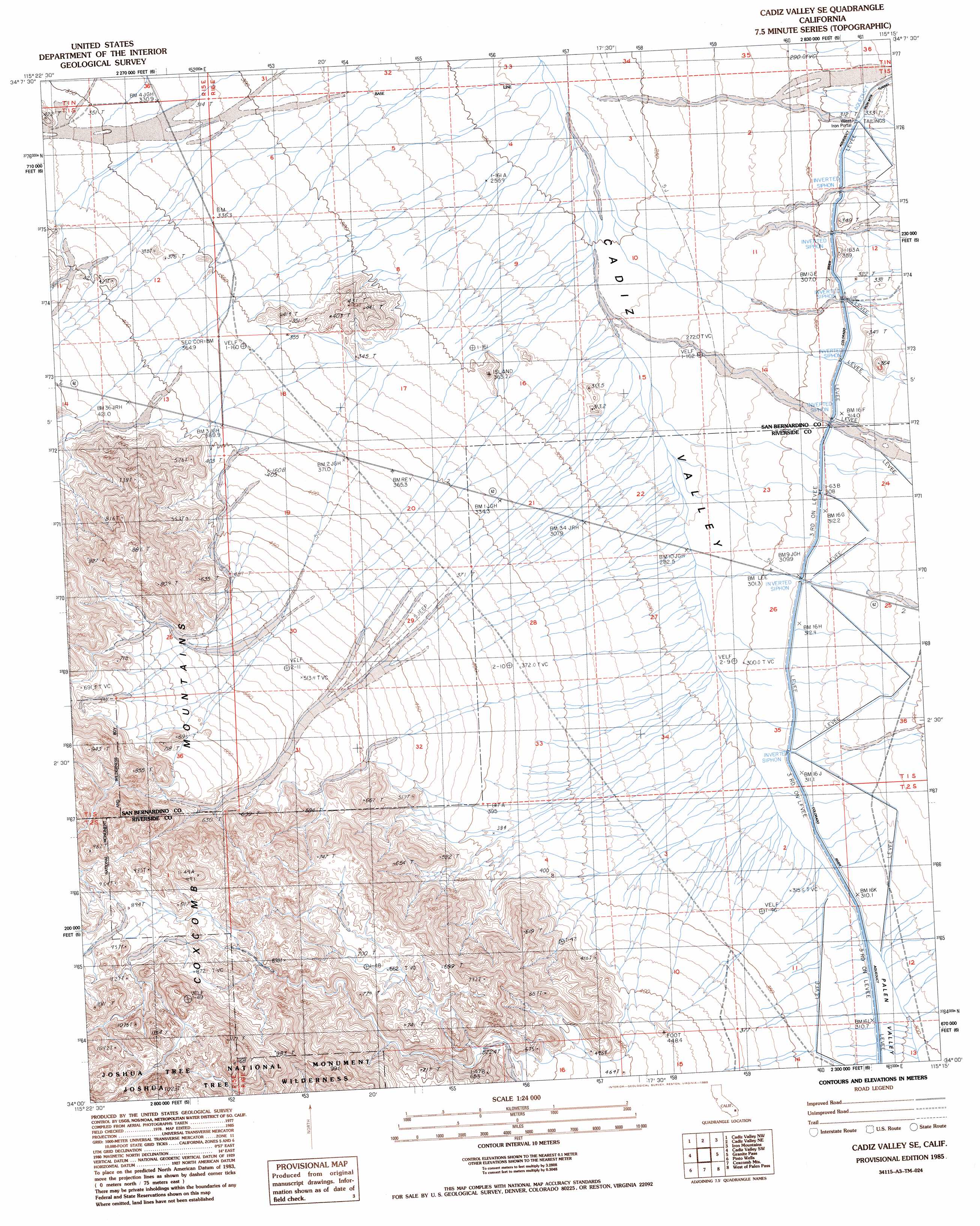
USGS Topo Quad 34115a3 - 1:24,000 scale
| Topo Map Name: | Cadiz Valley Se |
| USGS Topo Quad ID: | 34115a3 |
| Print Size: | ca. 21 1/4" wide x 27" high |
| Southeast Coordinates: | 34° N latitude / 115.25° W longitude |
| Map Center Coordinates: | 34.0625° N latitude / 115.3125° W longitude |
| U.S. State: | CA |
| Filename: | o34115a3.jpg |
| Download Map JPG Image: | Cadiz Valley Se topo map 1:24,000 scale |
| Map Type: | Topographic |
| Topo Series: | 7.5´ |
| Map Scale: | 1:24,000 |
| Source of Map Images: | United States Geological Survey (USGS) |
| Alternate Map Versions: |
Cadiz Valley SE CA 1985, updated 1985 Download PDF Buy paper map Cadiz Valley SE CA 2012 Download PDF Buy paper map Cadiz Valley SE CA 2015 Download PDF Buy paper map |
1:24,000 Topo Quads surrounding Cadiz Valley Se
Calumet Mountains |
Cadiz Lake |
Chubbuck |
Milligan |
East Of Milligan |
East Of Dale Lake |
Cadiz Valley Nw |
Cadiz Valley Ne |
Iron Mountains |
Danby Lake |
Clarks Pass |
Cadiz Valley Sw |
Cadiz Valley Se |
Granite Pass |
East Of Granite Pass |
Placer Canyon |
Pinto Wells |
Coxcomb Mountains |
West Of Palen Pass |
Palen Pass |
Buzzard Spring |
Victory Pass |
East Of Victory Pass |
Palen Lake |
Palen Mountains |
> Back to 34115a1 at 1:100,000 scale
> Back to 34114a1 at 1:250,000 scale
> Back to U.S. Topo Maps home
Cadiz Valley Se digital topo map on disk
Buy this Cadiz Valley Se topo map showing relief, roads, GPS coordinates and other geographical features, as a high-resolution digital map file on DVD: