Twentynine Palms Mountain Topo Map California
To zoom in, hover over the map of Twentynine Palms Mountain
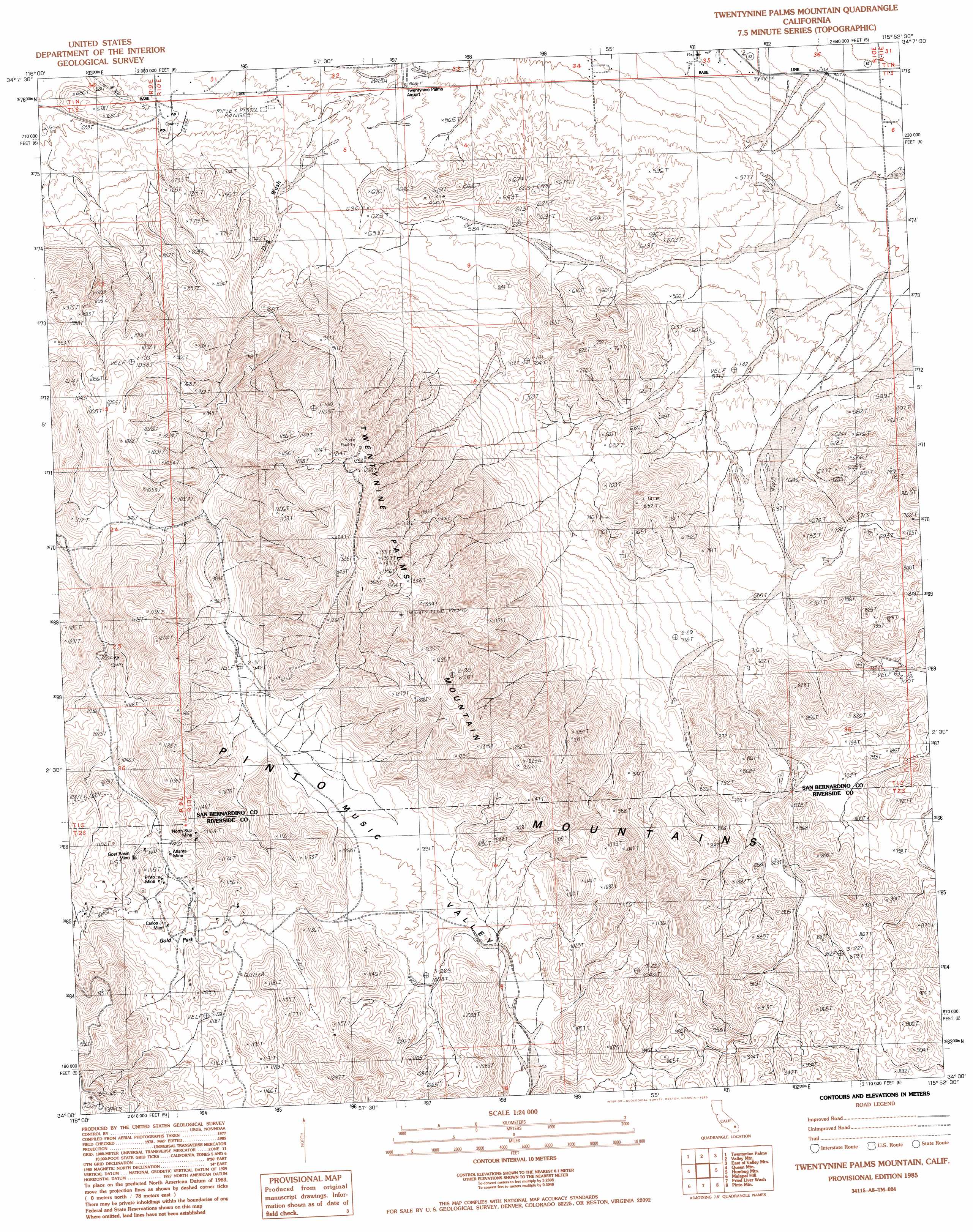
USGS Topo Quad 34115a8 - 1:24,000 scale
| Topo Map Name: | Twentynine Palms Mountain |
| USGS Topo Quad ID: | 34115a8 |
| Print Size: | ca. 21 1/4" wide x 27" high |
| Southeast Coordinates: | 34° N latitude / 115.875° W longitude |
| Map Center Coordinates: | 34.0625° N latitude / 115.9375° W longitude |
| U.S. State: | CA |
| Filename: | o34115a8.jpg |
| Download Map JPG Image: | Twentynine Palms Mountain topo map 1:24,000 scale |
| Map Type: | Topographic |
| Topo Series: | 7.5´ |
| Map Scale: | 1:24,000 |
| Source of Map Images: | United States Geological Survey (USGS) |
| Alternate Map Versions: |
Twentynine Palms Mountain CA 1985, updated 1985 Download PDF Buy paper map Twentynine Palms Mountain CA 1985, updated 1993 Download PDF Buy paper map Twentynine Palms Mountain CA 1997, updated 2002 Download PDF Buy paper map Twentynine Palms Mountain CA 2012 Download PDF Buy paper map Twentynine Palms Mountain CA 2015 Download PDF Buy paper map |
1:24,000 Topo Quads surrounding Twentynine Palms Mountain
Deadman Lake Sw |
Deadman Lake Se |
Lead Mountain Sw |
Cleghorn Lakes |
Bristol Lake Sw |
Sunfair |
Twentynine Palms |
Valley Mountain |
East Of Valley Mountain |
Dale Lake |
Indian Cove |
Queen Mountain |
Twentynine Palms Mountain |
Humbug Mountain |
New Dale |
Keys View |
Malapai Hill |
Fried Liver Wash |
Pinto Mountain |
San Bernardino Wash |
West Berdoo Canyon |
Rockhouse Canyon |
Washington Wash |
Porcupine Wash |
Conejo Well |
> Back to 34115a1 at 1:100,000 scale
> Back to 34114a1 at 1:250,000 scale
> Back to U.S. Topo Maps home
Twentynine Palms Mountain topo map: Gazetteer
Twentynine Palms Mountain: Basins
Music Valley elevation 994m 3261′Twentynine Palms Mountain: Flats
Gold Park elevation 1118m 3667′Twentynine Palms Mountain: Mines
Atlanta Mine elevation 1073m 3520′Carlos Junior Mine elevation 1102m 3615′
Goat Basin Mine elevation 1070m 3510′
Marbolite Mine elevation 698m 2290′
North Star Mine elevation 1124m 3687′
Pinto Mine elevation 1080m 3543′
Twentynine Palms Mountain: Summits
Twentynine Palms Mountain elevation 1372m 4501′Twentynine Palms Mountain digital topo map on disk
Buy this Twentynine Palms Mountain topo map showing relief, roads, GPS coordinates and other geographical features, as a high-resolution digital map file on DVD: