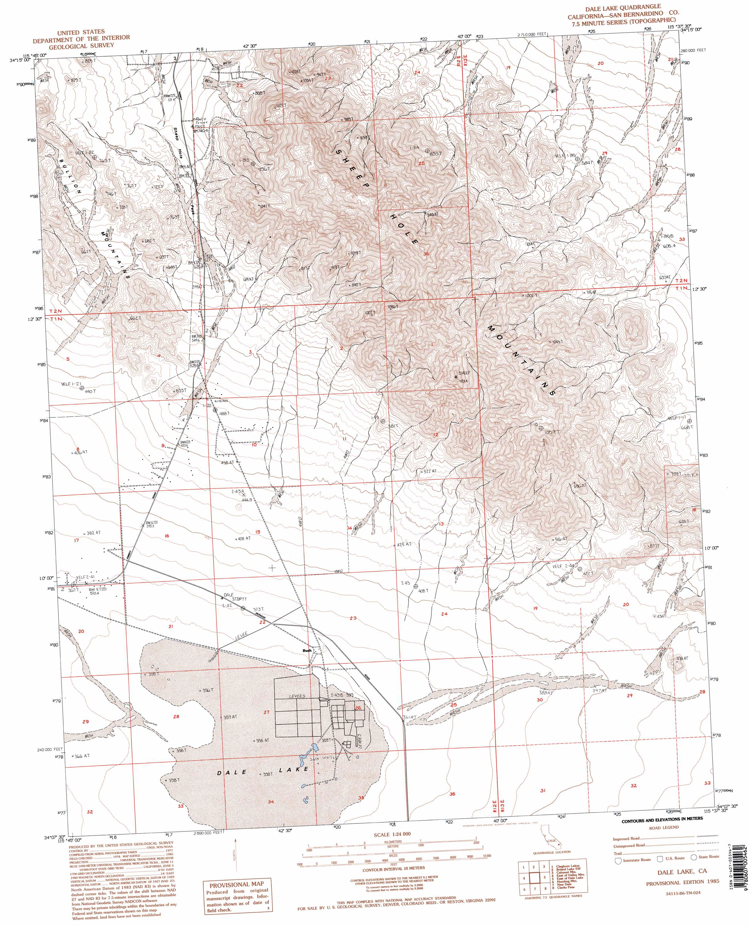
Dale Lake Topo Map California
To zoom in, hover over the map of Dale Lake
USGS Topo Quad 34115b6 - 1:24,000 scale
| Topo Map Name: | Dale Lake |
| USGS Topo Quad ID: | 34115b6 |
| Print Size: | ca. 21 1/4" wide x 27" high |
| Southeast Coordinates: | 34.125° N latitude / 115.625° W longitude |
| Map Center Coordinates: | 34.1875° N latitude / 115.6875° W longitude |
| U.S. State: | CA |
| Filename: | o34115b6.jpg |
| Download Map JPG Image: | Dale Lake topo map 1:24,000 scale |
| Map Type: | Topographic |
| Topo Series: | 7.5´ |
| Map Scale: | 1:24,000 |
| Source of Map Images: | United States Geological Survey (USGS) |
| Alternate Map Versions: |
Dale Lake CA 1985, updated 1985 Download PDF Buy paper map Dale Lake CA 1985, updated 1995 Download PDF Buy paper map Dale Lake CA 2012 Download PDF Buy paper map Dale Lake CA 2015 Download PDF Buy paper map |
1:24,000 Topo Quads surrounding Dale Lake
Lead Mountain |
Lead Mountain Ne |
Bristol Lake Nw |
Calumet Mine |
Cadiz Lake Nw |
Lead Mountain Sw |
Cleghorn Lakes |
Bristol Lake Sw |
Calumet Mountains |
Cadiz Lake |
Valley Mountain |
East Of Valley Mountain |
Dale Lake |
East Of Dale Lake |
Cadiz Valley Nw |
Twentynine Palms Mountain |
Humbug Mountain |
New Dale |
Clarks Pass |
Cadiz Valley Sw |
Fried Liver Wash |
Pinto Mountain |
San Bernardino Wash |
Placer Canyon |
Pinto Wells |
> Back to 34115a1 at 1:100,000 scale
> Back to 34114a1 at 1:250,000 scale
> Back to U.S. Topo Maps home
Dale Lake topo map: Gazetteer
Dale Lake: Flats
Dale Lake elevation 358m 1174′Dale Lake: Populated Places
Bush elevation 351m 1151′Dale Lake: Ranges
Sheep Hole Mountains elevation 1060m 3477′Dale Lake: Streams
Dog Wash elevation 359m 1177′Dale Lake: Summits
Sheep Hole Pass elevation 708m 2322′Dale Lake digital topo map on disk
Buy this Dale Lake topo map showing relief, roads, GPS coordinates and other geographical features, as a high-resolution digital map file on DVD: